EP3506212B1 - Method and apparatus for generating raster map - Google Patents
Method and apparatus for generating raster map Download PDFInfo
- Publication number
- EP3506212B1 EP3506212B1 EP18215854.3A EP18215854A EP3506212B1 EP 3506212 B1 EP3506212 B1 EP 3506212B1 EP 18215854 A EP18215854 A EP 18215854A EP 3506212 B1 EP3506212 B1 EP 3506212B1
- Authority
- EP
- European Patent Office
- Prior art keywords
- map
- raster map
- raster
- point cloud
- laser point
- Prior art date
- Legal status (The legal status is an assumption and is not a legal conclusion. Google has not performed a legal analysis and makes no representation as to the accuracy of the status listed.)
- Active
Links
Images


Classifications
-
- G—PHYSICS
- G06—COMPUTING OR CALCULATING; COUNTING
- G06F—ELECTRIC DIGITAL DATA PROCESSING
- G06F16/00—Information retrieval; Database structures therefor; File system structures therefor
- G06F16/20—Information retrieval; Database structures therefor; File system structures therefor of structured data, e.g. relational data
- G06F16/29—Geographical information databases
-
- G—PHYSICS
- G09—EDUCATION; CRYPTOGRAPHY; DISPLAY; ADVERTISING; SEALS
- G09B—EDUCATIONAL OR DEMONSTRATION APPLIANCES; APPLIANCES FOR TEACHING, OR COMMUNICATING WITH, THE BLIND, DEAF OR MUTE; MODELS; PLANETARIA; GLOBES; MAPS; DIAGRAMS
- G09B29/00—Maps; Plans; Charts; Diagrams, e.g. route diagram
- G09B29/003—Maps
-
- G—PHYSICS
- G01—MEASURING; TESTING
- G01C—MEASURING DISTANCES, LEVELS OR BEARINGS; SURVEYING; NAVIGATION; GYROSCOPIC INSTRUMENTS; PHOTOGRAMMETRY OR VIDEOGRAMMETRY
- G01C21/00—Navigation; Navigational instruments not provided for in groups G01C1/00 - G01C19/00
- G01C21/38—Electronic maps specially adapted for navigation; Updating thereof
- G01C21/3863—Structures of map data
- G01C21/387—Organisation of map data, e.g. version management or database structures
- G01C21/3881—Tile-based structures
-
- G—PHYSICS
- G01—MEASURING; TESTING
- G01S—RADIO DIRECTION-FINDING; RADIO NAVIGATION; DETERMINING DISTANCE OR VELOCITY BY USE OF RADIO WAVES; LOCATING OR PRESENCE-DETECTING BY USE OF THE REFLECTION OR RERADIATION OF RADIO WAVES; ANALOGOUS ARRANGEMENTS USING OTHER WAVES
- G01S17/00—Systems using the reflection or reradiation of electromagnetic waves other than radio waves, e.g. lidar systems
- G01S17/86—Combinations of lidar systems with systems other than lidar, radar or sonar, e.g. with direction finders
-
- G—PHYSICS
- G01—MEASURING; TESTING
- G01S—RADIO DIRECTION-FINDING; RADIO NAVIGATION; DETERMINING DISTANCE OR VELOCITY BY USE OF RADIO WAVES; LOCATING OR PRESENCE-DETECTING BY USE OF THE REFLECTION OR RERADIATION OF RADIO WAVES; ANALOGOUS ARRANGEMENTS USING OTHER WAVES
- G01S17/00—Systems using the reflection or reradiation of electromagnetic waves other than radio waves, e.g. lidar systems
- G01S17/88—Lidar systems specially adapted for specific applications
- G01S17/89—Lidar systems specially adapted for specific applications for mapping or imaging
-
- G—PHYSICS
- G01—MEASURING; TESTING
- G01S—RADIO DIRECTION-FINDING; RADIO NAVIGATION; DETERMINING DISTANCE OR VELOCITY BY USE OF RADIO WAVES; LOCATING OR PRESENCE-DETECTING BY USE OF THE REFLECTION OR RERADIATION OF RADIO WAVES; ANALOGOUS ARRANGEMENTS USING OTHER WAVES
- G01S17/00—Systems using the reflection or reradiation of electromagnetic waves other than radio waves, e.g. lidar systems
- G01S17/88—Lidar systems specially adapted for specific applications
- G01S17/93—Lidar systems specially adapted for specific applications for anti-collision purposes
- G01S17/931—Lidar systems specially adapted for specific applications for anti-collision purposes of land vehicles
-
- G—PHYSICS
- G06—COMPUTING OR CALCULATING; COUNTING
- G06T—IMAGE DATA PROCESSING OR GENERATION, IN GENERAL
- G06T17/00—Three-dimensional [3D] modelling for computer graphics
- G06T17/005—Tree description, e.g. octree, quadtree
-
- G—PHYSICS
- G06—COMPUTING OR CALCULATING; COUNTING
- G06T—IMAGE DATA PROCESSING OR GENERATION, IN GENERAL
- G06T17/00—Three-dimensional [3D] modelling for computer graphics
- G06T17/05—Geographic models
-
- G—PHYSICS
- G06—COMPUTING OR CALCULATING; COUNTING
- G06T—IMAGE DATA PROCESSING OR GENERATION, IN GENERAL
- G06T7/00—Image analysis
- G06T7/30—Determination of transform parameters for the alignment of images, i.e. image registration
-
- G—PHYSICS
- G06—COMPUTING OR CALCULATING; COUNTING
- G06T—IMAGE DATA PROCESSING OR GENERATION, IN GENERAL
- G06T9/00—Image coding
-
- G—PHYSICS
- G06—COMPUTING OR CALCULATING; COUNTING
- G06T—IMAGE DATA PROCESSING OR GENERATION, IN GENERAL
- G06T2207/00—Indexing scheme for image analysis or image enhancement
- G06T2207/10—Image acquisition modality
- G06T2207/10028—Range image; Depth image; 3D point clouds
-
- G—PHYSICS
- G06—COMPUTING OR CALCULATING; COUNTING
- G06T—IMAGE DATA PROCESSING OR GENERATION, IN GENERAL
- G06T2210/00—Indexing scheme for image generation or computer graphics
- G06T2210/36—Level of detail
Definitions
- Embodiments of the present disclosure generally relate to the field of electronic map technology, and more specifically to a method and apparatus for generating a raster map.
- Electronic maps refer to maps in digital form generated using computing technologies, which may be widely used in scenarios such as querying, positioning, and navigating.
- the electronic maps are generally divided into ordinary navigation maps and high-precision maps.
- the ordinary navigation maps are user-oriented maps that provide visual interfaces for querying by users and displaying, while the high-precision maps are machine-oriented map data that may be used for such as autonomous driving, robot navigation and positioning.
- the ordinary navigation maps are usually obtained by satellite mapping, and their accuracies are usually not high (for example, the error can be several meters or even tens of meters).
- the high-precision maps are high-precision map data that not only are highly accurate, but also include other information that may be used for precise navigation and positioning, such as lane line information, object height information, and road shape information.
- a raster map is a commonly used form of high-precision map that divides an environment into a series of rasters, where each raster is marked with a value indicating whether the raster is occupied. That is, the raster map is a product of digital rasterization of a real environment that identifies obstacles in the environment by determining whether the raster is occupied.
- the raster map describing the occupation is widely used in the navigation and positioning scenarios for driverless vehicles and intelligent robots.
- Document US 2007/262988 discloses a system, apparatus and method of rendering images for computer graphics or animation at multiple levels of detail or resolution.
- the method uses a hierarchical data structure for rendering images.
- the method generates a data structure containing data elements representing multiple resolutions of data and then determines a desired resolution for the image.
- the data elements in the data structure corresponding to the desired resolution are accessed and each data element in the accessed data is associated with a renderable primitive.
- the image is then rendered by processing the renderable primitive associated with each data element.
- Document CN 106407408 discloses a spatial index construction method and device for mass point cloud data.
- the method includes performing partitioning treatment on acquired original point cloud data to obtain a plurality of point cloud data blocks; for each point cloud data block, establishing an octree index of the current point cloud data block; and performing combining treatment on the octree indexes of the multiple point cloud data blocks to obtain a spatial index structure of the original point cloud data.
- a solution for generating a raster map is provided.
- the present disclosure provides a method according to claim
- the present disclosure provides an apparatus according to claim 7.
- the present disclosure provides a computer readable medium, storing a computer program thereon, the computer program, when executed by a processor, implements the method or process according to some embodiments of the present disclosure.
- the term “include” and wordings similar to the term should be understood as open-ended, i.e., “including but not limited to.”
- the term “based on” should be understood as “at least partially based on.”
- the term “one embodiment” or “the embodiment” should be understood as “at least one embodiment.”
- the terms, such as “first, " and “second, " may refer to different or identical objects. Other explicit and implicit definitions may also be included hereinafter.
- the laser acquisition device 125 has a laser scanner that may acquire data of the surrounding environment (e.g., identify location of the surrounding objects, types, reflectivity, densities, curvatures, etc. of the objects) during travelling of the vehicle 120, thus forming laser point cloud (such as point cloud 128 shown in Fig. 1 ).
- the laser point cloud refers to a set of mass points representing the spatial distribution of the target obtained by acquiring the spatial coordinates of each sample point on the surface of the object in the environment.
- the laser acquisition device 125 may be an airborne lidar system with light detection and ranging (LiDAR) functionality that utilizes a global positioning system (GPS) and an inertial measuring unit (IMU) to measure the three-dimensional coordinates of the object in the environment.
- LiDAR light detection and ranging
- the laser point cloud acquired by LiDAR has the advantages of high data precision, high data density, strong penetrating ability, and strong anti-interference ability.
- the vehicle 120 and the laser acquisition device 125 may be collectively referred to as a laser acquisition entity, a laser acquisition vehicle, and the like.
- the positioning system is not limited to the GPS.
- the Galileo satellite positioning system of Europe, the Beidou satellite positioning system of China, etc. may all be used in combination with some embodiments of the present disclosure.
- the map generation module 130 may generate the raster map 155 based on the acquired laser point cloud, for example the laser point cloud 128, and store the raster map 155 in the map database 150 for invocation. According to some embodiments of the present disclosure, the map generation module 130 may also generate raster maps of multiple resolutions and store only the raster map having the highest resolution directly in the map database 150.
- the map generation module 130 may obtain a three-dimensional laser point cloud from the laser acquisition device 125.
- point clouds acquired using depth cameras and ordinary sensors are not as dense and accurate as laser point clouds, and cannot meet the demand for fine navigation and positioning.
- the map generation module 130 may first filter noise from the laser point cloud and then segment the laser point cloud at a predetermined resolution. For example, whether a point in a raster is a noise point may be determined based on the spatial neighborhood relationship between the raster maps, and the specific size of the raster map is determined based on the average point distance.
- the multi-dimensional attribute may also include a color attribute that represents the color of the obstacle.
- the color attribute may be generated based on the laser point cloud and its corresponding photo. The color of a point is determined, for example, by identifying the value of the photo's pixel corresponding to the point in the laser point cloud, thereby providing powerful navigation and positioning capabilities.
- the merged upper-level raster is determined to be occupied.
- the merged upper-level raster is determined to be unoccupied, as shown in Fig. 3B .
- the node corresponding to each raster in the raster map 429 also has eight branch nodes.
- the node 423 has eight branch nodes 4231, 4232, 4233, 4234, 4235, 4236, 4237, and 4238, each of which corresponds to a raster in a raster map 4239.
- the raster map 429 of the lower resolution and the raster map 419 of the lowest resolution may be quickly determined by the octree spatial index.
- the map is invoked, it may be possible to quickly switch between these raster maps of different resolution according to the required resolution to meet the navigation and positioning requirements of different resolutions.
- Fig. 5 shows a flowchart of a process 500 for invoking a raster map according to some embodiments of the present disclosure. It should be understood that the process 500 may be performed by the map generation module 130 or a storage scheduling module in the map database 150 described above with reference to Fig. 1 .
- a request for a digital map is received, for example, in an autonomous driving scenario or an indoor robot navigation scenario, receiving a scheduling request by the computing device for the raster map.
- the request involves the raster map other than the first raster map
- a determination is made as to whether the request relates to the second raster map. If so, since the second raster map is not the map of the highest resolution, it is not stored directly in the map database 150, then at block 510, the first raster map and the association between the first raster map and the second raster map (e.g., the spatial index) are obtained from the map database 150.
- the second raster map is dynamically generated based on the first raster map and the association between the first raster map and the second raster map.
- generating the second raster map from the first raster map or generating the third raster map from the first raster map is very fast by using the octree spatial index, thereby ensuring the timeliness of map invoking.
- Fig. 6 shows a block diagram of an apparatus 600 for generating a raster map according to some embodiments of the present disclosure.
- the apparatus 600 includes a first map generation module 620, a second map generation module 630, and a map storage module 640.
- the first map generation module 620 is configured to generate a first raster map having a first resolution based on acquired laser point cloud.
- the first map generation module 620 may include a point cloud acquisition module (not shown) for obtaining a laser point cloud acquired by a laser acquisition entity.
- the second map generation module 630 is configured to generate a second raster map having a second resolution by merging rasters in the first raster map, the second resolution being lower than the first resolution.
- the map storage module 640 is configured to store the first raster map and an association between the first raster map and the second raster map.
- the apparatus 600 further includes a third map generation module (not shown), configured to generate a third raster map having a third resolution by merging rasters in the second raster map, the third resolution being lower than the second resolution.
- first map generation module 620 the second map generation module 630, and the map storage module 640 shown in Fig. 6 may be included in the map generation module 130 described with reference to Fig. 1 .
- the modules illustrated in Fig. 6 may perform steps or actions in the method or process with reference to some embodiments of the present disclosure.
- Fig. 7 shows a schematic block diagram of an illustrative device 700 capable of implementing various embodiments of the present disclosure.
- the device 700 may be used to implement the apparatus 600 for generating a raster map of the present disclosure.
- the device 700 includes a central processing unit (CPU) 701 that may perform various appropriate actions and processing in accordance with computer program instructions stored in a read only memory (ROM) 702 or computer program instructions loaded into a random access memory (RAM) 703 from a storage unit 708.
- ROM read only memory
- RAM random access memory
- various programs and data required for the operation of the device 700 may also be stored.
- the CPU 701, the ROM 702, and the RAM 703 are connected to each other through a bus 704.
- An input/output (I/O) interface 705 is also coupled to the bus 704.
- a plurality of components in the device 700 are coupled to the I/O interface 705, including: an input unit 706, such as a keyboard or a mouse; an output unit 707, such as various types of displays, or speakers; the storage unit 708, such as a disk or an optical disk; and a communication unit 709 such as a network card, a modem, or a wireless communication transceiver.
- the communication unit 709 allows the device 700 to exchange information/data with other devices over a computer network such as the Internet and/or various telecommunication networks.
- the processing unit 701 performs the various methods and processes described above, such as the process 200 and/or the process 500.
- the process 200 and/or the process 500 may be implemented as a computer software program that is tangibly embodied in a machine readable medium, such as the storage unit 708.
- some or all of the computer programs may be loaded and/or installed onto the device 700 via the ROM 702 and/or the communication unit 709.
- the CPU 701 may be configured to perform the process 200 and/or the process 500 by any other suitable means (e.g., by means of firmware).
- FPGA Field Programmable Gate Array
- ASIC Application Specific Integrated Circuit
- ASSP Application Specific Standard Product
- SOC System on Chip
- CPLD Complex Programmable Logic Device
- the machine readable medium may be a tangible medium that may contain or store programs for use by or in connection with an instruction execution system, apparatus, or device.
- the machine readable medium may be a machine readable signal medium or a machine readable storage medium.
- the machine readable medium may include, but is not limited to, an electronic, magnetic, optical, electromagnetic, infrared, or semiconductor system, apparatus, or device, or any suitable combination of the foregoing.
Landscapes
- Engineering & Computer Science (AREA)
- Physics & Mathematics (AREA)
- Remote Sensing (AREA)
- Radar, Positioning & Navigation (AREA)
- General Physics & Mathematics (AREA)
- Theoretical Computer Science (AREA)
- Software Systems (AREA)
- Geometry (AREA)
- Electromagnetism (AREA)
- Computer Networks & Wireless Communication (AREA)
- Databases & Information Systems (AREA)
- Computer Graphics (AREA)
- Automation & Control Theory (AREA)
- Multimedia (AREA)
- Business, Economics & Management (AREA)
- Educational Administration (AREA)
- Educational Technology (AREA)
- Computer Vision & Pattern Recognition (AREA)
- Mathematical Physics (AREA)
- General Engineering & Computer Science (AREA)
- Data Mining & Analysis (AREA)
- Processing Or Creating Images (AREA)
- Navigation (AREA)
- Traffic Control Systems (AREA)
- Instructional Devices (AREA)
Description
- Embodiments of the present disclosure generally relate to the field of electronic map technology, and more specifically to a method and apparatus for generating a raster map.
- Electronic maps refer to maps in digital form generated using computing technologies, which may be widely used in scenarios such as querying, positioning, and navigating. The electronic maps are generally divided into ordinary navigation maps and high-precision maps. The ordinary navigation maps are user-oriented maps that provide visual interfaces for querying by users and displaying, while the high-precision maps are machine-oriented map data that may be used for such as autonomous driving, robot navigation and positioning. The ordinary navigation maps are usually obtained by satellite mapping, and their accuracies are usually not high (for example, the error can be several meters or even tens of meters). The high-precision maps are high-precision map data that not only are highly accurate, but also include other information that may be used for precise navigation and positioning, such as lane line information, object height information, and road shape information.
- A raster map is a commonly used form of high-precision map that divides an environment into a series of rasters, where each raster is marked with a value indicating whether the raster is occupied. That is, the raster map is a product of digital rasterization of a real environment that identifies obstacles in the environment by determining whether the raster is occupied. Out of the demand for the navigation and positioning of autonomous vehicles and robots, the raster map describing the occupation is widely used in the navigation and positioning scenarios for driverless vehicles and intelligent robots.
- Document
US 2007/262988 discloses a system, apparatus and method of rendering images for computer graphics or animation at multiple levels of detail or resolution. The method uses a hierarchical data structure for rendering images. The method generates a data structure containing data elements representing multiple resolutions of data and then determines a desired resolution for the image. The data elements in the data structure corresponding to the desired resolution are accessed and each data element in the accessed data is associated with a renderable primitive. The image is then rendered by processing the renderable primitive associated with each data element. - Document
CN 106407408 discloses a spatial index construction method and device for mass point cloud data. The method includes performing partitioning treatment on acquired original point cloud data to obtain a plurality of point cloud data blocks; for each point cloud data block, establishing an octree index of the current point cloud data block; and performing combining treatment on the octree indexes of the multiple point cloud data blocks to obtain a spatial index structure of the original point cloud data. - According to illustrative embodiments of the present disclosure, a solution for generating a raster map is provided.
- In a first aspect, the present disclosure provides a method according to claim
- In a second aspect, the present disclosure provides an apparatus according to claim 7.
- In a third aspect, the present disclosure provides a computing device, the computing device including one or more processors; and a storage apparatus, for storing one or more programs. The one or more programs, when executed by the one or more processors, cause the computing device to implement the method or process according to some embodiments of the present disclosure.
- In a fourth aspect, the present disclosure provides a computer readable medium, storing a computer program thereon, the computer program, when executed by a processor, implements the method or process according to some embodiments of the present disclosure.
- It should be appreciated that the content described in the Summary of the Invention is not intended to limit the key or important features of some embodiments of the present disclosure, and is not intended to limit the scope of the present disclosure. Other features of the present disclosure will be readily understood by the following description.
- The above and other characteristics, advantages, and aspects of embodiments of the present disclosure will become more apparent by referring to following detailed description in conjunction with the accompanying drawings. In the accompanying drawings, the identical or similar reference numerals indicate the identical or similar elements, in which:
-
Fig. 1 shows a schematic diagram of an example environment in which some embodiments of the present disclosure can be implemented; -
Fig. 2 shows a flowchart of a process for generating a raster map according to some embodiments of the present disclosure; -
Fig. 3A shows a schematic diagram of raster merging according to some embodiments of the present disclosure; -
Fig. 3B shows another schematic diagram of raster merging according to some embodiments of the present disclosure; -
Fig. 4 shows a schematic diagram of an octree spatial index according to some embodiments of the present disclosure; -
Fig. 5 shows a flowchart of a process for invoking a raster map according to some embodiments of the present disclosure; -
Fig. 6 shows a block diagram of an apparatus for generating a raster map according to some embodiments of the present disclosure; and -
Fig. 7 shows a block diagram of a computing device capable of implementing various embodiments of the present disclosure. - Embodiments of the present disclosure will be described in more detail below by referring to the accompanying drawings. Although some embodiments of the present disclosure are shown in the drawings, it should be understood that the present disclosure may be implemented in various forms, and should not be construed as limited to the embodiments set forth herein. Rather, these embodiments are provided to understand the present disclosure more thoroughly and completely. It should be understood that the accompanying drawings and some embodiments of the present disclosure are only used as examples, rather than limiting the scope of protection of the present disclosure.
- In the description on some embodiments of the present disclosure, the term "include" and wordings similar to the term should be understood as open-ended, i.e., "including but not limited to." The term "based on" should be understood as "at least partially based on." The term "one embodiment" or "the embodiment" should be understood as "at least one embodiment." The terms, such as "first, " and "second, " may refer to different or identical objects. Other explicit and implicit definitions may also be included hereinafter.
- The raster map is a high-precision map that can provide higher precision than that of ordinary navigation maps. However, a traditional raster map typically only provides map data with one resolution. That is, there is only a single-scale raster map. Therefore, the traditional raster map cannot meet navigation or positioning services at different demand levels (e.g., different precision). In addition, the traditional raster map faces the problem that the old and new data are difficult to register when updating, causing difficulty in updating the raster map. Thus, the raster map is usually updated in a completely updated approach, which consumes a large amount of storage and computing resources and time cost. In addition, each of the rasters in the conventional raster map usually has only one attribute information of whether it is occupied, and the amount of information of the raster is small, so that the navigation and positioning performance are also weak.
- In order to solve at least one of the above problems, some embodiments of the present disclosure propose a method and apparatus for generating a raster map. Some embodiments of the present disclosure are capable of meeting navigation or positioning requirements at different levels by generating raster maps of multiple resolutions. At the same time, some embodiments of the present disclosure store only the raster map having the highest resolution, rather than directly storing raster maps of lower resolutions, thereby saving the storage space. In addition, some embodiments of the present disclosure update the raster map by applying a point cloud registration method, thereby enabling the effect of a partial update of the map. In addition, each raster in the raster map may be extended to add other attributes according to requirements, in addition to including the traditional information of whether being occupied, thereby improving navigation and positioning capabilities. Some illustrative embodiments of the present disclosure will be described in detail below with reference to
Figs. 1-7 . -
Fig. 1 shows a schematic diagram of anexample environment 100 in which some embodiments of the present disclosure can be implemented. In theexample environment 100, a data acquisition body, in this case avehicle 120, is traveling on aroad 110. Thevehicle 120 has alaser acquisition device 125 affixed thereto that is capable of acquiring spatial data of the surrounding environment using a lidar. Thevehicle 120 may be driven by a driver to acquire data on theroad 110 in accordance with a predetermined route and/or acquisition cycle. Of course, the driver may also autonomously determine the route of acquisition and/or acquisition cycle. Thevehicle 120 may be a common personal vehicle or a dedicated acquisition vehicle, or any other suitable vehicle. - The
laser acquisition device 125 has a laser scanner that may acquire data of the surrounding environment (e.g., identify location of the surrounding objects, types, reflectivity, densities, curvatures, etc. of the objects) during travelling of thevehicle 120, thus forming laser point cloud (such aspoint cloud 128 shown inFig. 1 ). In the embodiments described herein, the laser point cloud refers to a set of mass points representing the spatial distribution of the target obtained by acquiring the spatial coordinates of each sample point on the surface of the object in the environment. - In some embodiments, the
laser acquisition device 125 may be an airborne lidar system with light detection and ranging (LiDAR) functionality that utilizes a global positioning system (GPS) and an inertial measuring unit (IMU) to measure the three-dimensional coordinates of the object in the environment. The laser point cloud acquired by LiDAR has the advantages of high data precision, high data density, strong penetrating ability, and strong anti-interference ability. It should be understood that thevehicle 120 and thelaser acquisition device 125 may be collectively referred to as a laser acquisition entity, a laser acquisition vehicle, and the like. Moreover, the positioning system is not limited to the GPS. The Galileo satellite positioning system of Europe, the Beidou satellite positioning system of China, etc. may all be used in combination with some embodiments of the present disclosure. - As shown in
Fig. 1 , theenvironment 100 further includes amap generation module 130, a map-updatingmodule 140, and amap database 150. Themap generation module 130 may generate a raster map, which typically includes a plurality of rasters, based on the laser point cloud obtained by thelaser acquisition device 125, and stores the raster map in themap database 150. The map-updatingmodule 140 may obtain updated laser point cloud and update the data in themap database 150 by registering with the laser point cloud prior to the update (e.g., partial update may be implemented) . The generated raster map (e.g., the raster map 155) is stored and managed in themap database 150. In theraster map 155, a black raster indicates that the raster is already occupied, indicating that there is an obstacle at the corresponding position, and a white raster indicates that there is no obstacle at the corresponding position. In some embodiments, themap generation module 130, the map-updatingmodule 140, and themap database 150 may be integrated into a single computing device, collectively referred to as the computing device. Alternatively, themap generation module 130, the map-updatingmodule 140, and themap database 150 may also be arranged separately across multiple devices. - In some embodiments, alternatively, the
map generation module 130 may be locally connected to thelaser acquisition device 125. For example, themap generation module 130 may also be deployed inside thevehicle 120. Alternatively, themap generation module 130 may be remotely connected to thelaser acquisition device 125, such as via a wireless network. In addition, the laser point cloud acquired by thelaser acquisition device 125 may also be first stored in the storage device. Then, themap generation module 130 obtains the laser point cloud from the storage device. Some embodiments of the present disclosure have no limitations with respect to how themap generation module 130 obtains the laser point cloud. - As shown in
Fig. 1 , themap generation module 130 may generate theraster map 155 based on the acquired laser point cloud, for example thelaser point cloud 128, and store theraster map 155 in themap database 150 for invocation. According to some embodiments of the present disclosure, themap generation module 130 may also generate raster maps of multiple resolutions and store only the raster map having the highest resolution directly in themap database 150. - It should be understood by those skilled in the art that although an example of acquiring the laser point cloud on the
road 110 is shown in theenvironment 100 ofFig. 1 , the laser point cloud may also be acquired from other scenarios, for example, acquiring laser point cloud data indoor. In an indoor acquisition scenario, the acquired laser point cloud may be used for the navigation or positioning of indoor robots. In addition, althoughFig. 1 shows that the three-dimensional spatial coordinates in the environment are acquired, it is also possible to acquire, for example, indoor two-dimensional plane coordinates, for navigation and positioning of robots (for example, indoor sweeping robots) and the like. -
Fig. 2 shows a flowchart of aprocess 200 for generating a raster map according to some embodiments of the present disclosure. It should be understood that theprocess 200 may be performed by themap generation module 130 described above with reference toFig. 1 . - At
block 204, generating a first raster map having a first resolution based on acquired laser point cloud. For example, themap generation module 130 may obtain a three-dimensional laser point cloud from thelaser acquisition device 125. In general, point clouds acquired using depth cameras and ordinary sensors are not as dense and accurate as laser point clouds, and cannot meet the demand for fine navigation and positioning. In some embodiments, themap generation module 130 may first filter noise from the laser point cloud and then segment the laser point cloud at a predetermined resolution. For example, whether a point in a raster is a noise point may be determined based on the spatial neighborhood relationship between the raster maps, and the specific size of the raster map is determined based on the average point distance. - In some embodiments, a spatial grid containing laser point clouds may be first established and each raster may be set to a predetermined size (e.g., 0.125 meters or other size) . If there are one or more points in the point cloud at a location corresponding to a raster, the raster may be marked as occupied; on the contrary, if there is no point at the corresponding location of the raster, the raster is marked as unoccupied, thereby enabling marking of each raster in the spatial grid.
- In general, the smaller the size of each raster is, the higher its accuracy is and the higher the resolution is. That is to say, for the same spatial grid, the more the rasters are, the higher the resolution of the spatial grid is. When some embodiments of the present disclosure refer to the size of a raster of a predetermined size as the highest resolution, it represents the highest resolution in the case of such a predetermined size, and does not represent the highest resolution in all cases.
- In some embodiment, a multi-dimensional attribute of each of the rasters in the first raster map may be generated. Compared with the traditional technology, each of the rasters in the raster map may be extended to add other attributes according to requirements, in addition to including the traditional occupy attribute of whether being occupied, thereby providing navigation and positioning capabilities. In some embodiments, the multi-dimensional attribute may include an average reflectivity attribute, from which the material of the obstacle in the environment may be determined. In some embodiments, the multi-dimensional attribute may include a density attribute, from which the type of the obstacle may be determined. In some embodiments, the multi-dimensional attribute may include a curvature attribute. Based on the curvature attribute, the characteristic of the curved surface of the obstacle may be fitted, which is more suitable for navigation and positioning in the three-dimensional space.
- In some embodiments, the multi-dimensional attribute may also include a color attribute that represents the color of the obstacle. The color attribute may be generated based on the laser point cloud and its corresponding photo. The color of a point is determined, for example, by identifying the value of the photo's pixel corresponding to the point in the laser point cloud, thereby providing powerful navigation and positioning capabilities.
- At
block 206, generating a second raster map having a second resolution by merging rasters in the first raster map, the second resolution being lower than the first resolution. In some embodiments, after generating the first raster map having the highest resolution, themap generation module 130 may merge a fixed number of rasters in the first raster map into one raster, and may provide a second raster map having a lower resolution using this method. - For example, in three-dimensional space, every eight or 27 rasters or the like may be merged into one raster; and in two-dimensional space, every 4 or 9 rasters or the like may be merged into one raster. Each merged raster has an attribute, which may be determined based on the attributes of the plurality of rasters being merged. For example, if one or more of the multiple rasters are occupied, the merged single raster may be determined to be occupied.
- In some embodiments, in order to provide more raster maps having different resolutions, rasters in the second raster map may also be merged to generate a third raster map having a third resolution. In addition, rasters in the third raster map may be further merged as needed. Some illustrative embodiments of merging the rasters are described below with reference to
Figs. 3A, 3B, and 4 . - At
block 208, storing the first raster map and an association between the first raster map and the second raster map. For example, after generating the raster maps of multiple resolutions (e.g., the first raster map and the second raster map), themap generation module 130 stores the first raster map in themap database 150. Moreover, for the second raster map having a lower resolution, some embodiments of the present disclosure do not store the second raster map itself, but instead store an association between the first raster map and the second raster map (e.g., the spatial index between the two raster maps), such that the second raster map is dynamically generated by the first raster map and the association, saving storage space in the map database. - As will be appreciated from the above description, the
process 200 according to some embodiments of the present disclosure is capable of meeting different levels of navigation or positioning requirements by generating raster maps of multiple resolutions. At the same time, some embodiments of the present disclosure store only the raster map having the highest resolution, rather than directly storing raster maps of lower resolutions, thereby saving the storage space. - In some embodiments, when an update to the map database is required, the map-updating
module 140 may obtain updated laser point cloud and register the updated laser point cloud with the pre-update laser point cloud by adjusting the coordinate system of the updated laser point cloud to coincide with the coordinate system of the pre-update laser point cloud, thereby updating the map database using the registered updated laser point cloud. According to some embodiments of the present disclosure, updating the raster map by applying a point cloud registration method may update only a part of the first raster map, thereby achieving the effect of a partial update of the map. It should be understood that in the embodiments according to the present disclosure, since only the raster map having the highest resolution is stored in themap database 150, the update is performed at the highest resolution when the map is updated. - In some embodiments, in the process of point cloud registration, an objective function for all corresponding points may be set first, and the updated laser point cloud is transformed by a rotation and translation matrix. For example, the transformed laser point cloud may be compared with the original laser point cloud. As long as there are two points with a distance less than the threshold in the two point clouds, the two points are considered to be corresponding points. After obtaining a set of corresponding points, the rotation and translation may be estimated based on the corresponding points. Next, the discovery of the corresponding points and the estimation of the rotation and translation may be performed iteratively until convergence. That is to say, the rotation and translation may be fixed first to find the optimal corresponding points by using the nearest neighbor algorithm, and then the optimal corresponding points are fixed to optimize the rotation and translation, so that the value of the objective function is continuously reduced until convergence, thereby completing the registration between the point clouds.
-
Fig. 3A shows a schematic diagram 300 of raster merging according to some embodiments of the present disclosure. As shown inFig. 3A , the raster map in a first-level raster 310 is the highest resolution map, which is stored in the map database. According to some embodiments of the present disclosure, every eight rasters in the first-level raster 310 (2 in length, width and height in the stereo space) may be merged into one raster, thereby generating a second-level raster 320. Every eight rasters in the second-level raster 320 may further be merged into one raster, thereby generating a third-level raster 330. During the raster merging, the multi-dimensional attribute is re-determined for each merged raster. For example, for the occupy attribute, if one or more occupied rasters exist in the eight lower-level rasters, the merged upper-level raster is determined to be occupied. On the contrary, if there is no occupied raster in the eight lower-level rasters, the merged upper-level raster is determined to be unoccupied, as shown inFig. 3A . -
Fig. 3B shows another schematic diagram 350 of raster merging according to some embodiments of the present disclosure. As shown inFig. 3B , the raster map in a first-level raster 360 is the highest resolution map, which is stored in the map database. According to some embodiments of the present disclosure, every twenty-seven rasters in the first-level raster 360 (3 in length, width and height in the stereo space) may be merged into one raster, thereby generating a second-level raster 370. During the raster merging, the multi-dimensional attribute is re-determined for each merged raster. For example, for the occupy attribute, if one or more occupied rasters exist in the twenty-seven lower-level rasters, the merged upper-level raster is determined to be occupied. On the contrary, if there is no occupied raster in the twenty-seven lower-level rasters, the merged upper-level raster is determined to be unoccupied, as shown inFig. 3B . -
Fig. 4 shows a schematic diagram 400 of an octree spatial index according to some embodiments of the present disclosure. For example, an octree spatial index is used to establish the association between raster maps of different resolution levels. As shown inFig. 4 , anode 410 may correspond to a raster in theraster map 419, and have eightbranch nodes raster map 429. That is, the raster corresponding to thenode 410 is generated by merging the eight rasters corresponding to thenodes raster map 429 also has eight branch nodes. For example, the node 423 has eightbranch nodes raster map 4239. In this way, based on theraster map 4239 of the highest resolution (which has the largest number of rasters and the highest resolution, as described above), theraster map 429 of the lower resolution and theraster map 419 of the lowest resolution may be quickly determined by the octree spatial index. When the map is invoked, it may be possible to quickly switch between these raster maps of different resolution according to the required resolution to meet the navigation and positioning requirements of different resolutions. -
Fig. 5 shows a flowchart of aprocess 500 for invoking a raster map according to some embodiments of the present disclosure. It should be understood that theprocess 500 may be performed by themap generation module 130 or a storage scheduling module in themap database 150 described above with reference toFig. 1 . - At
block 502, a request for a digital map is received, for example, in an autonomous driving scenario or an indoor robot navigation scenario, receiving a scheduling request by the computing device for the raster map. - At
block 504, a determination is made as to whether the request relates to the first raster map, i.e., a raster map of the highest resolution. If it is determined that the request relates to the first raster map, since the first raster map already exists in the map database, then atblock 506, the first raster map may be obtained directly from the map database (e.g., the map database 150). - If it is determined at
block 504 that the request involves the raster map other than the first raster map, then atblock 508, a determination is made as to whether the request relates to the second raster map. If so, since the second raster map is not the map of the highest resolution, it is not stored directly in themap database 150, then atblock 510, the first raster map and the association between the first raster map and the second raster map (e.g., the spatial index) are obtained from themap database 150. Atblock 512, the second raster map is dynamically generated based on the first raster map and the association between the first raster map and the second raster map. - On the other hand, if it is determined at
block 508 that the request is not related to the second raster map, then atblock 514, it is determined whether the request relates to the third raster map of a lower resolution level. If it is determined that the request relates to the third raster map, since the third raster map is not the map of the highest resolution, it is not stored directly in the map database, then atblock 516, the first raster map, the association between the first raster map and the second raster map, and the association between the second raster map and the third raster map are obtained from the map database. Then atblock 518, the third raster map is dynamically generated based on the first raster map, the association between the first raster map and the second raster map, and the association between the second raster map and the third raster map. - By means of the above process, the raster maps can be retrieved step by step in descending order of resolution, in response to the request for a map. Of course, this is not obligatory. For example, in some alternative embodiments, an association index between the first raster map and the third raster map may also be generated directly, thereby generating the third raster map directly without the second raster map. Further, in the
process 500, if the request does not involve the third raster map, then other processing may be performed. - According to some embodiments of the present disclosure, generating the second raster map from the first raster map or generating the third raster map from the first raster map is very fast by using the octree spatial index, thereby ensuring the timeliness of map invoking.
-
Fig. 6 shows a block diagram of anapparatus 600 for generating a raster map according to some embodiments of the present disclosure. As shown inFig. 6 , theapparatus 600 includes a firstmap generation module 620, a secondmap generation module 630, and amap storage module 640. The firstmap generation module 620 is configured to generate a first raster map having a first resolution based on acquired laser point cloud. In some embodiments, the firstmap generation module 620 may include a point cloud acquisition module (not shown) for obtaining a laser point cloud acquired by a laser acquisition entity. In addition, the secondmap generation module 630 is configured to generate a second raster map having a second resolution by merging rasters in the first raster map, the second resolution being lower than the first resolution. Themap storage module 640 is configured to store the first raster map and an association between the first raster map and the second raster map. In some embodiments, theapparatus 600 further includes a third map generation module (not shown), configured to generate a third raster map having a third resolution by merging rasters in the second raster map, the third resolution being lower than the second resolution. - It should be understood that the first
map generation module 620, the secondmap generation module 630, and themap storage module 640 shown inFig. 6 may be included in themap generation module 130 described with reference toFig. 1 . Moreover, it should be understood that the modules illustrated inFig. 6 may perform steps or actions in the method or process with reference to some embodiments of the present disclosure. -
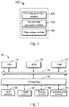
Fig. 7 shows a schematic block diagram of anillustrative device 700 capable of implementing various embodiments of the present disclosure. Thedevice 700 may be used to implement theapparatus 600 for generating a raster map of the present disclosure. As shown in the figure, thedevice 700 includes a central processing unit (CPU) 701 that may perform various appropriate actions and processing in accordance with computer program instructions stored in a read only memory (ROM) 702 or computer program instructions loaded into a random access memory (RAM) 703 from astorage unit 708. In theRAM 703, various programs and data required for the operation of thedevice 700 may also be stored. TheCPU 701, theROM 702, and theRAM 703 are connected to each other through abus 704. An input/output (I/O)interface 705 is also coupled to thebus 704. - A plurality of components in the
device 700 are coupled to the I/O interface 705, including: aninput unit 706, such as a keyboard or a mouse; anoutput unit 707, such as various types of displays, or speakers; thestorage unit 708, such as a disk or an optical disk; and acommunication unit 709 such as a network card, a modem, or a wireless communication transceiver. Thecommunication unit 709 allows thedevice 700 to exchange information/data with other devices over a computer network such as the Internet and/or various telecommunication networks. - The
processing unit 701 performs the various methods and processes described above, such as theprocess 200 and/or theprocess 500. For example, in some embodiments, theprocess 200 and/or theprocess 500 may be implemented as a computer software program that is tangibly embodied in a machine readable medium, such as thestorage unit 708. In some embodiments, some or all of the computer programs may be loaded and/or installed onto thedevice 700 via theROM 702 and/or thecommunication unit 709. When a computer program is loaded into theRAM 703 and executed by theCPU 701, one or more of the actions or steps of theprocess 200 and/or theprocess 500 described above may be performed. Alternatively, in other embodiments, theCPU 701 may be configured to perform theprocess 200 and/or theprocess 500 by any other suitable means (e.g., by means of firmware). - The functions described herein above may be performed, at least in part, by one or more hardware logic components. For example, and without limitation, illustrative types of hardware logic components that may be used include: Field Programmable Gate Array (FPGA), Application Specific Integrated Circuit (ASIC), Application Specific Standard Product (ASSP), System on Chip (SOC), Complex Programmable Logic Device (CPLD), and the like.
- Program codes for implementing the method of the present disclosure may be written in any combination of one or more programming languages. These program codes may be provided to a processor or controller of a general purpose computer, special purpose computer or other programmable data processing apparatus such that the program codes, when executed by the processor or controller, enables the functions/operations specified in the flowcharts and/or block diagrams being implemented. The program codes may execute entirely on the machine, partly on the machine, as a stand-alone software package partly on the machine and partly on the remote machine, or entirely on the remote machine or server.
- In the context of the present disclosure, the machine readable medium may be a tangible medium that may contain or store programs for use by or in connection with an instruction execution system, apparatus, or device. The machine readable medium may be a machine readable signal medium or a machine readable storage medium. The machine readable medium may include, but is not limited to, an electronic, magnetic, optical, electromagnetic, infrared, or semiconductor system, apparatus, or device, or any suitable combination of the foregoing. More specific examples of the machine readable storage medium may include an electrical connection based on one or more wires, portable computer disk, hard disk, random access memory (RAM), read only memory (ROM), erasable programmable read only memory (EPROM or flash memory), optical fiber, portable compact disk read only memory (CD-ROM), optical storage device, magnetic storage device, or any suitable combination of the foregoing.
- In addition, although various actions or steps are described in a specific order, this should not be understood that such actions or steps are required to be performed in the specific order shown or in sequential order, or all illustrated actions or steps should be performed to achieve the desired result. Multitasking and parallel processing may be advantageous in certain circumstances. Likewise, although several specific implementation details are included in the above discussion, these should not be construed as limiting the scope of the present disclosure. Certain features described in the context of separate embodiments may also be implemented in combination in a single implementation. Conversely, various features described in the context of a single implementation may also be implemented in a plurality of implementations, either individually or in any suitable sub-combination.
- Although some embodiments of the present disclosure are described in language specific to structural features and/or method logic actions, it should be understood that the subject matter defined in the appended claims is not limited to the specific features or actions described above. Instead, the specific features and actions described above are merely illustrative forms of implementing the claims.
Claims (12)
- A method for generating a raster map for navigation or positioning, the method comprising:generating (204) a first raster map having a first resolution based on an acquired laser point cloud;generating (206) a second raster map having a second resolution by merging rasters in the first raster map, the second resolution being lower than the first resolution; andstoring (208) the first raster map and an association between the first raster map and the second raster map;characterized in that the method further comprises:acquiring an updated laser point cloud;registering the updated laser point cloud with the laser point cloud by adjusting a coordinate system of the updated laser point cloud based on the coordinate system of the laser point cloud; andupdating the first raster map using the registered updated laser point cloud;wherein the method further comprises invoking the first raster map during the navigation or positioning, comprising:receiving a request for a digital map;in response to determining that the request relates to the first raster map, obtaining the first raster map; andin response to determining that the request relates to the second raster map, obtaining the first raster map and the association between the first raster map and the second raster map; and dynamically generating (206) the second raster map based on the stored first raster map and the stored association between the first raster map and the second raster map.
- The method according to claim 1, characterized in that the method further comprises:
establishing the association between the first raster map and the second raster map using an octree spatial index. - The method according to claim 1, characterized in that the method further comprises:generating a third raster map having a third resolution by merging rasters in the second raster map, the third resolution being lower than the second resolution; andstoring the association between the second raster map and the third raster map.
- The method according to claim 1, characterized in that the generating the first raster map comprises:
generating a multi-dimensional attribute of each of the rasters in the first raster map, the multi-dimensional attribute comprising an occupancy attribute indicating whether a raster being occupied and at least one of: an average reflectivity attribute, a color attribute, a density attribute, or a curvature attribute. - The method according to claim 4, characterized in that the color attribute is generated based on the laser point cloud and a photo associated with the laser point cloud.
- The method according to claim 5, characterized in that the updated laser point cloud is associated with a part of the laser point cloud, and the updating the first raster map comprises:
updating the part of the first raster map using the registered updated laser point cloud. - An apparatus for generating a raster map for navigation positioning, the apparatus comprising:a first map generation module (620), configured to generate a first raster map having a first resolution based on an acquired laser point cloud;a second map generation module (630), configured to generate a second raster map having a second resolution by merging rasters in the first raster map, the second resolution being lower than the first resolution; anda map storage module (640), configured to store the first raster map and an association between the first raster map and the second raster map;characterized in that the apparatus further comprises a map-updating module, configured to:acquire an updated laser point cloud;register the updated laser point cloud with the laser point cloud by adjusting a coordinate system of the updated laser point cloud based on the coordinate system of the laser point cloud; andupdate the first raster map using the registered updated laser point cloud;wherein the second map generation module (630) is further configured to invoke the first raster map during the navigation or positioning, comprising:receiving a request for a digital map;in response to determining that the request relates to the first raster map, obtaining the first raster map; andin response to determining that the request relates to the second raster map, obtaining the first raster map and the association between the first raster map and the second raster map; and dynamically generating the second raster map based on the stored first raster map and the stored association between the first raster map and the second raster map.
- The apparatus according to claim 7, characterized in that the apparatus further comprises:
an association establishing module, configured to establish the association between the first raster map and the second raster map using an octree spatial index. - The apparatus according to claim 7, characterized in that the apparatus further comprises:a third map generation module, configured to generate a third raster map having a third resolution by merging rasters in the second raster map, the third resolution being lower than the second resolution; anda map association storing module, configured to store the association between the second raster map and the third raster map.
- The apparatus according to claim 7, characterized in that the first map generation module is further configured to:generate a multi-dimensional attribute of each of the rasters in the first raster map, the multi-dimensional attribute comprising an occupancy attribute indicating whether a raster being occupied and at least one of: an average reflectivity attribute, a color attribute, a density attribute, or a curvature attribute;preferably, the color attribute is generated based on the laser point cloud and a photo associated with the laser point cloud.
- The apparatus according to claim 7, characterized in that the updated laser point cloud is associated with a part of the laser point cloud, and the map-updating module is further configured to:
update the part of the first raster map using the registered updated laser point cloud. - A computer readable storage medium, storing a computer program thereon, wherein the computer program, when executed by a processor, implements the method according to any one of claims 1-6.
Applications Claiming Priority (1)
| Application Number | Priority Date | Filing Date | Title |
|---|---|---|---|
| CN201711485401.0A CN108319655B (en) | 2017-12-29 | 2017-12-29 | Method and device for generating grid map |
Publications (2)
| Publication Number | Publication Date |
|---|---|
| EP3506212A1 EP3506212A1 (en) | 2019-07-03 |
| EP3506212B1 true EP3506212B1 (en) | 2022-08-24 |
Family
ID=62892947
Family Applications (1)
| Application Number | Title | Priority Date | Filing Date |
|---|---|---|---|
| EP18215854.3A Active EP3506212B1 (en) | 2017-12-29 | 2018-12-24 | Method and apparatus for generating raster map |
Country Status (5)
| Country | Link |
|---|---|
| US (1) | US11030803B2 (en) |
| EP (1) | EP3506212B1 (en) |
| JP (1) | JP7068989B2 (en) |
| KR (1) | KR102235827B1 (en) |
| CN (1) | CN108319655B (en) |
Families Citing this family (57)
| Publication number | Priority date | Publication date | Assignee | Title |
|---|---|---|---|---|
| US11422259B2 (en) * | 2018-06-28 | 2022-08-23 | Zoox, Inc. | Multi-resolution maps for localization |
| US10890663B2 (en) * | 2018-06-28 | 2021-01-12 | Zoox, Inc. | Loading multi-resolution maps for localization |
| CN109146976B (en) | 2018-08-23 | 2020-06-02 | 百度在线网络技术(北京)有限公司 | Method and device for locating unmanned vehicles |
| CN109085836A (en) * | 2018-08-29 | 2018-12-25 | 深圳市浦硕科技有限公司 | A kind of method that sweeping robot returns designated position minimal path |
| JP6873960B2 (en) * | 2018-09-27 | 2021-05-19 | 株式会社日立製作所 | Map data high-detailed system, its server, and its method |
| CN109544650B (en) * | 2018-11-07 | 2020-05-05 | 苏州工业园区格网信息科技有限公司 | Geographic coordinate compression coding and decoding method based on three-dimensional space subdivision |
| CN109558471B (en) * | 2018-11-14 | 2020-10-16 | 广州广电研究院有限公司 | Updating method, device, storage medium and system of grid map |
| EP3654064B1 (en) | 2018-11-16 | 2021-01-13 | Bayerische Motoren Werke Aktiengesellschaft | Apparatus and method for characterizing an object based on measurement samples from one or more location sensors |
| CN109540142B (en) * | 2018-11-27 | 2021-04-06 | 达闼科技(北京)有限公司 | A method, device and computing device for robot positioning and navigation |
| JP7351079B2 (en) | 2018-11-30 | 2023-09-27 | ソニーグループ株式会社 | Control device, control method and program |
| CN112015929B (en) * | 2019-05-30 | 2024-07-05 | 阿里云计算有限公司 | Raster data access method and device, electronic equipment and computer storage medium |
| CN110319832B (en) * | 2019-07-05 | 2024-05-17 | 京东科技信息技术有限公司 | Robot positioning method, device, electronic equipment and medium |
| CN110411464B (en) * | 2019-07-12 | 2023-04-07 | 中南大学 | Three-dimensional point cloud map generation method, device, equipment and storage medium |
| CN112154429B (en) * | 2019-07-29 | 2024-03-19 | 深圳市大疆创新科技有限公司 | High-precision map positioning method, system, platform and computer-readable storage medium |
| CN112362059B (en) * | 2019-10-23 | 2023-05-30 | 北京京东乾石科技有限公司 | Mobile carrier positioning method, device, computer equipment and medium |
| CN110795521B (en) * | 2019-10-31 | 2024-04-19 | 中科软智(北京)科技有限公司 | Method and device for acquiring personnel distribution situation information of complex space |
| CN111028350B (en) * | 2019-11-21 | 2022-05-20 | 大连理工大学 | Method for constructing grid map by using binocular stereo camera |
| CN110849352B (en) * | 2019-11-21 | 2021-07-02 | 大连理工大学 | A method for building raster maps using infrared, depth and binocular camera fusion |
| CN110849351B (en) * | 2019-11-21 | 2021-07-06 | 大连理工大学 | A method for building a raster map using a depth camera and a binocular camera |
| US11138787B2 (en) * | 2019-11-25 | 2021-10-05 | Rockwell Collins, Inc. | Efficient transfer of dynamic 3D world model data |
| US11139570B2 (en) | 2019-12-10 | 2021-10-05 | Rockwell Collins, Inc. | Ultra-wideband circular beamformer |
| WO2021155558A1 (en) * | 2020-02-07 | 2021-08-12 | 深圳市商汤科技有限公司 | Road marking identification method, map generation method and related product |
| CN111381245B (en) * | 2020-02-29 | 2023-06-06 | 天津大学 | Laser SLAM Adaptive Resolution Raster Map Construction Method |
| CN113359811A (en) * | 2020-03-04 | 2021-09-07 | 贾敏忠 | Logistics operation task planning management system and method for unmanned aerial vehicle |
| CN111461982B (en) * | 2020-03-30 | 2023-09-22 | 北京百度网讯科技有限公司 | Method and device for splicing point clouds |
| CN113916215B (en) * | 2020-03-31 | 2024-11-19 | 上海擎朗智能科技有限公司 | Method, device, equipment and storage medium for updating positioning map |
| CN111479321B (en) * | 2020-04-17 | 2021-01-12 | 滴图(北京)科技有限公司 | Grid construction method and device, electronic equipment and storage medium |
| CN111631639B (en) * | 2020-05-26 | 2021-07-06 | 珠海市一微半导体有限公司 | Map traversal block establishment method, chip and mobile robot for global grid map |
| US20230245349A1 (en) * | 2020-05-29 | 2023-08-03 | Nippon Telegraph And Telephone Corporation | Data update method, data update apparatus and program |
| CN111813101B (en) * | 2020-06-04 | 2024-04-02 | 深圳优地科技有限公司 | Robot path planning method, device, terminal equipment and storage medium |
| CN111765884B (en) * | 2020-06-18 | 2023-06-23 | 京东科技信息技术有限公司 | Robot relocation method, device, electronic device and storage medium |
| CN111968229B (en) * | 2020-06-28 | 2024-07-16 | 阿波罗智能技术(北京)有限公司 | High-precision map making method and device |
| CN113865598B (en) * | 2020-06-30 | 2025-07-22 | 华为技术有限公司 | Positioning map generation method, positioning method and positioning device |
| CN111881239B (en) * | 2020-07-17 | 2023-07-28 | 上海高仙自动化科技发展有限公司 | Construction method, construction device, intelligent robot and readable storage medium |
| CN111737395B (en) * | 2020-08-19 | 2020-12-22 | 浙江欣奕华智能科技有限公司 | A method, device and robot system for generating an occupancy grid map |
| CN112083722B (en) * | 2020-08-27 | 2023-08-04 | 广州赛特智能科技有限公司 | Multi-machine multi-floor scheduling system and scheduling method for mobile robot |
| CN114255275B (en) * | 2020-09-14 | 2025-05-06 | 深圳引望智能技术有限公司 | A method for constructing a map and a computing device |
| CN112129266B (en) * | 2020-09-28 | 2022-12-16 | 北京嘀嘀无限科技发展有限公司 | Method, apparatus, device and computer readable storage medium for processing map |
| WO2022067534A1 (en) * | 2020-09-29 | 2022-04-07 | 华为技术有限公司 | Occupancy grid map generation method and device |
| CN112180946B (en) * | 2020-10-22 | 2023-10-03 | 湖南格兰博智能科技有限责任公司 | Navigation path planning method and system of sweeping robot and electronic equipment |
| KR20220068043A (en) * | 2020-11-18 | 2022-05-25 | 현대자동차주식회사 | Apparatus and method for determining error of precise map |
| US11430182B1 (en) * | 2021-03-09 | 2022-08-30 | Pony Ai Inc. | Correcting or expanding an existing high-definition map |
| CN112907747B (en) * | 2021-03-26 | 2024-10-29 | 上海商汤临港智能科技有限公司 | Point cloud data processing method and device, electronic equipment and storage medium |
| CN113298715A (en) * | 2021-05-26 | 2021-08-24 | 深圳优地科技有限公司 | Robot grid map construction method and device, robot and storage medium |
| CN113256712B (en) * | 2021-06-01 | 2023-04-18 | 北京有竹居网络技术有限公司 | Positioning method, positioning device, electronic equipment and storage medium |
| CN113640822B (en) * | 2021-07-07 | 2023-08-18 | 华南理工大学 | A high-precision map construction method based on non-map element filtering |
| CN113568997B (en) * | 2021-07-30 | 2025-02-21 | 京东鲲鹏(江苏)科技有限公司 | Point cloud map updating method, device, electronic device and computer readable medium |
| CN114384920B (en) * | 2022-03-23 | 2022-06-10 | 安徽大学 | Dynamic obstacle avoidance method based on real-time construction of local grid map |
| EP4523170A4 (en) * | 2022-05-11 | 2025-09-24 | Grabtaxi Holdings Pte Ltd | METHOD, DEVICE AND SYSTEM FOR PROCESSING SPATIAL DATA |
| US12131531B2 (en) * | 2022-06-23 | 2024-10-29 | Lockheed Martin Corporation | Real time light-detection and ranging point decimation |
| US12165405B2 (en) | 2022-06-23 | 2024-12-10 | Lockheed Martin Corporation | Terrain fusion real-time ray tracing optimization |
| CN115290098B (en) * | 2022-09-30 | 2022-12-23 | 成都朴为科技有限公司 | Robot positioning method and system based on variable step length |
| CN117129990B (en) * | 2022-11-02 | 2024-09-20 | 神顶科技(南京)有限公司 | Grid map detection method and system |
| CN117470247B (en) * | 2023-12-19 | 2024-05-03 | 珠海云洲智能科技股份有限公司 | Path planning method and path planning controller |
| CN117557681B (en) * | 2024-01-09 | 2024-04-16 | 山东鲁邦地理信息工程有限公司 | A method and device for generating high-precision topographic maps based on multi-source surveying and mapping data |
| CN121685692A (en) * | 2024-08-27 | 2026-03-17 | 南京泉峰科技有限公司 | Grid map and robot mows |
| CN119762506B (en) * | 2024-12-27 | 2025-11-04 | 东南大学 | A method and system for ground point cloud segmentation for intelligent wheelchairs |
Citations (1)
| Publication number | Priority date | Publication date | Assignee | Title |
|---|---|---|---|---|
| US20140005933A1 (en) * | 2011-09-30 | 2014-01-02 | Evolution Robotics, Inc. | Adaptive Mapping with Spatial Summaries of Sensor Data |
Family Cites Families (17)
| Publication number | Priority date | Publication date | Assignee | Title |
|---|---|---|---|---|
| CN1702432A (en) * | 2005-06-08 | 2005-11-30 | 武汉虹信通信技术有限责任公司 | Method for processing dynamic display of grid electronic map |
| US20070229501A1 (en) * | 2006-03-31 | 2007-10-04 | Vladmir Kouznetsov | Method and system for organizing and rendering multiple geometric parts within a volume graphics data set |
| US20070262988A1 (en) * | 2006-05-09 | 2007-11-15 | Pixar Animation Studios | Method and apparatus for using voxel mip maps and brick maps as geometric primitives in image rendering process |
| CN100452050C (en) * | 2006-09-28 | 2009-01-14 | 江苏天泽信息产业有限公司 | Method for generation, organization and target data generation of raster electronic map source data |
| JP5531474B2 (en) * | 2008-12-12 | 2014-06-25 | 株式会社豊田中央研究所 | Map generation device, runway estimation device, movable region estimation device, and program |
| JP2013140515A (en) * | 2012-01-05 | 2013-07-18 | Toyota Central R&D Labs Inc | Solid object detection device and program |
| DE102012105332A1 (en) * | 2012-06-19 | 2013-12-19 | Continental Teves Ag & Co. Ohg | Method for displaying a vehicle environment |
| WO2014205769A1 (en) | 2013-06-28 | 2014-12-31 | Hulu Llc | Local binary pattern-based optical flow |
| CN103699641A (en) * | 2013-12-24 | 2014-04-02 | 北京易华录信息技术股份有限公司 | Method for accessing different raster map services |
| US9476730B2 (en) * | 2014-03-18 | 2016-10-25 | Sri International | Real-time system for multi-modal 3D geospatial mapping, object recognition, scene annotation and analytics |
| JP7345237B2 (en) * | 2014-11-05 | 2023-09-15 | シエラ・ネバダ・コーポレイション | System and method for generating improved environmental representations for mobile objects |
| US9600929B1 (en) * | 2014-12-01 | 2017-03-21 | Ngrain (Canada) Corporation | System, computer-readable medium and method for 3D-differencing of 3D voxel models |
| CN105787873A (en) * | 2014-12-22 | 2016-07-20 | 北京四维图新科技股份有限公司 | Map difference extraction method, device and terminal |
| US9877031B2 (en) * | 2015-04-29 | 2018-01-23 | Pitney Bowes Inc. | System and method for multi-resolution raster data processing |
| US20170214943A1 (en) | 2016-01-22 | 2017-07-27 | Mitsubishi Electric Research Laboratories, Inc. | Point Cloud Compression using Prediction and Shape-Adaptive Transforms |
| CN106407408B (en) * | 2016-09-22 | 2019-08-16 | 北京数字绿土科技有限公司 | A kind of the spatial index construction method and device of mass cloud data |
| EP3324209A1 (en) * | 2016-11-18 | 2018-05-23 | Dibotics | Methods and systems for vehicle environment map generation and updating |
-
2017
- 2017-12-29 CN CN201711485401.0A patent/CN108319655B/en active Active
-
2018
- 2018-09-28 KR KR1020180115910A patent/KR102235827B1/en not_active Expired - Fee Related
- 2018-10-30 JP JP2018203651A patent/JP7068989B2/en not_active Expired - Fee Related
- 2018-12-21 US US16/230,671 patent/US11030803B2/en active Active
- 2018-12-24 EP EP18215854.3A patent/EP3506212B1/en active Active
Patent Citations (1)
| Publication number | Priority date | Publication date | Assignee | Title |
|---|---|---|---|---|
| US20140005933A1 (en) * | 2011-09-30 | 2014-01-02 | Evolution Robotics, Inc. | Adaptive Mapping with Spatial Summaries of Sensor Data |
Non-Patent Citations (1)
| Title |
|---|
| YANG SINING ET AL: "Real-time globally consistent 3D grid mapping", 2017 IEEE INTERNATIONAL CONFERENCE ON ROBOTICS AND BIOMIMETICS (ROBIO), IEEE, 5 December 2017 (2017-12-05), pages 929 - 935, XP033333058, DOI: 10.1109/ROBIO.2017.8324536 * |
Also Published As
| Publication number | Publication date |
|---|---|
| KR102235827B1 (en) | 2021-04-07 |
| JP7068989B2 (en) | 2022-05-17 |
| KR20190082060A (en) | 2019-07-09 |
| EP3506212A1 (en) | 2019-07-03 |
| US11030803B2 (en) | 2021-06-08 |
| US20190206122A1 (en) | 2019-07-04 |
| CN108319655A (en) | 2018-07-24 |
| CN108319655B (en) | 2021-05-07 |
| JP2019120927A (en) | 2019-07-22 |
Similar Documents
| Publication | Publication Date | Title |
|---|---|---|
| EP3506212B1 (en) | Method and apparatus for generating raster map | |
| EP4116935B1 (en) | High-definition map creation method and device, and electronic device | |
| KR102145109B1 (en) | Methods and apparatuses for map generation and moving entity localization | |
| KR102126724B1 (en) | Method and apparatus for restoring point cloud data | |
| KR102314228B1 (en) | Map construction method, apparatus, device and readable storage medium | |
| CN113932790B (en) | Map updating method, device, system, electronic device and storage medium | |
| CN109840448A (en) | Information output method and device for automatic driving vehicle | |
| CN114092660B (en) | High-precision map generation method, apparatus, and vehicle for map generation | |
| CN112132951B (en) | A vision-based grid semantic map construction method | |
| CN114445565B (en) | Data processing method, device, electronic device and computer readable medium | |
| CN108732556A (en) | A kind of mobile lidar emulation mode based on geometry intersection operation | |
| CN113936109A (en) | Processing method, device and equipment of high-precision map point cloud data and storage medium | |
| KR20230006628A (en) | method and device for processing image, electronic equipment, storage medium and computer program | |
| CN116929377A (en) | Laser radar and inertial navigation fusion positioning method and related equipment | |
| CN115909262A (en) | Parking space detection method, device, electronic device and storage medium | |
| CN114842106A (en) | Method and apparatus for constructing grid map, self-walking apparatus, and storage medium | |
| CN114241083B (en) | Lane line generation method, device, electronic device and storage medium | |
| CN114252081A (en) | Positioning method, device, equipment and storage medium | |
| CN119759929B (en) | An electronic map updating method, computer device, and storage medium | |
| CN113447032A (en) | Positioning method, positioning device, electronic equipment and storage medium | |
| CN115239899A (en) | Pose map generation method, high-precision map generation method and device | |
| CN117011486B (en) | Grid map construction method, device, electronic equipment and computer storage medium | |
| CN118736104A (en) | Method, device, equipment and storage medium for acquiring voxel information in three-dimensional space | |
| CN120685073A (en) | Repositioning method, repositioning device and vehicle | |
| Bulatov et al. | Very fast road database verification using textured 3D city models obtained from airborne imagery |
Legal Events
| Date | Code | Title | Description |
|---|---|---|---|
| PUAI | Public reference made under article 153(3) epc to a published international application that has entered the european phase |
Free format text: ORIGINAL CODE: 0009012 |
|
| STAA | Information on the status of an ep patent application or granted ep patent |
Free format text: STATUS: THE APPLICATION HAS BEEN PUBLISHED |
|
| AK | Designated contracting states |
Kind code of ref document: A1 Designated state(s): AL AT BE BG CH CY CZ DE DK EE ES FI FR GB GR HR HU IE IS IT LI LT LU LV MC MK MT NL NO PL PT RO RS SE SI SK SM TR |
|
| AX | Request for extension of the european patent |
Extension state: BA ME |
|
| STAA | Information on the status of an ep patent application or granted ep patent |
Free format text: STATUS: REQUEST FOR EXAMINATION WAS MADE |
|
| 17P | Request for examination filed |
Effective date: 20191220 |
|
| RBV | Designated contracting states (corrected) |
Designated state(s): AL AT BE BG CH CY CZ DE DK EE ES FI FR GB GR HR HU IE IS IT LI LT LU LV MC MK MT NL NO PL PT RO RS SE SI SK SM TR |
|
| STAA | Information on the status of an ep patent application or granted ep patent |
Free format text: STATUS: EXAMINATION IS IN PROGRESS |
|
| 17Q | First examination report despatched |
Effective date: 20200827 |
|
| RAP1 | Party data changed (applicant data changed or rights of an application transferred) |
Owner name: APOLLO INTELLIGENT DRIVING TECHNOLOGY (BEIJING) CO., LTD. |
|
| REG | Reference to a national code |
Ref country code: DE Ref legal event code: R079 Ref document number: 602018039648 Country of ref document: DE Free format text: PREVIOUS MAIN CLASS: G06T0017000000 Ipc: G01C0021320000 |
|
| RIC1 | Information provided on ipc code assigned before grant |
Ipc: G06T 17/00 20060101ALI20211214BHEP Ipc: G06T 9/00 20060101ALI20211214BHEP Ipc: G01S 17/931 20200101ALI20211214BHEP Ipc: G01S 17/89 20200101ALI20211214BHEP Ipc: G01S 17/86 20200101ALI20211214BHEP Ipc: G01C 21/32 20060101AFI20211214BHEP |
|
| GRAP | Despatch of communication of intention to grant a patent |
Free format text: ORIGINAL CODE: EPIDOSNIGR1 |
|
| STAA | Information on the status of an ep patent application or granted ep patent |
Free format text: STATUS: GRANT OF PATENT IS INTENDED |
|
| INTG | Intention to grant announced |
Effective date: 20220321 |
|
| GRAS | Grant fee paid |
Free format text: ORIGINAL CODE: EPIDOSNIGR3 |
|
| GRAA | (expected) grant |
Free format text: ORIGINAL CODE: 0009210 |
|
| STAA | Information on the status of an ep patent application or granted ep patent |
Free format text: STATUS: THE PATENT HAS BEEN GRANTED |
|
| AK | Designated contracting states |
Kind code of ref document: B1 Designated state(s): AL AT BE BG CH CY CZ DE DK EE ES FI FR GB GR HR HU IE IS IT LI LT LU LV MC MK MT NL NO PL PT RO RS SE SI SK SM TR |
|
| REG | Reference to a national code |
Ref country code: CH Ref legal event code: EP |
|
| REG | Reference to a national code |
Ref country code: DE Ref legal event code: R096 Ref document number: 602018039648 Country of ref document: DE |
|
| REG | Reference to a national code |
Ref country code: IE Ref legal event code: FG4D |
|
| REG | Reference to a national code |
Ref country code: AT Ref legal event code: REF Ref document number: 1513946 Country of ref document: AT Kind code of ref document: T Effective date: 20220915 |
|
| REG | Reference to a national code |
Ref country code: LT Ref legal event code: MG9D |
|
| REG | Reference to a national code |
Ref country code: NL Ref legal event code: MP Effective date: 20220824 |
|
| PG25 | Lapsed in a contracting state [announced via postgrant information from national office to epo] |
Ref country code: SE Free format text: LAPSE BECAUSE OF FAILURE TO SUBMIT A TRANSLATION OF THE DESCRIPTION OR TO PAY THE FEE WITHIN THE PRESCRIBED TIME-LIMIT Effective date: 20220824 Ref country code: RS Free format text: LAPSE BECAUSE OF FAILURE TO SUBMIT A TRANSLATION OF THE DESCRIPTION OR TO PAY THE FEE WITHIN THE PRESCRIBED TIME-LIMIT Effective date: 20220824 Ref country code: PT Free format text: LAPSE BECAUSE OF FAILURE TO SUBMIT A TRANSLATION OF THE DESCRIPTION OR TO PAY THE FEE WITHIN THE PRESCRIBED TIME-LIMIT Effective date: 20221226 Ref country code: NO Free format text: LAPSE BECAUSE OF FAILURE TO SUBMIT A TRANSLATION OF THE DESCRIPTION OR TO PAY THE FEE WITHIN THE PRESCRIBED TIME-LIMIT Effective date: 20221124 Ref country code: NL Free format text: LAPSE BECAUSE OF FAILURE TO SUBMIT A TRANSLATION OF THE DESCRIPTION OR TO PAY THE FEE WITHIN THE PRESCRIBED TIME-LIMIT Effective date: 20220824 Ref country code: LV Free format text: LAPSE BECAUSE OF FAILURE TO SUBMIT A TRANSLATION OF THE DESCRIPTION OR TO PAY THE FEE WITHIN THE PRESCRIBED TIME-LIMIT Effective date: 20220824 Ref country code: LT Free format text: LAPSE BECAUSE OF FAILURE TO SUBMIT A TRANSLATION OF THE DESCRIPTION OR TO PAY THE FEE WITHIN THE PRESCRIBED TIME-LIMIT Effective date: 20220824 Ref country code: FI Free format text: LAPSE BECAUSE OF FAILURE TO SUBMIT A TRANSLATION OF THE DESCRIPTION OR TO PAY THE FEE WITHIN THE PRESCRIBED TIME-LIMIT Effective date: 20220824 |
|
| REG | Reference to a national code |
Ref country code: AT Ref legal event code: MK05 Ref document number: 1513946 Country of ref document: AT Kind code of ref document: T Effective date: 20220824 |
|
| PG25 | Lapsed in a contracting state [announced via postgrant information from national office to epo] |
Ref country code: PL Free format text: LAPSE BECAUSE OF FAILURE TO SUBMIT A TRANSLATION OF THE DESCRIPTION OR TO PAY THE FEE WITHIN THE PRESCRIBED TIME-LIMIT Effective date: 20220824 Ref country code: IS Free format text: LAPSE BECAUSE OF FAILURE TO SUBMIT A TRANSLATION OF THE DESCRIPTION OR TO PAY THE FEE WITHIN THE PRESCRIBED TIME-LIMIT Effective date: 20221224 Ref country code: HR Free format text: LAPSE BECAUSE OF FAILURE TO SUBMIT A TRANSLATION OF THE DESCRIPTION OR TO PAY THE FEE WITHIN THE PRESCRIBED TIME-LIMIT Effective date: 20220824 Ref country code: GR Free format text: LAPSE BECAUSE OF FAILURE TO SUBMIT A TRANSLATION OF THE DESCRIPTION OR TO PAY THE FEE WITHIN THE PRESCRIBED TIME-LIMIT Effective date: 20221125 |
|
| PG25 | Lapsed in a contracting state [announced via postgrant information from national office to epo] |
Ref country code: SM Free format text: LAPSE BECAUSE OF FAILURE TO SUBMIT A TRANSLATION OF THE DESCRIPTION OR TO PAY THE FEE WITHIN THE PRESCRIBED TIME-LIMIT Effective date: 20220824 Ref country code: RO Free format text: LAPSE BECAUSE OF FAILURE TO SUBMIT A TRANSLATION OF THE DESCRIPTION OR TO PAY THE FEE WITHIN THE PRESCRIBED TIME-LIMIT Effective date: 20220824 Ref country code: ES Free format text: LAPSE BECAUSE OF FAILURE TO SUBMIT A TRANSLATION OF THE DESCRIPTION OR TO PAY THE FEE WITHIN THE PRESCRIBED TIME-LIMIT Effective date: 20220824 Ref country code: DK Free format text: LAPSE BECAUSE OF FAILURE TO SUBMIT A TRANSLATION OF THE DESCRIPTION OR TO PAY THE FEE WITHIN THE PRESCRIBED TIME-LIMIT Effective date: 20220824 Ref country code: CZ Free format text: LAPSE BECAUSE OF FAILURE TO SUBMIT A TRANSLATION OF THE DESCRIPTION OR TO PAY THE FEE WITHIN THE PRESCRIBED TIME-LIMIT Effective date: 20220824 Ref country code: AT Free format text: LAPSE BECAUSE OF FAILURE TO SUBMIT A TRANSLATION OF THE DESCRIPTION OR TO PAY THE FEE WITHIN THE PRESCRIBED TIME-LIMIT Effective date: 20220824 |
|
| REG | Reference to a national code |
Ref country code: DE Ref legal event code: R097 Ref document number: 602018039648 Country of ref document: DE |
|
| PG25 | Lapsed in a contracting state [announced via postgrant information from national office to epo] |
Ref country code: SK Free format text: LAPSE BECAUSE OF FAILURE TO SUBMIT A TRANSLATION OF THE DESCRIPTION OR TO PAY THE FEE WITHIN THE PRESCRIBED TIME-LIMIT Effective date: 20220824 Ref country code: EE Free format text: LAPSE BECAUSE OF FAILURE TO SUBMIT A TRANSLATION OF THE DESCRIPTION OR TO PAY THE FEE WITHIN THE PRESCRIBED TIME-LIMIT Effective date: 20220824 |
|
| PG25 | Lapsed in a contracting state [announced via postgrant information from national office to epo] |
Ref country code: AL Free format text: LAPSE BECAUSE OF FAILURE TO SUBMIT A TRANSLATION OF THE DESCRIPTION OR TO PAY THE FEE WITHIN THE PRESCRIBED TIME-LIMIT Effective date: 20220824 |
|
| PLBE | No opposition filed within time limit |
Free format text: ORIGINAL CODE: 0009261 |
|
| STAA | Information on the status of an ep patent application or granted ep patent |
Free format text: STATUS: NO OPPOSITION FILED WITHIN TIME LIMIT |
|
| P01 | Opt-out of the competence of the unified patent court (upc) registered |
Effective date: 20230526 |
|
| REG | Reference to a national code |
Ref country code: CH Ref legal event code: PL |
|
| 26N | No opposition filed |
Effective date: 20230525 |
|
| GBPC | Gb: european patent ceased through non-payment of renewal fee |
Effective date: 20221224 |
|
| REG | Reference to a national code |
Ref country code: BE Ref legal event code: MM Effective date: 20221231 |
|
| PG25 | Lapsed in a contracting state [announced via postgrant information from national office to epo] |
Ref country code: SI Free format text: LAPSE BECAUSE OF FAILURE TO SUBMIT A TRANSLATION OF THE DESCRIPTION OR TO PAY THE FEE WITHIN THE PRESCRIBED TIME-LIMIT Effective date: 20220824 Ref country code: LU Free format text: LAPSE BECAUSE OF NON-PAYMENT OF DUE FEES Effective date: 20221224 |
|
| PG25 | Lapsed in a contracting state [announced via postgrant information from national office to epo] |
Ref country code: LI Free format text: LAPSE BECAUSE OF NON-PAYMENT OF DUE FEES Effective date: 20221231 Ref country code: IE Free format text: LAPSE BECAUSE OF NON-PAYMENT OF DUE FEES Effective date: 20221224 Ref country code: GB Free format text: LAPSE BECAUSE OF NON-PAYMENT OF DUE FEES Effective date: 20221224 Ref country code: CH Free format text: LAPSE BECAUSE OF NON-PAYMENT OF DUE FEES Effective date: 20221231 |
|
| PG25 | Lapsed in a contracting state [announced via postgrant information from national office to epo] |
Ref country code: BE Free format text: LAPSE BECAUSE OF NON-PAYMENT OF DUE FEES Effective date: 20221231 |
|
| PG25 | Lapsed in a contracting state [announced via postgrant information from national office to epo] |
Ref country code: HU Free format text: LAPSE BECAUSE OF FAILURE TO SUBMIT A TRANSLATION OF THE DESCRIPTION OR TO PAY THE FEE WITHIN THE PRESCRIBED TIME-LIMIT; INVALID AB INITIO Effective date: 20181224 |
|
| PG25 | Lapsed in a contracting state [announced via postgrant information from national office to epo] |
Ref country code: CY Free format text: LAPSE BECAUSE OF FAILURE TO SUBMIT A TRANSLATION OF THE DESCRIPTION OR TO PAY THE FEE WITHIN THE PRESCRIBED TIME-LIMIT Effective date: 20220824 |
|
| PG25 | Lapsed in a contracting state [announced via postgrant information from national office to epo] |
Ref country code: MK Free format text: LAPSE BECAUSE OF FAILURE TO SUBMIT A TRANSLATION OF THE DESCRIPTION OR TO PAY THE FEE WITHIN THE PRESCRIBED TIME-LIMIT Effective date: 20220824 Ref country code: IT Free format text: LAPSE BECAUSE OF FAILURE TO SUBMIT A TRANSLATION OF THE DESCRIPTION OR TO PAY THE FEE WITHIN THE PRESCRIBED TIME-LIMIT Effective date: 20220824 |
|
| PG25 | Lapsed in a contracting state [announced via postgrant information from national office to epo] |
Ref country code: MC Free format text: LAPSE BECAUSE OF FAILURE TO SUBMIT A TRANSLATION OF THE DESCRIPTION OR TO PAY THE FEE WITHIN THE PRESCRIBED TIME-LIMIT Effective date: 20220824 |
|
| PG25 | Lapsed in a contracting state [announced via postgrant information from national office to epo] |
Ref country code: MC Free format text: LAPSE BECAUSE OF FAILURE TO SUBMIT A TRANSLATION OF THE DESCRIPTION OR TO PAY THE FEE WITHIN THE PRESCRIBED TIME-LIMIT Effective date: 20220824 |
|
| PG25 | Lapsed in a contracting state [announced via postgrant information from national office to epo] |
Ref country code: BG Free format text: LAPSE BECAUSE OF FAILURE TO SUBMIT A TRANSLATION OF THE DESCRIPTION OR TO PAY THE FEE WITHIN THE PRESCRIBED TIME-LIMIT Effective date: 20220824 |
|
| PG25 | Lapsed in a contracting state [announced via postgrant information from national office to epo] |
Ref country code: MT Free format text: LAPSE BECAUSE OF FAILURE TO SUBMIT A TRANSLATION OF THE DESCRIPTION OR TO PAY THE FEE WITHIN THE PRESCRIBED TIME-LIMIT Effective date: 20220824 |
|
| PG25 | Lapsed in a contracting state [announced via postgrant information from national office to epo] |
Ref country code: TR Free format text: LAPSE BECAUSE OF FAILURE TO SUBMIT A TRANSLATION OF THE DESCRIPTION OR TO PAY THE FEE WITHIN THE PRESCRIBED TIME-LIMIT Effective date: 20220824 |
|
| PGFP | Annual fee paid to national office [announced via postgrant information from national office to epo] |
Ref country code: FR Payment date: 20251110 Year of fee payment: 8 |
|
| PGFP | Annual fee paid to national office [announced via postgrant information from national office to epo] |
Ref country code: DE Payment date: 20251222 Year of fee payment: 8 |