EP3460404B1 - Autonomous mobile robot, map building method, and map calling method for combined robot - Google Patents
Autonomous mobile robot, map building method, and map calling method for combined robot Download PDFInfo
- Publication number
- EP3460404B1 EP3460404B1 EP17798770.8A EP17798770A EP3460404B1 EP 3460404 B1 EP3460404 B1 EP 3460404B1 EP 17798770 A EP17798770 A EP 17798770A EP 3460404 B1 EP3460404 B1 EP 3460404B1
- Authority
- EP
- European Patent Office
- Prior art keywords
- robot
- combined
- dimensional map
- self
- map information
- Prior art date
- Legal status (The legal status is an assumption and is not a legal conclusion. Google has not performed a legal analysis and makes no representation as to the accuracy of the status listed.)
- Active
Links
Images

Classifications
-
- B—PERFORMING OPERATIONS; TRANSPORTING
- B25—HAND TOOLS; PORTABLE POWER-DRIVEN TOOLS; MANIPULATORS
- B25J—MANIPULATORS; CHAMBERS PROVIDED WITH MANIPULATION DEVICES
- B25J9/00—Program-controlled manipulators
- B25J9/16—Program controls
- B25J9/1656—Program controls characterised by programming, planning systems for manipulators
- B25J9/1664—Program controls characterised by programming, planning systems for manipulators characterised by motion, path, trajectory planning
- B25J9/1666—Avoiding collision or forbidden zones
-
- B—PERFORMING OPERATIONS; TRANSPORTING
- B25—HAND TOOLS; PORTABLE POWER-DRIVEN TOOLS; MANIPULATORS
- B25J—MANIPULATORS; CHAMBERS PROVIDED WITH MANIPULATION DEVICES
- B25J11/00—Manipulators not otherwise provided for
- B25J11/008—Manipulators for service tasks
- B25J11/0085—Cleaning
-
- B—PERFORMING OPERATIONS; TRANSPORTING
- B25—HAND TOOLS; PORTABLE POWER-DRIVEN TOOLS; MANIPULATORS
- B25J—MANIPULATORS; CHAMBERS PROVIDED WITH MANIPULATION DEVICES
- B25J5/00—Manipulators mounted on wheels or on carriages
- B25J5/007—Manipulators mounted on wheels or on carriages mounted on wheels
-
- G—PHYSICS
- G01—MEASURING; TESTING
- G01C—MEASURING DISTANCES, LEVELS OR BEARINGS; SURVEYING; NAVIGATION; GYROSCOPIC INSTRUMENTS; PHOTOGRAMMETRY OR VIDEOGRAMMETRY
- G01C21/00—Navigation; Navigational instruments not provided for in groups G01C1/00 - G01C19/00
- G01C21/38—Electronic maps specially adapted for navigation; Updating thereof
- G01C21/3804—Creation or updating of map data
- G01C21/3833—Creation or updating of map data characterised by the source of data
-
- G—PHYSICS
- G01—MEASURING; TESTING
- G01C—MEASURING DISTANCES, LEVELS OR BEARINGS; SURVEYING; NAVIGATION; GYROSCOPIC INSTRUMENTS; PHOTOGRAMMETRY OR VIDEOGRAMMETRY
- G01C21/00—Navigation; Navigational instruments not provided for in groups G01C1/00 - G01C19/00
- G01C21/38—Electronic maps specially adapted for navigation; Updating thereof
- G01C21/3863—Structures of map data
- G01C21/3867—Geometry of map features, e.g. shape points, polygons or for simplified maps
-
- G—PHYSICS
- G05—CONTROLLING; REGULATING
- G05D—SYSTEMS FOR CONTROLLING OR REGULATING NON-ELECTRIC VARIABLES
- G05D1/00—Control of position, course, altitude or attitude of land, water, air or space vehicles, e.g. using automatic pilots
- G05D1/02—Control of position or course in two dimensions
-
- G—PHYSICS
- G05—CONTROLLING; REGULATING
- G05D—SYSTEMS FOR CONTROLLING OR REGULATING NON-ELECTRIC VARIABLES
- G05D1/00—Control of position, course, altitude or attitude of land, water, air or space vehicles, e.g. using automatic pilots
- G05D1/02—Control of position or course in two dimensions
- G05D1/021—Control of position or course in two dimensions specially adapted to land vehicles
- G05D1/0231—Control of position or course in two dimensions specially adapted to land vehicles using optical position detecting means
- G05D1/0238—Control of position or course in two dimensions specially adapted to land vehicles using optical position detecting means using obstacle or wall sensors
-
- G—PHYSICS
- G05—CONTROLLING; REGULATING
- G05D—SYSTEMS FOR CONTROLLING OR REGULATING NON-ELECTRIC VARIABLES
- G05D1/00—Control of position, course, altitude or attitude of land, water, air or space vehicles, e.g. using automatic pilots
- G05D1/02—Control of position or course in two dimensions
- G05D1/021—Control of position or course in two dimensions specially adapted to land vehicles
- G05D1/0268—Control of position or course in two dimensions specially adapted to land vehicles using internal positioning means
- G05D1/0274—Control of position or course in two dimensions specially adapted to land vehicles using internal positioning means using mapping information stored in a memory device
Definitions
- the present disclosure relates to a self-moving robot, a map building method, and a map invoking method for a combined robot.
- a self-moving robot may be used for its convenient control and flexible action.
- the height may be limited to a certain degree. In the walking process of the self-moving robot, if the height of an obstacle is less than the height of the body of the self-moving robot, then the self-movement walk of the robot is hindered and the self-moving robot cannot pass through the obstacle smoothly.
- Prior document D1 discloses a mobile robot with single camera and a method for recognizing 3d surroundings of the same, where images of the surroundings are captured, and a preset number of particles with respect to feature points of a first image are projected to a second image based on matching information of feature points extracted from the two images sequentially captured, thereby extracting 3D information of the surroundings (see ABSTRACT of D1).
- Prior document D2 discloses a mobile robot, specifically discloses that a system has a path-setting unit for setting the path of a mobile apparatus according to the inputted path, a measuring unit for measuring an environment in which the mobile apparatus exists, an extracting unit for extracting an object existence region in the environment according to the values measured by the measuring unit, a judging unit that judges the validity of the path according to the path set by the path setting unit and to the object existence region extracted by the extracting unit, a position determining unit that determines a target position to which the mobile apparatus is to move by selecting it from the portions of the path judged as valid, and a movement controller for controlling the mobile apparatus to move to the target position (see ABSTRACT of D2).
- Prior document D8 ( KANEHIRO F ET AL: "Locomotion planning of humanoid robots to pass through narrow spaces ”) discloses generating a 3D local map from visual information and planning the appropriate locomotion based on the map from biped walking with the variable height and the width and from crawling (see ABSTRACT of D8).
- Prior art document D10 ( US 2016/027207 A1 ) generally discloses a method for cleaning or processing a room by means of an autonomously mobile device, and specifically discloses that in order the relieve the user of the task of finding the exact subarea to which the device must travel, or avoid, on a map of the room, the user in order to select a subarea takes a photograph of the subarea and transmits it to a processing unit (see ABSTRACT of D10).
- the first distance sensor and the second distance sensor may include an ultrasonic sensor, an infrared sensor and/or a visual sensor. Additionally or alternatively, the spatial height information above the working surface is a distance between the working surface and a lower surface of an encountered obstacle.
- the combined robot includes an uncombined mode and a combined mode.
- the self-moving robot works individually or alone, the combined robot is in the uncombined mode; and when the self-moving robot is combined and connected with the functional module, the combined robot is in the combined mode.
- the combined robot calculates: map information of a first plane P1 according to body height L and the three-dimensional map information.
- a height difference between the first plane P1 and the working surface is the body height L of the combined robot.
- the combined robot plans the walking path according to the two-dimensional map information of the first plane P1.
- the present disclosure provides a self-moving robot, a map building method, and a map invoking method for a combined robot.
- the robot invokes and plans the walking path in the working region based on the three-dimensional map, thereby helping to ensure smooth, safe and efficient operation of the combined robot in a complex environment.
- FIG. 1 is an example structural schematic diagram of a self-moving robot.
- the self-moving robot 10 includes a robot body 100 and a control center (not shown in the figure) disposed on the body 100, wherein the robot body 100 includes a first distance sensor 101 disposed in a horizontal direction and a second distance sensor 102 disposed in a vertical direction.
- the first distance sensor 101 collects two-dimensional map information of a working surface W in which the self-moving robot is located; and the second distance sensor 102 collects spatial height information above the working surface W in which the self-moving robot is located.
- the control center while obtaining the two-dimensional map information of the working surface W, the control center combines the spatial height information with the two-dimensional map information to obtain three-dimensional map information of a working region.
- two-dimensional map information is (x1, y1) and the spatial height information is h1
- the combining, by the control center, the spatial height information with the two-dimensional map information to obtain three-dimensional map information of a working region may be a process of combining the (x1, y1) and h1 to obtain (x1, y1, h1) as three-dimensional map information.
- the first distance sensor 101 and the second distance sensor 102 include an ultrasonic sensor, an infrared sensor and/or a visual sensor.
- the spatial height information above the working surface W is a distance between the working surface and a lower surface of an encountered obstacle in an up-down direction.
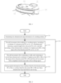
- FIG. 2 is a simplified flow chart of a three-dimensional map building method for a self-moving robot.
- a map building method for the self-moving robot provided in the embodiment as mentioned above includes the following example steps:
- An example process of combining the spatial height information with the pre-generated two-dimensional map information may include:
- FIG. 3 is an example structural schematic diagram of a combined robot.
- the combined robot A includes the above self-moving robot 10 and a functional module 20 integrated on the self-moving robot, wherein the self-moving robot includes, for example, a cleaning robot, a transporting robot or a walking robot capable of working individually.
- the self-moving robot 10 is a sweeping robot.
- the functional module 20 may be one submodule or a combination of more submodules of a security module, a humidifying module and a purifying module.
- the self-moving robot 10 invokes the two-dimensional map information and conducts a walking operation on a two-dimensional working surface W. Additionally or alternatively, for a wiping robot, conducting the walking operation may conduct wiping operation well walks in a working region.
- the combined robot 10 invokes the three-dimensional map information and conducts a walking operation in a three-dimensional working region.
- the body height of the self-moving robot 10 in the combined state is L.
- the combined robot calculates map information of the first plane P1 with a height L away from the working plane W of the self-moving robot through the above three-dimensional map.
- the first plane P1 can be regarded as the walkable working plane of the combined robot, and the walking path of the combined robot is planned in the map of the first plane P1.
Landscapes
- Engineering & Computer Science (AREA)
- Radar, Positioning & Navigation (AREA)
- Remote Sensing (AREA)
- Physics & Mathematics (AREA)
- Automation & Control Theory (AREA)
- General Physics & Mathematics (AREA)
- Aviation & Aerospace Engineering (AREA)
- Robotics (AREA)
- Mechanical Engineering (AREA)
- Geometry (AREA)
- Electromagnetism (AREA)
- Control Of Position, Course, Altitude, Or Attitude Of Moving Bodies (AREA)
- Manipulator (AREA)
Description
- The present disclosure relates to a self-moving robot, a map building method, and a map invoking method for a combined robot.
- A self-moving robot may be used for its convenient control and flexible action. For some self-moving robot, such as an integrated combined robot, the height may be limited to a certain degree. In the walking process of the self-moving robot, if the height of an obstacle is less than the height of the body of the self-moving robot, then the self-movement walk of the robot is hindered and the self-moving robot cannot pass through the obstacle smoothly.
- The subject matter claimed herein is not limited to embodiments that solve any disadvantages or that operate only in environments such as those described above. Rather, this background is only provided to illustrate one example technology area where some embodiments described herein may be practiced.
- Prior document D1 (
WO 2010/114235 A1 ) discloses a mobile robot with single camera and a method for recognizing 3d surroundings of the same, where images of the surroundings are captured, and a preset number of particles with respect to feature points of a first image are projected to a second image based on matching information of feature points extracted from the two images sequentially captured, thereby extracting 3D information of the surroundings (see ABSTRACT of D1). Prior document D2 (US 2007/100498 A1 ) discloses a mobile robot, specifically discloses that a system has a path-setting unit for setting the path of a mobile apparatus according to the inputted path, a measuring unit for measuring an environment in which the mobile apparatus exists, an extracting unit for extracting an object existence region in the environment according to the values measured by the measuring unit, a judging unit that judges the validity of the path according to the path set by the path setting unit and to the object existence region extracted by the extracting unit, a position determining unit that determines a target position to which the mobile apparatus is to move by selecting it from the portions of the path judged as valid, and a movement controller for controlling the mobile apparatus to move to the target position (see ABSTRACT of D2). Prior document D3 (WO 2002/153184 A1 ) discloses a robot cleaner, a robot cleaning system and a method for controlling same, the robot cleaner cleaning by wirelessly communicating with an external apparatus having a driving unit for driving a plurality of wheels; an upper camera disposed on a main body for photographing an upper image perpendicular to a direction of driving the robot cleaner; and a controller for controlling the driving unit to allow the robot cleaner to drive with a cleaning area according to a predetermined driving pattern, and compensating the driving path by analyzing the image photographed by the upper camera (see ABSTRACT of D3). Prior document D8 (KANEHIRO F ET AL: "Locomotion planning of humanoid robots to pass through narrow spaces") discloses generating a 3D local map from visual information and planning the appropriate locomotion based on the map from biped walking with the variable height and the width and from crawling (see ABSTRACT of D8). Prior art document D9 (CN 202005711 U ) generally discloses a robot capable of being automatically separated, and specifically discloses that the robot comprises a module part and a robot body, wherein the robot body comprises a driving unit, a walking mechanism, a control unit and an energy supply unit; the module part is provided with a first working module, a control mechanism and an automatic combination actuating mechanism; the control mechanism control the automatic combination actuating mechanism to combine the module part on the robot body according to the instructions of the control unit; and the first working module is supplied with power to work by the energy supply unit. According to the actual working requirements, the module part is separated or combined with the robot body, therefore, the energy waste is avoided, and the purpose of saving energy and electricity is achieved (see ABSTRACT of D9). Prior art document D10 (US 2016/027207 A1 ) generally discloses a method for cleaning or processing a room by means of an autonomously mobile device, and specifically discloses that in order the relieve the user of the task of finding the exact subarea to which the device must travel, or avoid, on a map of the room, the user in order to select a subarea takes a photograph of the subarea and transmits it to a processing unit (see ABSTRACT of D10). - The invention is set out in the appended set of claims.
- In the present disclosure, a self-moving robot, a map building method, and a map invoking method for a combined robot is provided in view of the defects of other applications. For example, through distance sensors disposed on the self-moving robot, based on a generated two-dimensional map, spatial height information may be overlaid and three-dimensional map information may be generated. Additionally or alternatively, in a combined state, the robot invokes and plans a walking path in a working region based on a three-dimensional map, thereby ensuring smooth, safe and efficient operation of the combined robot in a complex environment.
- In these or other embodiments of the present disclosure, a self-moving robot includes, for example, a robot body and a control center disposed on the body, wherein the robot body includes a first distance sensor disposed in a horizontal direction and a second distance sensor disposed in a vertical direction. In these or other embodiments, the first distance sensor collects two-dimensional map information of a working surface in which the self-moving robot is located. Additionally or alternatively, the second distance sensor collects spatial height information above the working surface in which the self-moving robot is located; and while obtaining the two-dimensional map information of the working surface, the control center combines the spatial height information with the two-dimensional map information to obtain three-dimensional map information of a working region.
- In these or other embodiments, the first distance sensor and the second distance sensor may include an ultrasonic sensor, an infrared sensor and/or a visual sensor. Additionally or alternatively, the spatial height information above the working surface is a distance between the working surface and a lower surface of an encountered obstacle.
- The present disclosure also provides a map building method for the above self-moving robot, including the following example steps:
- step 100: generating two-dimensional map information of a working surface; and
- step 200: collecting spatial height information above the working surface in real time and overlaying the spatial height information to the two-dimensional map information of the working surface to obtain and save three-dimensional map information of a working region.
- In these or other embodiments, the two-dimensional map information in the
step 100 is obtained by the self-moving robot scanning the working surface during a traversing walk. Additionally or alternatively, the spatial height information above the working surface in thestep 200 is a distance from the working surface to a lower surface of an encountered obstacle. A specific process of overlaying the spatial height information to the pre-generated two-dimensional map information may include: - step 201: the self-moving robot walking in the working region, recording a coordinate of a discrete point N1 as (xl, yl), simultaneously detecting a spatial height above the point N1 as h1, and then recording a three-dimensional coordinate of a highest point M1 of the space above the discrete point N1 as (x1, y1, h1);
- step 202: the self-moving robot continuing to walk, and continuing to record three-dimensional coordinates of highest points M2 to Mn of the spaces above discrete points N2 to Nn until the self-moving robot completes a traversing walk in the working region; and
- step 203: fitting spatial information from a surface fitted by the discrete points N1 to Nn to a surface fitted by the points M1 to Mn into three-dimensional map information and saving.
- A three-dimensional map of the working region is built according to the three-dimensional map information saved in the step 203.
- The present invention also provides a map invoking method conducted by a combined robot. The combined robot includes a self-moving robot combined to a functional module, where, in an uncombined mode, the self-moving robot works without the functional module, and in the uncombined mode, the self-moving robot generates two-dimensional map information of a working surface by scanning the working surface during a traversing walk and three-dimensional map information by collecting spatial height information above the working surface and by overlaying said spatial height information to the two-dimensional map information. The method comprises: invoking three-dimensional map information; calculating a plane map with a height L from the ground according to a body height of the combined robot and three-dimensional map information; planning a walking path according to the plane map; and conducting a walking operation along the walking path. The combined robot further includes the functional module combined and connected with the self-moving robot. The self-moving robot is provided with a storage unit and the two-dimensional map information and the three-dimensional map information of the working region configured to be stored in the storage unit.
- The combined robot includes an uncombined mode and a combined mode. When the self-moving robot works individually or alone, the combined robot is in the uncombined mode; and when the self-moving robot is combined and connected with the functional module, the combined robot is in the combined mode.
- In the uncombined mode, the self-moving robot invokes the two-dimensional map information and conducts a walking operation on a two-dimensional working surface. In the combined mode, the combined robot invokes the three-dimensional map information, calculates a plane map with a height L from the ground according to a body height of the combined robot and three-dimensional map information, planes a walking path according to the plane map, and conducts a walking operation along the walking path; wherein the combined robot including the self-moving robot and the functional module combined and connected on top of the self-moving robot; and a storage unit configured to store two-dimensional map information and the three-dimensional map information of a working region. For example, in the combined mode, the combined robot plans a walking path according to the three-dimensional map information and calculates a walkable working region.
- Additionally or alternatively, the combined robot calculates: map information of a first plane P1 according to body height L and the three-dimensional map information. In these or other embodiments, a height difference between the first plane P1 and the working surface is the body height L of the combined robot. Additionally or alternatively, the combined robot plans the walking path according to the two-dimensional map information of the first plane P1.
- Thus, in some embodiments, the present disclosure provides a self-moving robot, a map building method, and a map invoking method for a combined robot. In the present disclosure, through the distance sensors disposed on the self-moving robot, based on the generated two-dimensional map, the spatial height information is overlaid and the three-dimensional map information is generated; and in the combined state, the robot invokes and plans the walking path in the working region based on the three-dimensional map, thereby helping to ensure smooth, safe and efficient operation of the combined robot in a complex environment.
- The technical solution of the present disclosure is described below in detail in combination with drawings and specific embodiments.
-
-
FIG. 1 is an example structural schematic diagram of a self-moving robot provided by an embodiment of the present disclosure; -
FIG. 2 is a simplified flow chart of a three-dimensional map building method for a self-moving robot provided by an embodiment of the present disclosure; -
FIG. 3 is an example structural schematic diagram of a combined robot provided by an embodiment of the present disclosure; and -
FIG. 4 is an example schematic diagram of a walking state of a combined robot provided by an embodiment of the present disclosure on a working surface. -
FIG. 1 is an example structural schematic diagram of a self-moving robot. As shown inFIG. 1 , the self-movingrobot 10 includes arobot body 100 and a control center (not shown in the figure) disposed on thebody 100, wherein therobot body 100 includes afirst distance sensor 101 disposed in a horizontal direction and asecond distance sensor 102 disposed in a vertical direction. In these or other embodiments, thefirst distance sensor 101 collects two-dimensional map information of a working surface W in which the self-moving robot is located; and thesecond distance sensor 102 collects spatial height information above the working surface W in which the self-moving robot is located. Additionally or alternatively, while obtaining the two-dimensional map information of the working surface W, the control center combines the spatial height information with the two-dimensional map information to obtain three-dimensional map information of a working region. Additionally or alternatively, for a point A, two-dimensional map information is (x1, y1) and the spatial height information is h1, the combining, by the control center, the spatial height information with the two-dimensional map information to obtain three-dimensional map information of a working region may be a process of combining the (x1, y1) and h1 to obtain (x1, y1, h1) as three-dimensional map information. Additionally or alternatively, thefirst distance sensor 101 and thesecond distance sensor 102 include an ultrasonic sensor, an infrared sensor and/or a visual sensor. For example, the spatial height information above the working surface W is a distance between the working surface and a lower surface of an encountered obstacle in an up-down direction. -
FIG. 2 is a simplified flow chart of a three-dimensional map building method for a self-moving robot. As shown inFIG. 2 , a map building method for the self-moving robot provided in the embodiment as mentioned above includes the following example steps: - step 100: generating two-dimensional map information of a working surface; and
- step 200: collecting spatial height information above the working surface in real time and combining the spatial height information with the two-dimensional map information of the working surface to obtain and save three-dimensional map information of a working region (in other words, obtain the three-dimensional map information of a working region and save the obtained three-dimensional map information of a working region).
- Additionally or alternatively, the two-dimensional map information in the
step 100 is obtained by the self-moving robot scanning the working surface during a traversing walk. Additionally or alternatively, the traversing walk is a operation or a process that the self-moving robot walks in the in a working region and walks all through the in the working region (in other words, traverses the in the working region). In these or other embodiments, the spatial height information above the working surface in thestep 200 is a distance between the working surface and a lower surface of an encountered obstacle in an up-down direction. - An example process of combining the spatial height information with the pre-generated two-dimensional map information may include:
- step 201: the self-moving robot walking in the working region, recording a coordinate of a discrete point N1 as (x1, y1), simultaneously (or approximately simultaneously) detecting a spatial height above the point N1 as h1, and then recording a three-dimensional coordinate of a highest point M1 of the space above the discrete point N1 as (x1, y1, h1);
- step 202: the self-moving robot continuing to walk, and continuing to record three-dimensional coordinates of highest points M2 to Mn of the spaces above discrete points N2 to Nn until the self-moving robot completes a traversing walk in the working region;
- and step 203: fitting spatial information between a surface fitted by the discrete points N1 to Nn and a surface fitted by the points M1 to Mn into three-dimensional map information and saving. In these or other embodiments, a three-dimensional map of the working region is built according to the three-dimensional map information saved in the step 203.
-
FIG. 3 is an example structural schematic diagram of a combined robot. As shown inFIG. 3 , the combined robot A includes the above self-movingrobot 10 and afunctional module 20 integrated on the self-moving robot, wherein the self-moving robot includes, for example, a cleaning robot, a transporting robot or a walking robot capable of working individually. In one embodiment of the present disclosure, the self-movingrobot 10 is a sweeping robot. Additionally or alternatively, thefunctional module 20 may be one submodule or a combination of more submodules of a security module, a humidifying module and a purifying module. - In these or other embodiments, the present disclosure includes a map invoking method for a combined robot. The combined robot A includes a self-moving
robot 10 and afunctional module 20 combined and connected with the self-moving robot. The self-movingrobot 10 is provided with a storage unit (not shown in the figure), and the two-dimensional map information and the three-dimensional map information of the working region are stored in the storage unit. The combined robot A includes two working modes, such as an uncombined mode and a combined mode. When the self-movingrobot 10 individually works, the combined robot is in the uncombined mode; and when the self-movingrobot 10 is combined and connected with thefunctional module 20, the combined robot is in the combined mode. In the uncombined mode, the self-movingrobot 10 invokes the two-dimensional map information and conducts a walking operation on a two-dimensional working surface W. Additionally or alternatively, for a wiping robot, conducting the walking operation may conduct wiping operation well walks in a working region. In the combined mode, the combinedrobot 10 invokes the three-dimensional map information and conducts a walking operation in a three-dimensional working region. - For example, in the combined mode, the combined robot A plans a walking path according to the three-dimensional map information and calculates a walkable working region. A method for planning the walking path may include: the combined robot calculating a plane map with a height L from the ground according to body height L and the three-dimensional map; and the combined robot planning the walking path according to the plane map.
-
FIG. 4 is a schematic diagram of a walking state of a combined robot of the present disclosure on a working surface. As shown inFIG. 4 , for example, the combined robot calculates map information of a first plane P1 according to the body height L and the three-dimensional map information. In these or other embodiments, a height difference between the first plane P1 and the working surface W is the body height L of the combined robot. Additionally or alternatively, the combined robot plans the walking path according to the two-dimensional map information of the first plane P1. - As shown in
FIG. 1 to FIG. 4 , the actual working process of the embodiments of the present disclosure may be as follows:
As shown inFIG. 1 , after the self-movingrobot 10 walks and scans in the working environment to build a map or records the coordinate information of the working plane to build a map during a traversing walk, a two-dimensional map is formed in the control center of the self-movingrobot 10. The formation process of the above two-dimensional map is well-known in the arts, and is not repeated herein. Additionally or alternatively, the self-movingrobot 10 continues to conduct a traversing walk in the working environment. During walking, the distance sensors collect the height information in the working environment in real time (or approximately real time) and transmit the height information to the control center. The control center combines the height information with the pre-generated two-dimensional map to obtain a three-dimensional map and save the three-dimensional map into the control center. - In these or other embodiments, when the self-moving robot adopts the above mode of recording the coordinate information of the working plane to build the map during a traversing walk, the self-moving robot can simultaneously (or approximately simultaneously) record the spatial height information, e.g., when obtaining the two-dimensional information of the working plane, the self-moving robot can simultaneously (or approximately simultaneously) collect the three-dimensional information of the working region to complete the building of the three-dimensional map of the working region. When the combined robot, as shown in
FIG. 3 , is combined and connected, the height of the combined robot is higher than the height of the self-movingrobot 10. Therefore, an original two-dimensional map may not be enough to be used as the basis for planning the walking path of the combined robot. For example, a position which could be smoothly passed previously by the self-movingrobot 10 may become impassable due to the problem of the increased height of the combined robot. At this moment, the three-dimensional map may be invoked to plan the walking path of the combined robot. - As shown in
FIG. 4 , the body height of the self-movingrobot 10 in the combined state is L. In the present embodiment, the combined robot calculates map information of the first plane P1 with a height L away from the working plane W of the self-moving robot through the above three-dimensional map. The first plane P1 can be regarded as the walkable working plane of the combined robot, and the walking path of the combined robot is planned in the map of the first plane P1. - Thus, in some embodiments, the present disclosure provides a self-moving robot, a map building method, and a map invoking method for a combined robot. In the present disclosure, through the distance sensors disposed on the self-moving robot, based on the generated two-dimensional map, the spatial height information is overlaid and the three-dimensional map information is generated; and in the combined state, the robot invokes and plans the walking path in the working region based on the three-dimensional map, thereby helping to ensure smooth, safe and efficient operation of the combined robot in a complex environment.
Claims (3)
- A map invoking method, conducted by a combined robot (A), including a self-moving robot (10) combined to a functional module, wherein, in an uncombined mode, the self-moving robot (10) works without the functional module, and in the uncombined mode, the self-moving robot generates two-dimensional map information of a working surface by scanning the working surface during a traversing walk and three-dimensional map information by collecting spatial height information above the working surface and by overlaying said spatial height information to the two-dimensional map information;
the method comprising:invoking three-dimensional map information;calculating a plane map with a height L from the ground according to a body height (L) of the combined robot (A) and three-dimensional map information;planning a walking path according to the plane map; andconducting a walking operation along the walking path;wherein the combined robot (A) further includes the functional module combined and connected on top of the self-moving robot (10); anda storage unit configured to store two-dimensional map information and the three-dimensional map information of a working region. - The map invoking method of claim 1, wherein when the self-moving robot (10) of the combined robot (A) is combined and connected with a functional module, the combined robot (A) plans a walking path according to the three-dimensional map information and calculates a walkable working region.
- The map invoking method of claim 1, wherein:the combined robot (A) calculates map information of a first plane (P1) according to body height (L) of the combined robot (A) and the three-dimensional map information;the combined robot (A) plans the walking path according to the two-dimensional map information of the first plane (P1); anda height difference between the first plane and the working surface (W) is the body height of the combined robot (A).
Applications Claiming Priority (2)
| Application Number | Priority Date | Filing Date | Title |
|---|---|---|---|
| CN201610334640.5A CN107402569B (en) | 2016-05-19 | 2016-05-19 | Self-moving robot, map construction method and combined robot map calling method |
| PCT/CN2017/085017 WO2017198207A1 (en) | 2016-05-19 | 2017-05-19 | Autonomous mobile robot, map building method, and map calling method for combined robot |
Publications (3)
| Publication Number | Publication Date |
|---|---|
| EP3460404A1 EP3460404A1 (en) | 2019-03-27 |
| EP3460404A4 EP3460404A4 (en) | 2019-12-11 |
| EP3460404B1 true EP3460404B1 (en) | 2025-07-02 |
Family
ID=60324818
Family Applications (1)
| Application Number | Title | Priority Date | Filing Date |
|---|---|---|---|
| EP17798770.8A Active EP3460404B1 (en) | 2016-05-19 | 2017-05-19 | Autonomous mobile robot, map building method, and map calling method for combined robot |
Country Status (4)
| Country | Link |
|---|---|
| US (2) | US11052538B2 (en) |
| EP (1) | EP3460404B1 (en) |
| CN (2) | CN111190419B (en) |
| WO (1) | WO2017198207A1 (en) |
Families Citing this family (20)
| Publication number | Priority date | Publication date | Assignee | Title |
|---|---|---|---|---|
| IL259260A (en) * | 2018-05-09 | 2018-06-28 | Indoor Robotics Ltd | Map generating robot |
| CN108406731B (en) * | 2018-06-06 | 2023-06-13 | 珠海一微半导体股份有限公司 | A positioning device, method and robot based on depth vision |
| CN110647600B (en) * | 2018-06-26 | 2023-10-20 | 百度在线网络技术(北京)有限公司 | Three-dimensional map construction method, device, server and storage medium |
| CN108873908B (en) * | 2018-07-12 | 2020-01-24 | 重庆大学 | Robot city navigation system based on combination of visual SLAM and network map |
| TWI671610B (en) * | 2018-09-28 | 2019-09-11 | 財團法人工業技術研究院 | Automatic guided vehicle , agv control system, and agv control method |
| CN109276193A (en) * | 2018-11-13 | 2019-01-29 | 苏州苏相机器人智能装备有限公司 | A robot with adjustable height position and obstacle avoidance method |
| CN109620059A (en) * | 2018-11-16 | 2019-04-16 | 深圳市赛领未来科技有限公司 | For indoor cleaning and service robot and air navigation aid |
| CN109940620A (en) * | 2019-04-15 | 2019-06-28 | 于傲泽 | A kind of Intelligent exploration robot and its control method |
| CN111538338B (en) * | 2020-05-28 | 2023-05-26 | 长沙中联重科环境产业有限公司 | Robot welt motion control system and method |
| CN111631650B (en) * | 2020-06-05 | 2021-12-03 | 上海黑眸智能科技有限责任公司 | Indoor plan generating method, system and terminal based on obstacle height detection and sweeping robot |
| CN111984017A (en) * | 2020-08-31 | 2020-11-24 | 苏州三六零机器人科技有限公司 | Cleaning equipment control method, device and system and computer readable storage medium |
| CN112286185B (en) * | 2020-10-14 | 2024-09-13 | 深圳市杉川机器人有限公司 | Sweeping robot and three-dimensional mapping method, system and computer-readable storage medium |
| CN112568101B (en) * | 2020-12-03 | 2022-09-16 | 珠海格力电器股份有限公司 | Watering device and watering method |
| CN114625116A (en) * | 2021-05-06 | 2022-06-14 | 北京石头世纪科技股份有限公司 | Self-walking equipment obstacle avoidance method, device, medium and electronic equipment |
| CN113449021B (en) * | 2021-06-28 | 2023-05-19 | 华科融资租赁有限公司 | Space coordinate conversion method, apparatus, computer device, and readable storage medium |
| CN113848918A (en) * | 2021-09-27 | 2021-12-28 | 上海景吾智能科技有限公司 | Robot rapid, efficient and low-cost deployment method and system |
| CN114610820A (en) * | 2021-12-31 | 2022-06-10 | 北京石头创新科技有限公司 | Optimization method and device for three-dimensional map display |
| CN116413739A (en) * | 2023-01-12 | 2023-07-11 | 深圳先进技术研究院 | A composite map construction method and system based on laser technology |
| KR20250001483A (en) * | 2023-06-27 | 2025-01-07 | 삼성전자주식회사 | An electronic device for generating a map and method for controlling the same |
| CN118034318A (en) * | 2024-03-13 | 2024-05-14 | 北京石头创新科技有限公司 | Control method and device of mobile equipment, medium and electronic device |
Citations (2)
| Publication number | Priority date | Publication date | Assignee | Title |
|---|---|---|---|---|
| CN202005711U (en) * | 2011-03-31 | 2011-10-12 | 泰怡凯电器(苏州)有限公司 | Robot capable of being automatically separated |
| US20160027207A1 (en) * | 2014-07-22 | 2016-01-28 | Vorwerk & Co. Interholding Gmbh | Method for cleaning or processing a room by means of an autonomously mobile device |
Family Cites Families (16)
| Publication number | Priority date | Publication date | Assignee | Title |
|---|---|---|---|---|
| RU2220643C2 (en) * | 2001-04-18 | 2004-01-10 | Самсунг Гванджу Электроникс Ко., Лтд. | Automatic cleaning apparatus, automatic cleaning system and method for controlling of system (versions) |
| US6917893B2 (en) * | 2002-03-14 | 2005-07-12 | Activmedia Robotics, Llc | Spatial data collection apparatus and method |
| US20090006480A1 (en) * | 2002-06-27 | 2009-01-01 | Tele Atlas North America, Inc. | System and method for providing efficient access to digital map data |
| WO2006026436A2 (en) * | 2004-08-27 | 2006-03-09 | Sharper Image Corporation | Robot cleaner with improved vacuum unit |
| US20090216501A1 (en) * | 2005-03-24 | 2009-08-27 | Shin We Yeow | System and apparatus for vicinity and in-building visualization, planning, monitoring and exploring |
| JP4375320B2 (en) * | 2005-10-27 | 2009-12-02 | 株式会社日立製作所 | Mobile robot |
| KR101461185B1 (en) | 2007-11-09 | 2014-11-14 | 삼성전자 주식회사 | Apparatus and method for building 3D map using structured light |
| KR101570377B1 (en) * | 2009-03-31 | 2015-11-20 | 엘지전자 주식회사 | 3 Method for builing 3D map by mobile robot with a single camera |
| CN102359784B (en) * | 2011-08-01 | 2013-07-24 | 东北大学 | Autonomous navigation and obstacle avoidance system and method of indoor mobile robot |
| JP6235216B2 (en) * | 2013-02-15 | 2017-11-22 | トヨタ自動車株式会社 | Autonomous mobile body and control method thereof |
| WO2015090399A1 (en) * | 2013-12-19 | 2015-06-25 | Aktiebolaget Electrolux | Robotic cleaning device and method for landmark recognition |
| CN105091884A (en) * | 2014-05-08 | 2015-11-25 | 东北大学 | Indoor moving robot route planning method based on sensor network dynamic environment monitoring |
| WO2016005012A1 (en) * | 2014-07-10 | 2016-01-14 | Aktiebolaget Electrolux | Method for detecting a measurement error in a robotic cleaning device |
| JP6401961B2 (en) * | 2014-08-01 | 2018-10-10 | 八潮建材工業株式会社 | Connecting member and ceiling base material construction method |
| US10182284B2 (en) | 2015-06-11 | 2019-01-15 | Facebook Technologies, Llc | Connector assembly for detachable audio system |
| DE102015119865B4 (en) * | 2015-11-17 | 2023-12-21 | RobArt GmbH | Robot-assisted processing of a surface using a robot |
-
2016
- 2016-05-19 CN CN202010006459.8A patent/CN111190419B/en not_active Ceased
- 2016-05-19 CN CN201610334640.5A patent/CN107402569B/en not_active Ceased
-
2017
- 2017-05-19 WO PCT/CN2017/085017 patent/WO2017198207A1/en not_active Ceased
- 2017-05-19 EP EP17798770.8A patent/EP3460404B1/en active Active
- 2017-05-19 US US16/303,100 patent/US11052538B2/en active Active
-
2021
- 2021-06-03 US US17/338,406 patent/US11628569B2/en active Active
Patent Citations (2)
| Publication number | Priority date | Publication date | Assignee | Title |
|---|---|---|---|---|
| CN202005711U (en) * | 2011-03-31 | 2011-10-12 | 泰怡凯电器(苏州)有限公司 | Robot capable of being automatically separated |
| US20160027207A1 (en) * | 2014-07-22 | 2016-01-28 | Vorwerk & Co. Interholding Gmbh | Method for cleaning or processing a room by means of an autonomously mobile device |
Non-Patent Citations (1)
| Title |
|---|
| KANEHIRO F ET AL: "Locomotion planning of humanoid robots to pass through narrow spaces", ROBOTICS AND AUTOMATION, 2004. PROCEEDINGS. ICRA '04. 2004 IEEE INTERN ATIONAL CONFERENCE ON NEW ORLEANS, LA, USA APRIL 26-MAY 1, 2004, PISCATAWAY, NJ, USA,IEEE, US, vol. 1, 26 April 2004 (2004-04-26), pages 604 - 609, XP010768341, ISBN: 978-0-7803-8232-9, DOI: 10.1109/ROBOT.2004.1307215 * |
Also Published As
| Publication number | Publication date |
|---|---|
| WO2017198207A1 (en) | 2017-11-23 |
| EP3460404A4 (en) | 2019-12-11 |
| CN107402569B (en) | 2020-01-21 |
| US20190168386A1 (en) | 2019-06-06 |
| EP3460404A1 (en) | 2019-03-27 |
| US11628569B2 (en) | 2023-04-18 |
| US20210347050A1 (en) | 2021-11-11 |
| US11052538B2 (en) | 2021-07-06 |
| CN111190419A (en) | 2020-05-22 |
| CN111190419B (en) | 2022-08-09 |
| CN107402569A (en) | 2017-11-28 |
Similar Documents
| Publication | Publication Date | Title |
|---|---|---|
| EP3460404A1 (en) | Autonomous mobile robot, map building method, and map calling method for combined robot | |
| JP6211734B1 (en) | Combination of stereo processing and structured light processing | |
| US11407116B2 (en) | Robot and operation method therefor | |
| EP4193897A1 (en) | Method and apparatus for detecting obstacle, self-propelled robot, and storage medium | |
| JP3994950B2 (en) | Environment recognition apparatus and method, path planning apparatus and method, and robot apparatus | |
| US12124270B2 (en) | Systems and methods for VSLAM scale estimation using optical flow sensor on a robotic device | |
| KR102203439B1 (en) | a Moving robot and Controlling method for the moving robot | |
| CN104238557B (en) | The method of Unpiloted carrier vehicle and operation Unpiloted carrier vehicle | |
| US9563528B2 (en) | Mobile apparatus and localization method thereof | |
| CN113885495A (en) | An outdoor automatic work control system, method and device based on machine vision | |
| CN119816794A (en) | Automatically switches the robot to an operating mode optimized for a specific terrain | |
| GB2513912A (en) | Apparatus for guiding an autonomous vehicle towards a docking station | |
| Prats et al. | Combining template tracking and laser peak detection for 3D reconstruction and grasping in underwater environments | |
| US12346123B2 (en) | Robotic cleaning device with dynamic area coverage | |
| CN111700544A (en) | Anti-collision control system and control method of intelligent cleaning robot | |
| Oßwald et al. | Autonomous climbing of spiral staircases with humanoids | |
| CN114895675A (en) | Robot autonomous charging method and system based on machine vision | |
| Poomarin et al. | Automatic docking with obstacle avoidance of a differential wheel mobile robot | |
| CN114903374B (en) | A sweeping machine and control method thereof | |
| JP7495293B2 (en) | Autonomous mobile work device and program | |
| Veerajagadheswar et al. | An autonomous descending-stair cleaning robot with RGB-d based detection, approaching, and area coverage process | |
| Paromtchik et al. | Optical guidance system for multiple mobile robots | |
| CN119347818B (en) | Intelligent water cutting explosion-eliminating robot system and method | |
| EP2325713B1 (en) | Methods and systems for movement of robotic device using video signal | |
| Miller et al. | Self-driving mobile robots using human-robot interactions |
Legal Events
| Date | Code | Title | Description |
|---|---|---|---|
| STAA | Information on the status of an ep patent application or granted ep patent |
Free format text: STATUS: THE INTERNATIONAL PUBLICATION HAS BEEN MADE |
|
| PUAI | Public reference made under article 153(3) epc to a published international application that has entered the european phase |
Free format text: ORIGINAL CODE: 0009012 |
|
| STAA | Information on the status of an ep patent application or granted ep patent |
Free format text: STATUS: REQUEST FOR EXAMINATION WAS MADE |
|
| 17P | Request for examination filed |
Effective date: 20181206 |
|
| AK | Designated contracting states |
Kind code of ref document: A1 Designated state(s): AL AT BE BG CH CY CZ DE DK EE ES FI FR GB GR HR HU IE IS IT LI LT LU LV MC MK MT NL NO PL PT RO RS SE SI SK SM TR |
|
| AX | Request for extension of the european patent |
Extension state: BA ME |
|
| DAV | Request for validation of the european patent (deleted) | ||
| DAX | Request for extension of the european patent (deleted) | ||
| REG | Reference to a national code |
Ref country code: DE Ref legal event code: R079 Free format text: PREVIOUS MAIN CLASS: G01C0021320000 Ipc: G05D0001020000 |
|
| A4 | Supplementary search report drawn up and despatched |
Effective date: 20191111 |
|
| RIC1 | Information provided on ipc code assigned before grant |
Ipc: G05D 1/02 20060101AFI20191105BHEP |
|
| STAA | Information on the status of an ep patent application or granted ep patent |
Free format text: STATUS: EXAMINATION IS IN PROGRESS |
|
| 17Q | First examination report despatched |
Effective date: 20210813 |
|
| REG | Reference to a national code |
Free format text: PREVIOUS MAIN CLASS: G05D0001020000 Ref country code: DE Ref legal event code: R079 Ref document number: 602017090317 Country of ref document: DE Ipc: G05D0001000000 |
|
| GRAP | Despatch of communication of intention to grant a patent |
Free format text: ORIGINAL CODE: EPIDOSNIGR1 |
|
| STAA | Information on the status of an ep patent application or granted ep patent |
Free format text: STATUS: GRANT OF PATENT IS INTENDED |
|
| RIC1 | Information provided on ipc code assigned before grant |
Ipc: G05D 1/00 20060101AFI20250123BHEP |
|
| INTG | Intention to grant announced |
Effective date: 20250217 |
|
| GRAS | Grant fee paid |
Free format text: ORIGINAL CODE: EPIDOSNIGR3 |
|
| GRAA | (expected) grant |
Free format text: ORIGINAL CODE: 0009210 |
|
| STAA | Information on the status of an ep patent application or granted ep patent |
Free format text: STATUS: THE PATENT HAS BEEN GRANTED |
|
| AK | Designated contracting states |
Kind code of ref document: B1 Designated state(s): AL AT BE BG CH CY CZ DE DK EE ES FI FR GB GR HR HU IE IS IT LI LT LU LV MC MK MT NL NO PL PT RO RS SE SI SK SM TR |
|
| REG | Reference to a national code |
Ref country code: GB Ref legal event code: FG4D |
|
| REG | Reference to a national code |
Ref country code: CH Ref legal event code: EP |
|
| REG | Reference to a national code |
Ref country code: DE Ref legal event code: R096 Ref document number: 602017090317 Country of ref document: DE |
|
| REG | Reference to a national code |
Ref country code: IE Ref legal event code: FG4D |
|
| REG | Reference to a national code |
Ref country code: NL Ref legal event code: MP Effective date: 20250702 |
|
| PG25 | Lapsed in a contracting state [announced via postgrant information from national office to epo] |
Ref country code: PT Free format text: LAPSE BECAUSE OF FAILURE TO SUBMIT A TRANSLATION OF THE DESCRIPTION OR TO PAY THE FEE WITHIN THE PRESCRIBED TIME-LIMIT Effective date: 20251103 |
|
| PG25 | Lapsed in a contracting state [announced via postgrant information from national office to epo] |
Ref country code: NL Free format text: LAPSE BECAUSE OF FAILURE TO SUBMIT A TRANSLATION OF THE DESCRIPTION OR TO PAY THE FEE WITHIN THE PRESCRIBED TIME-LIMIT Effective date: 20250702 |
|
| REG | Reference to a national code |
Ref country code: AT Ref legal event code: MK05 Ref document number: 1809934 Country of ref document: AT Kind code of ref document: T Effective date: 20250702 |
|
| PG25 | Lapsed in a contracting state [announced via postgrant information from national office to epo] |
Ref country code: IS Free format text: LAPSE BECAUSE OF FAILURE TO SUBMIT A TRANSLATION OF THE DESCRIPTION OR TO PAY THE FEE WITHIN THE PRESCRIBED TIME-LIMIT Effective date: 20251102 |
|
| PG25 | Lapsed in a contracting state [announced via postgrant information from national office to epo] |
Ref country code: NO Free format text: LAPSE BECAUSE OF FAILURE TO SUBMIT A TRANSLATION OF THE DESCRIPTION OR TO PAY THE FEE WITHIN THE PRESCRIBED TIME-LIMIT Effective date: 20251002 |
|
| REG | Reference to a national code |
Ref country code: LT Ref legal event code: MG9D |
|
| PG25 | Lapsed in a contracting state [announced via postgrant information from national office to epo] |
Ref country code: AT Free format text: LAPSE BECAUSE OF FAILURE TO SUBMIT A TRANSLATION OF THE DESCRIPTION OR TO PAY THE FEE WITHIN THE PRESCRIBED TIME-LIMIT Effective date: 20250702 |
|
| PG25 | Lapsed in a contracting state [announced via postgrant information from national office to epo] |
Ref country code: FI Free format text: LAPSE BECAUSE OF FAILURE TO SUBMIT A TRANSLATION OF THE DESCRIPTION OR TO PAY THE FEE WITHIN THE PRESCRIBED TIME-LIMIT Effective date: 20250702 |
|
| PG25 | Lapsed in a contracting state [announced via postgrant information from national office to epo] |
Ref country code: HR Free format text: LAPSE BECAUSE OF FAILURE TO SUBMIT A TRANSLATION OF THE DESCRIPTION OR TO PAY THE FEE WITHIN THE PRESCRIBED TIME-LIMIT Effective date: 20250702 |
|
| PG25 | Lapsed in a contracting state [announced via postgrant information from national office to epo] |
Ref country code: GR Free format text: LAPSE BECAUSE OF FAILURE TO SUBMIT A TRANSLATION OF THE DESCRIPTION OR TO PAY THE FEE WITHIN THE PRESCRIBED TIME-LIMIT Effective date: 20251003 |
|
| PG25 | Lapsed in a contracting state [announced via postgrant information from national office to epo] |
Ref country code: CZ Free format text: LAPSE BECAUSE OF FAILURE TO SUBMIT A TRANSLATION OF THE DESCRIPTION OR TO PAY THE FEE WITHIN THE PRESCRIBED TIME-LIMIT Effective date: 20250702 Ref country code: SE Free format text: LAPSE BECAUSE OF FAILURE TO SUBMIT A TRANSLATION OF THE DESCRIPTION OR TO PAY THE FEE WITHIN THE PRESCRIBED TIME-LIMIT Effective date: 20250702 |
|
| PG25 | Lapsed in a contracting state [announced via postgrant information from national office to epo] |
Ref country code: LV Free format text: LAPSE BECAUSE OF FAILURE TO SUBMIT A TRANSLATION OF THE DESCRIPTION OR TO PAY THE FEE WITHIN THE PRESCRIBED TIME-LIMIT Effective date: 20250702 |
|
| PG25 | Lapsed in a contracting state [announced via postgrant information from national office to epo] |
Ref country code: BG Free format text: LAPSE BECAUSE OF FAILURE TO SUBMIT A TRANSLATION OF THE DESCRIPTION OR TO PAY THE FEE WITHIN THE PRESCRIBED TIME-LIMIT Effective date: 20250702 Ref country code: PL Free format text: LAPSE BECAUSE OF FAILURE TO SUBMIT A TRANSLATION OF THE DESCRIPTION OR TO PAY THE FEE WITHIN THE PRESCRIBED TIME-LIMIT Effective date: 20250702 |
|
| PG25 | Lapsed in a contracting state [announced via postgrant information from national office to epo] |
Ref country code: RS Free format text: LAPSE BECAUSE OF FAILURE TO SUBMIT A TRANSLATION OF THE DESCRIPTION OR TO PAY THE FEE WITHIN THE PRESCRIBED TIME-LIMIT Effective date: 20251002 |
|
| PG25 | Lapsed in a contracting state [announced via postgrant information from national office to epo] |
Ref country code: ES Free format text: LAPSE BECAUSE OF FAILURE TO SUBMIT A TRANSLATION OF THE DESCRIPTION OR TO PAY THE FEE WITHIN THE PRESCRIBED TIME-LIMIT Effective date: 20250702 |
|
| PG25 | Lapsed in a contracting state [announced via postgrant information from national office to epo] |
Ref country code: SM Free format text: LAPSE BECAUSE OF FAILURE TO SUBMIT A TRANSLATION OF THE DESCRIPTION OR TO PAY THE FEE WITHIN THE PRESCRIBED TIME-LIMIT Effective date: 20250702 |
|
| PG25 | Lapsed in a contracting state [announced via postgrant information from national office to epo] |
Ref country code: DK Free format text: LAPSE BECAUSE OF FAILURE TO SUBMIT A TRANSLATION OF THE DESCRIPTION OR TO PAY THE FEE WITHIN THE PRESCRIBED TIME-LIMIT Effective date: 20250702 |
|
| PG25 | Lapsed in a contracting state [announced via postgrant information from national office to epo] |
Ref country code: IT Free format text: LAPSE BECAUSE OF FAILURE TO SUBMIT A TRANSLATION OF THE DESCRIPTION OR TO PAY THE FEE WITHIN THE PRESCRIBED TIME-LIMIT Effective date: 20250702 |
|
| PG25 | Lapsed in a contracting state [announced via postgrant information from national office to epo] |
Ref country code: EE Free format text: LAPSE BECAUSE OF FAILURE TO SUBMIT A TRANSLATION OF THE DESCRIPTION OR TO PAY THE FEE WITHIN THE PRESCRIBED TIME-LIMIT Effective date: 20250702 Ref country code: SK Free format text: LAPSE BECAUSE OF FAILURE TO SUBMIT A TRANSLATION OF THE DESCRIPTION OR TO PAY THE FEE WITHIN THE PRESCRIBED TIME-LIMIT Effective date: 20250702 |
|
| PLBE | No opposition filed within time limit |
Free format text: ORIGINAL CODE: 0009261 |
|
| STAA | Information on the status of an ep patent application or granted ep patent |
Free format text: STATUS: NO OPPOSITION FILED WITHIN TIME LIMIT |