EP3009791A1 - Preparation system used in surveying work - Google Patents
Preparation system used in surveying work Download PDFInfo
- Publication number
- EP3009791A1 EP3009791A1 EP14810846.7A EP14810846A EP3009791A1 EP 3009791 A1 EP3009791 A1 EP 3009791A1 EP 14810846 A EP14810846 A EP 14810846A EP 3009791 A1 EP3009791 A1 EP 3009791A1
- Authority
- EP
- European Patent Office
- Prior art keywords
- position coordinate
- reference point
- station
- unknown
- fixed station
- Prior art date
- Legal status (The legal status is an assumption and is not a legal conclusion. Google has not performed a legal analysis and makes no representation as to the accuracy of the status listed.)
- Granted
Links
Images




Classifications
-
- G—PHYSICS
- G01—MEASURING; TESTING
- G01C—MEASURING DISTANCES, LEVELS OR BEARINGS; SURVEYING; NAVIGATION; GYROSCOPIC INSTRUMENTS; PHOTOGRAMMETRY OR VIDEOGRAMMETRY
- G01C15/00—Surveying instruments or accessories not provided for in groups G01C1/00 - G01C13/00
- G01C15/002—Active optical surveying means
-
- G—PHYSICS
- G01—MEASURING; TESTING
- G01C—MEASURING DISTANCES, LEVELS OR BEARINGS; SURVEYING; NAVIGATION; GYROSCOPIC INSTRUMENTS; PHOTOGRAMMETRY OR VIDEOGRAMMETRY
- G01C5/00—Measuring height; Measuring distances transverse to line of sight; Levelling between separated points; Surveyors' levels
-
- G—PHYSICS
- G01—MEASURING; TESTING
- G01S—RADIO DIRECTION-FINDING; RADIO NAVIGATION; DETERMINING DISTANCE OR VELOCITY BY USE OF RADIO WAVES; LOCATING OR PRESENCE-DETECTING BY USE OF THE REFLECTION OR RERADIATION OF RADIO WAVES; ANALOGOUS ARRANGEMENTS USING OTHER WAVES
- G01S19/00—Satellite radio beacon positioning systems; Determining position, velocity or attitude using signals transmitted by such systems
- G01S19/01—Satellite radio beacon positioning systems transmitting time-stamped messages, e.g. GPS [Global Positioning System], GLONASS [Global Orbiting Navigation Satellite System] or GALILEO
- G01S19/13—Receivers
- G01S19/14—Receivers specially adapted for specific applications
-
- G—PHYSICS
- G01—MEASURING; TESTING
- G01S—RADIO DIRECTION-FINDING; RADIO NAVIGATION; DETERMINING DISTANCE OR VELOCITY BY USE OF RADIO WAVES; LOCATING OR PRESENCE-DETECTING BY USE OF THE REFLECTION OR RERADIATION OF RADIO WAVES; ANALOGOUS ARRANGEMENTS USING OTHER WAVES
- G01S19/00—Satellite radio beacon positioning systems; Determining position, velocity or attitude using signals transmitted by such systems
- G01S19/38—Determining a navigation solution using signals transmitted by a satellite radio beacon positioning system
- G01S19/39—Determining a navigation solution using signals transmitted by a satellite radio beacon positioning system the satellite radio beacon positioning system transmitting time-stamped messages, e.g. GPS [Global Positioning System], GLONASS [Global Orbiting Navigation Satellite System] or GALILEO
- G01S19/40—Correcting position, velocity or attitude
- G01S19/41—Differential correction, e.g. DGPS [differential GPS]
-
- G—PHYSICS
- G01—MEASURING; TESTING
- G01S—RADIO DIRECTION-FINDING; RADIO NAVIGATION; DETERMINING DISTANCE OR VELOCITY BY USE OF RADIO WAVES; LOCATING OR PRESENCE-DETECTING BY USE OF THE REFLECTION OR RERADIATION OF RADIO WAVES; ANALOGOUS ARRANGEMENTS USING OTHER WAVES
- G01S19/00—Satellite radio beacon positioning systems; Determining position, velocity or attitude using signals transmitted by such systems
- G01S19/38—Determining a navigation solution using signals transmitted by a satellite radio beacon positioning system
- G01S19/39—Determining a navigation solution using signals transmitted by a satellite radio beacon positioning system the satellite radio beacon positioning system transmitting time-stamped messages, e.g. GPS [Global Positioning System], GLONASS [Global Orbiting Navigation Satellite System] or GALILEO
- G01S19/42—Determining position
- G01S19/48—Determining position by combining or switching between position solutions derived from the satellite radio beacon positioning system and position solutions derived from a further system
- G01S19/485—Determining position by combining or switching between position solutions derived from the satellite radio beacon positioning system and position solutions derived from a further system whereby the further system is an optical system or imaging system
-
- G—PHYSICS
- G01—MEASURING; TESTING
- G01S—RADIO DIRECTION-FINDING; RADIO NAVIGATION; DETERMINING DISTANCE OR VELOCITY BY USE OF RADIO WAVES; LOCATING OR PRESENCE-DETECTING BY USE OF THE REFLECTION OR RERADIATION OF RADIO WAVES; ANALOGOUS ARRANGEMENTS USING OTHER WAVES
- G01S19/00—Satellite radio beacon positioning systems; Determining position, velocity or attitude using signals transmitted by such systems
- G01S19/38—Determining a navigation solution using signals transmitted by a satellite radio beacon positioning system
- G01S19/39—Determining a navigation solution using signals transmitted by a satellite radio beacon positioning system the satellite radio beacon positioning system transmitting time-stamped messages, e.g. GPS [Global Positioning System], GLONASS [Global Orbiting Navigation Satellite System] or GALILEO
- G01S19/42—Determining position
- G01S19/43—Determining position using carrier phase measurements, e.g. kinematic positioning; using long or short baseline interferometry
Definitions
- the preparation system includes a mobile station disposed at an observation point, where a position coordinate is unknown, and a fixed station disposed at a reference point, where a position coordinate is known, and the system receives positioning data from satellites by the mobile station and the fixed station and determines the position coordinate of the observation point by correcting the received data with observation correction data sent from the fixed station.
- a surveying operation system (RTK surveying method) is known.
- the system includes a fixed station disposed at a reference point (an observation point at which the fixed station is positioned), where the position coordinate is known, and a mobile station disposed at an observation position, where the position coordinate is unknown.
- the system receives positioning data from satellites at the fixed station and mobile station while moving the mobile station, and determines the position coordinate of the unknown observation point using the mobile station by correcting the received data with observation correction data sent from the fixed station (see Patent Literature 1, Patent Literature 2, for example).
- the observation point is occupied by the fixed station.
- the known reference point for another object, i.e., the known observation point is exclusively used for the fixed station only.
- a preparation system In the preparation system, a fixed station is disposed at a reference point where the position coordinate is unknown, and the preparation system receives the positioning data from the fixed station. Before surveying an unknown observation point; the preparation system determines the position coordinate of the unknown reference point through independent positioning method based on the received positioning data and assigns the determined position coordinate as a position coordinate of a known reference point.
- the preparation system since the radio waves have fluctuations and the like, it is difficult for the preparation system to accurately determine the unknown position coordinate of the unknown reference point based on the positioning data. Therefore, the preparation system repeatedly acquires positioning data of the unknown reference point through independent positioning method and statistically processes the acquired data. The system then assigns the processed position coordinate as a position coordinate of a known reference point.
- the conventional preparation system for surveying operation needs to acquire the positioning data repeatedly to perform the statically processing. That is, the system takes more time to determine the position coordinate of the unknown reference point and to assign the processed position coordinate as a positioning coordinate of a known reference point.
- An object of the present invention is, therefore, to provide a preparation system for surveying operation that disposes a fixed station at a reference point where the position coordinate is unknown, determines the position coordinate of the reference point, and assigns the determined position coordinate as a known reference point.
- An aspect of a preparation system for surveying operation includes a mobile station disposed at an observation point where a position coordinate is unknown and a fixed station disposed at a reference point where a position coordinate is known.
- the surveying operation receiving positioning data from satellites by the mobile station and the fixed station and determining the position coordinate of the unknown observation point based on the positioning data of the fixed station.
- the system includes an arithmetic step to determine the position coordinate of the unknown reference point based on positioning data received by the mobile station, positioning data received by the fixed station, and a position coordinate of the known observation point, and an assigning step to assign the unknown reference point whose position coordinate is determined as the known reference point.
- the preparation system of the present invention can easily determine a position coordinate of an unknown reference point and assign the determined position coordinate as a known reference point by disposing a fixed station at the unknown reference point.
- the preparation system of the present invention does not need to dispose the fixed station at a known reference point. Hence, it becomes possible to dispose a mobile station at the known reference point (i.e., an observation point), thereby improving convenience of the surveying operation.
- FIG. 1 is a view for schematically showing a surveying operation system according to the present invention.
- reference number 1 denotes a fixed station
- reference number 2 denotes a mobile station.
- the fixed station 1 is disposed at a reference point (known observation point) A where the position coordinate is known for RTK surveying method.
- the reference sign A (X1, Y1) in FIG. 2 represents a horizontal position coordinate of the known reference point A.
- the mobile station 2 is disposed at an observation point B where the position coordinate is unknown.
- the reference sign B (X2, Y2) in FIG. 2 represents a horizontal position coordinate of the unknown observation point B.
- the fixed station 1 is equipped with a fixed-station satellite positioning section (GPS device) 1a, a communication device 1b, and an arithmetic section 1c.
- the mobile station 2 is equipped with a mobile-station satellite positioning section (GPS device) 2a, a communication device 2b, and an arithmetic section 2c.
- the fixed-station satellite positioning section 1a and the mobile-station satellite positioning section 2a each receives positioning data from at least four satellites Sa1 to Sa 4, as illustrated in FIG. 1 . Accordingly, the fixed station 1 acquires a horizontal position coordinate A' (X1, Y1'), and the mobile station 2 acquires a horizontal position coordinate B' (X2', Y2') as positioning data, as illustrated in FIG. 2 .
- the arithmetic section 1c calculates correction data ⁇ (X1'-X1, Y1'-Y1) in accordance with the acquired horizontal position coordinate A' (X1, Y1') and the known horizontal position coordinate A (X1, Y1) of the reference point A.
- the correction data ⁇ is sent from the communication device 1b to the communication device 2b.
- the arithmetic section 2c calculates a horizontal position coordinate B (X2, Y2) of the unknown reference point B in accordance with the acquired horizontal position coordinate B' (X2', Y2') and the calculated correction data ⁇ (X1'-X1, Y1'-Y1).
- the arithmetic section 2c determines a horizontal relative position relationship of the mobile station 2 with respect to the fixed station 1 based on the positioning data of the known reference point A and the positioning data of the unknown observation point B, and further determines the horizontal position coordinate of the unknown observation point B based on the determined horizontal relative position relationship and the horizontal position coordinate of the known reference point A in real time.
- the known reference point A is occupied by the fixed station until the RTK surveying operation is completed. That is, it becomes impossible to use the known reference point A for any other object.
- a preparation system illustrated in FIG. 3 is used to prepare for determining the horizontal position coordinate of the unknown observation point B using the mobile station 2.
- the preparation system determines a horizontal position coordinate of an unknown reference point A" by disposing the fixed station 1 at the unknown reference point A" and the mobile station 2 at a known observation point B", and assigns the determined horizontal position coordinate as a known reference point A.
- the mobile station 2 acquires the horizontal position coordinate B' (X2', Y2') of the known observation point B" using the mobile-station satellite positioning section 2a.
- the horizontal position coordinate B' (X2', Y2') of the mobile station 2 and the horizontal position coordinate B" (X2", Y2") of the known observation point B" are then sent to the fixed station 1 by the communication device 2b.
- the arithmetic section 1c executes an arithmetic step of determining the horizontal position coordinate A" (X1", Y1") of the unknown reference point A" based on the positioning data sent from the mobile station 2, the positioning data acquired by the fixed station 1, and the known position coordinate B" (X2", Y2") of the observation point B". Further, the arithmetic section 1c executes an assigning step for assigning the determined reference point A" as the horizontal position coordinate A" (X1", Y1") of the known reference point A.
- the arithmetic section 1c of the fixed station 1 determines a horizontal relative position relationship of the unknown reference point A" with respect to the known observation point B" based on the initial location data and the positioning data acquired by the mobile station 2.
- the arithmetic section 1c determines the horizontal position coordinate (X1", Y1") of the unknown reference point A", at which the fixed station 1 is disposed, based on the determined horizontal relative position relationship and the horizontal position coordinate B" (X2", Y2") of the known observation point B", and assigns the determined horizontal position coordinate (X1", Y1") as the position coordinate of the known reference point A.
- X 1 X 1 ⁇
- Y 1 Y 1 ⁇
- the calculation to determine the reference point A may be carried out by the arithmetic section 2c of the mobile station 2, and the mobile station 2 sets (sends) the determined position coordinate to the fixed station 1.
- the altitude data as a part of the positioning data is also acquired and input to the arithmetic section 1c.
- the altitude data is calculated in accordance with the positioning data sent from the satellites and input to the arithmetic section 1c.
- the survey operation may need an accurate altitude data. Therefore, the preparation system of Embodiment 2 is configured to automatically determine accurate vertical position coordinates.
- a fixed station 1 of Embodiment 2 is configured with an electronic level device (surveying device). As illustrated in FIG. 5 , the electronic level device irradiates a laser beam P to form a horizontal reference surface S.
- the electronic level device includes a fixed-station satellite positioning section 1a, a communication device 1b, and an arithmetic section 1c.
- a target 2d to measure an altitude (height) is attached on a pole 2e of a mobile station 2 at a reference height Z2" from the ground at the known observation point B".
- the altitude data of the reference height Z2" is sent to the communication device 1b by a communication device 2b of the mobile station 2.
- the electronic level device irradiates a laser beam P to the target 2d to form the horizontal reference surface S and receives a reflected laser beam P' reflected by the target 2d so as to determine a relative height LZ of the electronic level device with respect to the target 2d of the mobile station 2.
- the arithmetic section 1c calculates a height Z1" at the unknown reference point A" and assigns the calculated height as a vertical position coordinate Z1 of the known reference point A.
- the arithmetic section 1c determines the vertical position coordinate Z1" of the unknown reference point A" and assigns the determined vertical position coordinate as the vertical position coordinate Z1 of the known reference point A based on the relative height LZ and the reference height Z2".
- the arithmetic section 1c can detect an altitude angle ⁇ of the target 2d with respect to the horizontal reference surface S, determine a difference (X1'-X2', Y1'-Y2') between the unknown reference point A" and the known observation point B" in the horizontal direction, and then determine a horizontal distance L from the fixed station 1 to the mobile station 2, as illustrated in FIG. 6 . Accordingly, the arithmetic section 1c can determine the relative height LZ based on the horizontal distance L and the altitude angle ⁇ .
- the arithmetic section 1c can determine the vertical position coordinate Z1" of the unknown reference point A", at which the fixed station 1 is disposed, and assign the determined vertical position coordinate Z1" as the vertical position coordinate Z1 of the known reference point A.
- the electronic level device is used for the fixed station 1 as the laser surveying device.
- the fixed station can determine the height of the target 2d, it should not be limited thereto.
- a laser level device or a total station may be used as the laser surveying device instead of the electronic level device.
- a preparation system of Embodiment 3 adopts a rotating laser device as a surveying device of the fixed station 1.
- the rotating laser device includes a satellite positioning section 1a, a communication device 1b, and an arithmetic section 1c.
- a mobile station 2 of Embodiment 3 includes a satellite positioning section 2a, a communication device 2b, an arithmetic section 2c, and a target 2d.
- the rotating laser device rotates and irradiates a fan-shaped laser beam P tilted against a horizontal reference surface S.
- the rotating laser device irradiates a fan-shaped laser beam P having an N-shape.
- a known configuration for instance, JP2007-271627 A ) is applicable.
- the arithmetic section 1c determines a relative height LZ of the fixed station 1 with respect to the mobile station 2 based on positioning data acquired by the mobile-station satellite positioning section 2a and positioning data acquired by the fixed-station satellite positioning section 1a.
- the arithmetic section 1c determines an altitude data Z1" at an unknown reference point A" based on the determined relative height LZ and an altitude angle ⁇ of a target 2d with respect to the horizontal reference surface S.
Landscapes
- Engineering & Computer Science (AREA)
- Radar, Positioning & Navigation (AREA)
- Remote Sensing (AREA)
- Physics & Mathematics (AREA)
- General Physics & Mathematics (AREA)
- Computer Networks & Wireless Communication (AREA)
- Position Fixing By Use Of Radio Waves (AREA)
Abstract
Description
- This invention is related to a preparation system for surveying operation. In particular, the preparation system includes a mobile station disposed at an observation point, where a position coordinate is unknown, and a fixed station disposed at a reference point, where a position coordinate is known, and the system receives positioning data from satellites by the mobile station and the fixed station and determines the position coordinate of the observation point by correcting the received data with observation correction data sent from the fixed station.
- Conventionally, a surveying operation system (RTK surveying method) is known. The system includes a fixed station disposed at a reference point (an observation point at which the fixed station is positioned), where the position coordinate is known, and a mobile station disposed at an observation position, where the position coordinate is unknown. The system receives positioning data from satellites at the fixed station and mobile station while moving the mobile station, and determines the position coordinate of the unknown observation point using the mobile station by correcting the received data with observation correction data sent from the fixed station (see
Patent Literature 1,Patent Literature 2, for example). -
- Patent Literature 1: Japanese Lai-Open Patent Application
2007-309667 - Patent Literature 2: Japanese Laid-Open Patent Application
2007-271429 - By disposing the fixed station at an observation point where the position coordinate is known, the observation point is occupied by the fixed station. As a result, it becomes impossible to use the known reference point for another object, i.e., the known observation point is exclusively used for the fixed station only.
- To overcome such a deficiency, a preparation system is known. In the preparation system, a fixed station is disposed at a reference point where the position coordinate is unknown, and the preparation system receives the positioning data from the fixed station. Before surveying an unknown observation point; the preparation system determines the position coordinate of the unknown reference point through independent positioning method based on the received positioning data and assigns the determined position coordinate as a position coordinate of a known reference point.
- However, since the radio waves have fluctuations and the like, it is difficult for the preparation system to accurately determine the unknown position coordinate of the unknown reference point based on the positioning data. Therefore, the preparation system repeatedly acquires positioning data of the unknown reference point through independent positioning method and statistically processes the acquired data. The system then assigns the processed position coordinate as a position coordinate of a known reference point.
- The conventional preparation system for surveying operation, however, needs to acquire the positioning data repeatedly to perform the statically processing. That is, the system takes more time to determine the position coordinate of the unknown reference point and to assign the processed position coordinate as a positioning coordinate of a known reference point.
- An object of the present invention is, therefore, to provide a preparation system for surveying operation that disposes a fixed station at a reference point where the position coordinate is unknown, determines the position coordinate of the reference point, and assigns the determined position coordinate as a known reference point.
- An aspect of a preparation system for surveying operation according to the present invention includes a mobile station disposed at an observation point where a position coordinate is unknown and a fixed station disposed at a reference point where a position coordinate is known. The surveying operation receiving positioning data from satellites by the mobile station and the fixed station and determining the position coordinate of the unknown observation point based on the positioning data of the fixed station. The system includes an arithmetic step to determine the position coordinate of the unknown reference point based on positioning data received by the mobile station, positioning data received by the fixed station, and a position coordinate of the known observation point, and an assigning step to assign the unknown reference point whose position coordinate is determined as the known reference point.
- With this, the preparation system of the present invention can easily determine a position coordinate of an unknown reference point and assign the determined position coordinate as a known reference point by disposing a fixed station at the unknown reference point.
- Further, the preparation system of the present invention does not need to dispose the fixed station at a known reference point. Hence, it becomes possible to dispose a mobile station at the known reference point (i.e., an observation point), thereby improving convenience of the surveying operation.
-
- [
FIG. 1] FIG. 1 is a view for schematically showing a surveying operation system according to the present invention. - [
FIG. 2] FIG. 2 is an explanatory view for explaining a relationship of the known reference point, the unknown reference point, and positioning data. - [
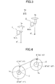
FIG. 3] FIG. 3 is an explanatory view for explaining an overall idea of a preparation system for surveying operation of a first embodiment according to the present invention. - [
FIG. 4] FIG. 4 is an explanatory view for showing a relationship of the unknown reference point, the known reference point, and positioning data. - [
FIG. 5] FIG. 5 is an explanatory view for explaining an overall idea of a preparation system for surveying operation of a second embodiment according to the present invention. - [
FIG. 6] FIG. 6 is an explanatory view for explaining a variation of the preparation system for surveying operation of the second embodiment according to the present invention. - [
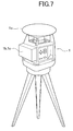
FIG. 7] FIG. 7 is a perspective view for showing an outlook appearance of a rotating laser device used in a preparation system for surveying operation of a third embodiment according to the present invention. - [
FIG. 8] FIG. 8 is an explanatory view for explaining an overall idea of a preparation system for surveying operation of a third embodiment according to the present invention. -
FIG. 1 is a view for schematically showing a surveying operation system according to the present invention. - In
FIG. 1 ,reference number 1 denotes a fixed station, andreference number 2 denotes a mobile station. As illustrated inFIGs. 1 and 2 , thefixed station 1 is disposed at a reference point (known observation point) A where the position coordinate is known for RTK surveying method. The reference sign A (X1, Y1) inFIG. 2 represents a horizontal position coordinate of the known reference point A. - As illustrated in
FIGs. 1 and 2 , themobile station 2 is disposed at an observation point B where the position coordinate is unknown. The reference sign B (X2, Y2) inFIG. 2 represents a horizontal position coordinate of the unknown observation point B. - The
fixed station 1 is equipped with a fixed-station satellite positioning section (GPS device) 1a, acommunication device 1b, and anarithmetic section 1c. Themobile station 2 is equipped with a mobile-station satellite positioning section (GPS device) 2a, acommunication device 2b, and anarithmetic section 2c. - The fixed-station
satellite positioning section 1a and the mobile-stationsatellite positioning section 2a each receives positioning data from at least four satellites Sa1 to Sa 4, as illustrated inFIG. 1 . Accordingly, thefixed station 1 acquires a horizontal position coordinate A' (X1, Y1'), and themobile station 2 acquires a horizontal position coordinate B' (X2', Y2') as positioning data, as illustrated inFIG. 2 . - The
arithmetic section 1c calculates correction data Δ (X1'-X1, Y1'-Y1) in accordance with the acquired horizontal position coordinate A' (X1, Y1') and the known horizontal position coordinate A (X1, Y1) of the reference point A. - The correction data Δ is sent from the
communication device 1b to thecommunication device 2b. Thearithmetic section 2c calculates a horizontal position coordinate B (X2, Y2) of the unknown reference point B in accordance with the acquired horizontal position coordinate B' (X2', Y2') and the calculated correction data Δ (X1'-X1, Y1'-Y1). - The equation to calculate the data Δ is as follows:

- That is, the
arithmetic section 2c determines a horizontal relative position relationship of themobile station 2 with respect to thefixed station 1 based on the positioning data of the known reference point A and the positioning data of the unknown observation point B, and further determines the horizontal position coordinate of the unknown observation point B based on the determined horizontal relative position relationship and the horizontal position coordinate of the known reference point A in real time. - If the
fixed station 1 is disposed at the known reference point A, the known reference point A is occupied by the fixed station until the RTK surveying operation is completed. That is, it becomes impossible to use the known reference point A for any other object. - To overcome such a deficiency, a preparation system illustrated in
FIG. 3 is used to prepare for determining the horizontal position coordinate of the unknown observation point B using themobile station 2. The preparation system determines a horizontal position coordinate of an unknown reference point A" by disposing thefixed station 1 at the unknown reference point A" and themobile station 2 at a known observation point B", and assigns the determined horizontal position coordinate as a known reference point A. - As illustrated in
FIG. 4 , in the preparation system thefixed station 1 acquires the horizontal position coordinate A' (X1, Y1') of the unknown reference point A" as the positioning data using the fixed-stationsatellite positioning section 1a. Thearithmetic section 1c then sets the acquired horizontal position coordinate A' (X1, Y1') of the unknown reference point A" as an initial location data. - By referring observation correction data sent from the
fixed station 1, themobile station 2 acquires the horizontal position coordinate B' (X2', Y2') of the known observation point B" using the mobile-stationsatellite positioning section 2a. - The horizontal position coordinate B' (X2', Y2') of the
mobile station 2 and the horizontal position coordinate B" (X2", Y2") of the known observation point B" are then sent to thefixed station 1 by thecommunication device 2b. - Based on the acquired horizontal position coordinate A' (X1, Y1'), which is used as the initial location data, and the horizontal position coordinate B' (X2', Y2'), which is used as the positioning data, as well as the horizontal position coordinate B" (X2", Y2") of the known observation point B" sent from the
mobile station 2; thearithmetic section 1c determines the horizontal position coordinate A" (X1", Y1") of the unknown reference point A" using the following equation:
- That is, the
arithmetic section 1c executes an arithmetic step of determining the horizontal position coordinate A" (X1", Y1") of the unknown reference point A" based on the positioning data sent from themobile station 2, the positioning data acquired by thefixed station 1, and the known position coordinate B" (X2", Y2") of the observation point B". Further, thearithmetic section 1c executes an assigning step for assigning the determined reference point A" as the horizontal position coordinate A" (X1", Y1") of the known reference point A. - In other words, the
arithmetic section 1c of the fixedstation 1 determines a horizontal relative position relationship of the unknown reference point A" with respect to the known observation point B" based on the initial location data and the positioning data acquired by themobile station 2. Thearithmetic section 1c then determines the horizontal position coordinate (X1", Y1") of the unknown reference point A", at which the fixedstation 1 is disposed, based on the determined horizontal relative position relationship and the horizontal position coordinate B" (X2", Y2") of the known observation point B", and assigns the determined horizontal position coordinate (X1", Y1") as the position coordinate of the known referencepoint A. 
- In
Embodiment 1, the preparation system can assign the unknown reference point A" as the known reference point A without acquiring positioning data of the unknown reference point A" through independent positioning method and performing statically processing to assign the unknown reference point A" as the known reference point A. As a result, the preparation system according toEmbodiment 1 can easily perform a preparation for surveying operation. - Here, the calculation to determine the reference point A may be carried out by the
arithmetic section 2c of themobile station 2, and themobile station 2 sets (sends) the determined position coordinate to the fixedstation 1. - Note in
Embodiment 1, the altitude data as a part of the positioning data is also acquired and input to thearithmetic section 1c. - In
Embodiment 1, the altitude data is calculated in accordance with the positioning data sent from the satellites and input to thearithmetic section 1c. However, the survey operation may need an accurate altitude data. Therefore, the preparation system ofEmbodiment 2 is configured to automatically determine accurate vertical position coordinates. - A fixed
station 1 ofEmbodiment 2 is configured with an electronic level device (surveying device). As illustrated inFIG. 5 , the electronic level device irradiates a laser beam P to form a horizontal reference surface S. The electronic level device includes a fixed-stationsatellite positioning section 1a, acommunication device 1b, and anarithmetic section 1c. - A
target 2d to measure an altitude (height) is attached on apole 2e of amobile station 2 at a reference height Z2" from the ground at the known observation point B". The altitude data of the reference height Z2" is sent to thecommunication device 1b by acommunication device 2b of themobile station 2. - The electronic level device irradiates a laser beam P to the
target 2d to form the horizontal reference surface S and receives a reflected laser beam P' reflected by thetarget 2d so as to determine a relative height LZ of the electronic level device with respect to thetarget 2d of themobile station 2. - Based on the relative height LZ and the reference height Z2", the
arithmetic section 1c calculates a height Z1" at the unknown reference point A" and assigns the calculated height as a vertical position coordinate Z1 of the known reference point A. - The equation to calculate the height Z1 is as follows:

- As described, in
Embodiment 2, thearithmetic section 1c determines the vertical position coordinate Z1" of the unknown reference point A" and assigns the determined vertical position coordinate as the vertical position coordinate Z1 of the known reference point A based on the relative height LZ and the reference height Z2". - On the other hand, the
arithmetic section 1c can detect an altitude angle α of thetarget 2d with respect to the horizontal reference surface S, determine a difference (X1'-X2', Y1'-Y2') between the unknown reference point A" and the known observation point B" in the horizontal direction, and then determine a horizontal distance L from the fixedstation 1 to themobile station 2, as illustrated inFIG. 6 . Accordingly, thearithmetic section 1c can determine the relative height LZ based on the horizontal distance L and the altitude angle α. - Consequently, the
arithmetic section 1c can determine the vertical position coordinate Z1" of the unknown reference point A", at which the fixedstation 1 is disposed, and assign the determined vertical position coordinate Z1" as the vertical position coordinate Z1 of the known reference point A. - Note that in
Embodiment 2, the electronic level device is used for the fixedstation 1 as the laser surveying device. However, as long as the fixed station can determine the height of thetarget 2d, it should not be limited thereto. A laser level device or a total station may be used as the laser surveying device instead of the electronic level device. - As illustrated in
FIG. 7 , a preparation system of Embodiment 3 adopts a rotating laser device as a surveying device of the fixedstation 1. The rotating laser device includes asatellite positioning section 1a, acommunication device 1b, and anarithmetic section 1c. - As illustrated in
FIG. 8 , amobile station 2 of Embodiment 3 includes asatellite positioning section 2a, acommunication device 2b, anarithmetic section 2c, and atarget 2d. - The rotating laser device rotates and irradiates a fan-shaped laser beam P tilted against a horizontal reference surface S. Here, the rotating laser device irradiates a fan-shaped laser beam P having an N-shape. For the rotating laser device, a known configuration (for instance,
JP2007-271627 A - The
arithmetic section 1c determines a relative height LZ of the fixedstation 1 with respect to themobile station 2 based on positioning data acquired by the mobile-stationsatellite positioning section 2a and positioning data acquired by the fixed-stationsatellite positioning section 1a. - Further, the
arithmetic section 1c determines an altitude data Z1" at an unknown reference point A" based on the determined relative height LZ and an altitude angle α of atarget 2d with respect to the horizontal reference surface S. - Note that a method to calculate the relative height LZ is the same as that described above.
- The present application is based on and claims priority from Japanese Patent Application No.
2013-125120, filed on June 14, 2013
Claims (6)
- A preparation system for surveying operation, comprising:a mobile station disposed at an observation point where a position coordinate is unknown; anda fixed station disposed at a reference point where a position coordinate is known,the surveying operation receiving positioning data from satellites by the mobile station and the fixed station and determining the position coordinate of the unknown observation point based on the positioning data of the fixed station,wherein the system comprises:an arithmetic step to determine the position coordinate of the unknown reference point based on positioning data received by the mobile station, positioning data received by the fixed station, and a position coordinate of the known observation point, andan assigning step to assign the unknown reference point whose position coordinate is determined as the known reference point.
- The system according to claim 1, wherein
the mobile station includes at least a mobile-station satellite positioning section that receives the positioning data from the satellites, and
the fixed station includes at least:a fixed-station satellite positioning section that receives the positioning data from the satellites, andan arithmetic section that sets the positioning data received by the fixed-station satellite positioning section as an initial positioning data, determines a horizontal relative position relationship between the unknown reference point and the known observation point based on the initial positioning data and the positioning data received by the mobile-station satellite positioning section, determines a horizontal position coordinate of the unknown reference point based on the determined horizontal relative position relationship and a horizontal position coordinate of the known observation point, and assigns the determined horizontal position coordinate as a horizontal position coordinate of the known reference point. - The system according to claim 2, wherein
the mobile station includes a target to measure a height, and
the fixed station executes:an arithmetic step to determine the horizontal relative position relationship between the unknown reference point and the known observation point,a determination step to determine a vertical position coordinate of the unknown reference point by measuring the height of the target and acquiring a relative height of the fixed station with respect to the target, andan assigning step to assign the determined vertical position coordinate as a vertical position coordinate of the known reference point. - The system according to claim 2, wherein
the mobile station includes a target to measure a height, and
the fixed station executes:an arithmetic step to determine the horizontal relative position relationship between the unknown reference point and the known observation point,a detection step to detect an altitude angle of the target with respect to a reference surface, anda determination step to determine a vertical position coordinate of the fixed station based on the determined horizontal relative position relationship and the measured altitude angle. - The system according to claim 4, wherein
the fixed station is a surveying device having a satellite positioning section, and
the surveying device is any one of an electronic level device, a laser level device, and a total station to form the reference surface. - The system according to claim 2, wherein
the mobile station includes a target to measure a height,
the fixed station is a surveying device having a satellite positioning section,
the surveying device is a laser surveying device that rotates and irradiates a fan-shaped laser beam tilted against a reference surface, and
the arithmetic section of the fixed station executes an arithmetic step to determine a relative height data of the fixed station with respect to the mobile station based on the positioning data measured by the mobile-station satellite positioning section and the positioning data measured by the fixed-station satellite positioning section and to determine a vertical position data of the unknown reference point based on the determined relative height data and an altitude angle of the target with respect to the reference surface.
Applications Claiming Priority (2)
| Application Number | Priority Date | Filing Date | Title |
|---|---|---|---|
| JP2013125120A JP6302630B2 (en) | 2013-06-14 | 2013-06-14 | Preparation system for RTK survey work |
| PCT/JP2014/065527 WO2014200043A1 (en) | 2013-06-14 | 2014-06-12 | Preparation system used in surveying work |
Publications (3)
| Publication Number | Publication Date |
|---|---|
| EP3009791A1 true EP3009791A1 (en) | 2016-04-20 |
| EP3009791A4 EP3009791A4 (en) | 2017-02-08 |
| EP3009791B1 EP3009791B1 (en) | 2021-01-13 |
Family
ID=52022333
Family Applications (1)
| Application Number | Title | Priority Date | Filing Date |
|---|---|---|---|
| EP14810846.7A Active EP3009791B1 (en) | 2013-06-14 | 2014-06-12 | Preparation system used in surveying work |
Country Status (5)
| Country | Link |
|---|---|
| US (1) | US10705225B2 (en) |
| EP (1) | EP3009791B1 (en) |
| JP (1) | JP6302630B2 (en) |
| AU (1) | AU2014279081A1 (en) |
| WO (1) | WO2014200043A1 (en) |
Cited By (1)
| Publication number | Priority date | Publication date | Assignee | Title |
|---|---|---|---|---|
| CN110132222A (en) * | 2019-04-23 | 2019-08-16 | 广州南方卫星导航仪器有限公司 | The AM automatic monitoring of base station operating status and alarm method, electronic equipment, medium |
Families Citing this family (6)
| Publication number | Priority date | Publication date | Assignee | Title |
|---|---|---|---|---|
| WO2019113952A1 (en) * | 2017-12-15 | 2019-06-20 | 深圳市大疆创新科技有限公司 | Rtk measuring device |
| CN113029092A (en) * | 2021-03-12 | 2021-06-25 | 广东海纬地恒空间信息技术有限公司 | Leveling and measuring station automation system based on network RTK GNSS |
| CN114322926B (en) * | 2021-12-29 | 2024-05-31 | 湖南省测绘科技研究所 | A CORS normal high positioning method and system |
| CN115075307A (en) * | 2022-06-15 | 2022-09-20 | 上海交大海科检测技术有限公司 | Immersed tunnel pipe section sinking butt joint space positioning monitoring system and method |
| JP7256576B1 (en) * | 2022-12-12 | 2023-04-12 | 株式会社Daチャレンジャーズ | Pile construction method and pile measuring device |
| CN115822004B (en) * | 2022-12-13 | 2025-09-12 | 天津市政工程设计研究总院有限公司 | A platform-based monitoring method for highway roadbed settlement and convergence |
Family Cites Families (22)
| Publication number | Priority date | Publication date | Assignee | Title |
|---|---|---|---|---|
| JPH04175606A (en) * | 1990-11-08 | 1992-06-23 | Asahi Seimitsu Kk | Surveying device equipped with gps function and ts surveying function |
| US5148179A (en) | 1991-06-27 | 1992-09-15 | Trimble Navigation | Differential position determination using satellites |
| US5739785A (en) * | 1993-03-04 | 1998-04-14 | Trimble Navigation Limited | Location and generation of high accuracy survey control marks using satellites |
| US5563607A (en) * | 1994-05-26 | 1996-10-08 | Trimble Navigation Limited | Time and/or location tagging of an event |
| JPH09292224A (en) * | 1996-04-25 | 1997-11-11 | Nikon Corp | Surveying equipment using global positioning system |
| US6104339A (en) * | 1998-08-19 | 2000-08-15 | Trimble Navigation Limited | All-terrain error correction |
| US6317603B1 (en) * | 1999-05-21 | 2001-11-13 | Trimble Navigation, Ltd | Long baseline RTK using a secondary base receiver and a non-continuous data link |
| JP2002181917A (en) * | 2000-12-13 | 2002-06-26 | Furuno Electric Co Ltd | Surveying method and surveying system |
| US7480511B2 (en) * | 2003-09-19 | 2009-01-20 | Trimble Navigation Limited | Method and system for delivering virtual reference station data |
| JP4328654B2 (en) | 2004-03-23 | 2009-09-09 | 株式会社トプコン | Laser measuring method and laser measuring system |
| US7002513B2 (en) * | 2004-03-26 | 2006-02-21 | Topcon Gps, Llc | Estimation and resolution of carrier wave ambiguities in a position navigation system |
| US7456943B1 (en) * | 2004-03-26 | 2008-11-25 | Topcon Positioning Systems, Inc. | Laser positioning measurement system and method |
| US7532160B1 (en) * | 2004-07-30 | 2009-05-12 | Novariant, Inc. | Distributed radio frequency ranging signal receiver for navigation or position determination |
| US7310138B2 (en) * | 2005-08-27 | 2007-12-18 | Trimble Navigation, Ltd | Method for augmenting radio positioning system using single fan laser |
| US8159397B2 (en) * | 2006-03-30 | 2012-04-17 | Novatel Inc. | System for determining position using two way time transfer signals |
| JP4965149B2 (en) | 2006-03-31 | 2012-07-04 | 株式会社トプコン | RTK-GPS positioning system |
| JP4912739B2 (en) | 2006-05-16 | 2012-04-11 | 株式会社トプコン | RTK-GPS survey system |
| US7515100B2 (en) * | 2006-10-27 | 2009-04-07 | Trimble Navigation Limited | Method and system for initiating real-time kinematic network operations |
| JP2007271627A (en) * | 2007-04-26 | 2007-10-18 | Topcon Corp | Working position measuring device |
| WO2012151006A1 (en) * | 2011-03-22 | 2012-11-08 | Trimble Navigation Limited | Gnss signal processing with delta phase |
| CN103430046B (en) * | 2011-03-22 | 2015-08-12 | 天宝导航有限公司 | GNSS signal processing with known positioning for reconvergence |
| KR101326889B1 (en) * | 2011-11-07 | 2013-11-11 | 현대자동차주식회사 | A method and system to control relative position among vehicles using dgps mobile reference station |
-
2013
- 2013-06-14 JP JP2013125120A patent/JP6302630B2/en active Active
-
2014
- 2014-06-12 AU AU2014279081A patent/AU2014279081A1/en not_active Abandoned
- 2014-06-12 EP EP14810846.7A patent/EP3009791B1/en active Active
- 2014-06-12 US US14/897,980 patent/US10705225B2/en active Active
- 2014-06-12 WO PCT/JP2014/065527 patent/WO2014200043A1/en not_active Ceased
Non-Patent Citations (1)
| Title |
|---|
| See references of WO2014200043A1 * |
Cited By (1)
| Publication number | Priority date | Publication date | Assignee | Title |
|---|---|---|---|---|
| CN110132222A (en) * | 2019-04-23 | 2019-08-16 | 广州南方卫星导航仪器有限公司 | The AM automatic monitoring of base station operating status and alarm method, electronic equipment, medium |
Also Published As
| Publication number | Publication date |
|---|---|
| AU2014279081A1 (en) | 2016-01-21 |
| WO2014200043A1 (en) | 2014-12-18 |
| JP6302630B2 (en) | 2018-03-28 |
| US20160124093A1 (en) | 2016-05-05 |
| US10705225B2 (en) | 2020-07-07 |
| EP3009791B1 (en) | 2021-01-13 |
| JP2015001410A (en) | 2015-01-05 |
| EP3009791A4 (en) | 2017-02-08 |
Similar Documents
| Publication | Publication Date | Title |
|---|---|---|
| EP3009791B1 (en) | Preparation system used in surveying work | |
| US10816347B2 (en) | Tunnel mapping system and methods | |
| CN106030244B (en) | The contactless position and orientation of the apparatus coupled with moving machine determine | |
| EP3491421B1 (en) | Mobile reference station for gnss positioning | |
| US9121939B2 (en) | Self calibration for crane geometry | |
| US9547088B2 (en) | Crane boom pointing angle determination | |
| KR101229129B1 (en) | Method for measuring verticality of structure using GNSS and system thereof | |
| KR101700044B1 (en) | System and method for surveying 3-dimensional underwater topographic information using multiple gps receivers and echo sounder | |
| US11250622B2 (en) | Map creation system and map creation method | |
| JP6555522B2 (en) | Information processing apparatus, information processing method, and program | |
| US10094940B2 (en) | Method for localizing a marine mammal in an underwater environment implemented by a PAM system, corresponding device, computer program product and non-transitory computer-readable carrier medium | |
| JP2018040785A (en) | Position measurement system, position measurement method and mobile robot | |
| JP2005098746A (en) | Continuous cable position search device, continuous cable position search method, and continuous cable position search program | |
| US20230168387A1 (en) | Measurement apparatus, measurement method and program | |
| JP2009063531A (en) | Positioning system and positioning method | |
| CA2883062C (en) | Method for localizing a marine mammal in an underwater environment implemented by a pam system, corresponding device, computer program product and non-transitory computer-readable carrier medium | |
| JP2022110446A (en) | Positioning accuracy output system and its server device | |
| KR101255901B1 (en) | Apparatus for measuring vertical deformation of structure under construction and apparatus for computing compensation value against column shortening of structure under construction | |
| JP2017009561A (en) | Measuring device, measuring method and measuring program | |
| JP2009300407A (en) | Survey system by gps mobile phone | |
| JP2024110930A (en) | Measurement system and measurement method | |
| Pehlivan | Robotik Total Station ve GNSS Ölçümlerinin Analizi | |
| JP2019090758A (en) | Shape measurement system for floor, and measurement method | |
| JP6807526B2 (en) | Satellite positioning system, electronic equipment, transmitter and positioning method | |
| WO2024218336A1 (en) | Devices and methods for determining survey data |
Legal Events
| Date | Code | Title | Description |
|---|---|---|---|
| PUAI | Public reference made under article 153(3) epc to a published international application that has entered the european phase |
Free format text: ORIGINAL CODE: 0009012 |
|
| 17P | Request for examination filed |
Effective date: 20160108 |
|
| AK | Designated contracting states |
Kind code of ref document: A1 Designated state(s): AL AT BE BG CH CY CZ DE DK EE ES FI FR GB GR HR HU IE IS IT LI LT LU LV MC MK MT NL NO PL PT RO RS SE SI SK SM TR |
|
| AX | Request for extension of the european patent |
Extension state: BA ME |
|
| DAX | Request for extension of the european patent (deleted) | ||
| A4 | Supplementary search report drawn up and despatched |
Effective date: 20170111 |
|
| RIC1 | Information provided on ipc code assigned before grant |
Ipc: G01S 19/43 20100101ALI20170104BHEP Ipc: G01S 19/14 20100101ALI20170104BHEP Ipc: G01C 5/00 20060101ALI20170104BHEP Ipc: G01C 15/00 20060101AFI20170104BHEP Ipc: G01S 19/41 20100101ALI20170104BHEP Ipc: G01S 19/07 20100101ALI20170104BHEP |
|
| STAA | Information on the status of an ep patent application or granted ep patent |
Free format text: STATUS: EXAMINATION IS IN PROGRESS |
|
| 17Q | First examination report despatched |
Effective date: 20180622 |
|
| REG | Reference to a national code |
Ref country code: DE Ref legal event code: R079 Ref document number: 602014074266 Country of ref document: DE Free format text: PREVIOUS MAIN CLASS: G01C0015000000 Ipc: G01S0019040000 |
|
| GRAP | Despatch of communication of intention to grant a patent |
Free format text: ORIGINAL CODE: EPIDOSNIGR1 |
|
| STAA | Information on the status of an ep patent application or granted ep patent |
Free format text: STATUS: GRANT OF PATENT IS INTENDED |
|
| RIC1 | Information provided on ipc code assigned before grant |
Ipc: G01S 19/48 20100101ALI20200629BHEP Ipc: G01C 15/00 20060101ALI20200629BHEP Ipc: G01S 19/14 20100101ALI20200629BHEP Ipc: G01S 19/04 20100101AFI20200629BHEP Ipc: G01C 5/00 20060101ALI20200629BHEP Ipc: G01S 19/43 20100101ALI20200629BHEP Ipc: G01S 19/07 20100101ALI20200629BHEP Ipc: G01S 19/41 20100101ALI20200629BHEP |
|
| INTG | Intention to grant announced |
Effective date: 20200803 |
|
| RIN1 | Information on inventor provided before grant (corrected) |
Inventor name: OGAWA, TAKASHI Inventor name: KAMIZONO, FUMIHIKO |
|
| GRAS | Grant fee paid |
Free format text: ORIGINAL CODE: EPIDOSNIGR3 |
|
| GRAA | (expected) grant |
Free format text: ORIGINAL CODE: 0009210 |
|
| STAA | Information on the status of an ep patent application or granted ep patent |
Free format text: STATUS: THE PATENT HAS BEEN GRANTED |
|
| AK | Designated contracting states |
Kind code of ref document: B1 Designated state(s): AL AT BE BG CH CY CZ DE DK EE ES FI FR GB GR HR HU IE IS IT LI LT LU LV MC MK MT NL NO PL PT RO RS SE SI SK SM TR |
|
| REG | Reference to a national code |
Ref country code: GB Ref legal event code: FG4D |
|
| REG | Reference to a national code |
Ref country code: CH Ref legal event code: EP |
|
| REG | Reference to a national code |
Ref country code: DE Ref legal event code: R096 Ref document number: 602014074266 Country of ref document: DE |
|
| REG | Reference to a national code |
Ref country code: IE Ref legal event code: FG4D |
|
| REG | Reference to a national code |
Ref country code: AT Ref legal event code: REF Ref document number: 1354982 Country of ref document: AT Kind code of ref document: T Effective date: 20210215 Ref country code: CH Ref legal event code: NV Representative=s name: VALIPAT S.A. C/O BOVARD SA NEUCHATEL, CH |
|
| REG | Reference to a national code |
Ref country code: AT Ref legal event code: MK05 Ref document number: 1354982 Country of ref document: AT Kind code of ref document: T Effective date: 20210113 |
|
| REG | Reference to a national code |
Ref country code: NL Ref legal event code: MP Effective date: 20210113 |
|
| REG | Reference to a national code |
Ref country code: LT Ref legal event code: MG9D |
|
| PG25 | Lapsed in a contracting state [announced via postgrant information from national office to epo] |
Ref country code: LT Free format text: LAPSE BECAUSE OF FAILURE TO SUBMIT A TRANSLATION OF THE DESCRIPTION OR TO PAY THE FEE WITHIN THE PRESCRIBED TIME-LIMIT Effective date: 20210113 Ref country code: PT Free format text: LAPSE BECAUSE OF FAILURE TO SUBMIT A TRANSLATION OF THE DESCRIPTION OR TO PAY THE FEE WITHIN THE PRESCRIBED TIME-LIMIT Effective date: 20210513 Ref country code: FI Free format text: LAPSE BECAUSE OF FAILURE TO SUBMIT A TRANSLATION OF THE DESCRIPTION OR TO PAY THE FEE WITHIN THE PRESCRIBED TIME-LIMIT Effective date: 20210113 Ref country code: GR Free format text: LAPSE BECAUSE OF FAILURE TO SUBMIT A TRANSLATION OF THE DESCRIPTION OR TO PAY THE FEE WITHIN THE PRESCRIBED TIME-LIMIT Effective date: 20210414 Ref country code: HR Free format text: LAPSE BECAUSE OF FAILURE TO SUBMIT A TRANSLATION OF THE DESCRIPTION OR TO PAY THE FEE WITHIN THE PRESCRIBED TIME-LIMIT Effective date: 20210113 Ref country code: BG Free format text: LAPSE BECAUSE OF FAILURE TO SUBMIT A TRANSLATION OF THE DESCRIPTION OR TO PAY THE FEE WITHIN THE PRESCRIBED TIME-LIMIT Effective date: 20210413 Ref country code: NL Free format text: LAPSE BECAUSE OF FAILURE TO SUBMIT A TRANSLATION OF THE DESCRIPTION OR TO PAY THE FEE WITHIN THE PRESCRIBED TIME-LIMIT Effective date: 20210113 Ref country code: NO Free format text: LAPSE BECAUSE OF FAILURE TO SUBMIT A TRANSLATION OF THE DESCRIPTION OR TO PAY THE FEE WITHIN THE PRESCRIBED TIME-LIMIT Effective date: 20210413 |
|
| PG25 | Lapsed in a contracting state [announced via postgrant information from national office to epo] |
Ref country code: AT Free format text: LAPSE BECAUSE OF FAILURE TO SUBMIT A TRANSLATION OF THE DESCRIPTION OR TO PAY THE FEE WITHIN THE PRESCRIBED TIME-LIMIT Effective date: 20210113 Ref country code: LV Free format text: LAPSE BECAUSE OF FAILURE TO SUBMIT A TRANSLATION OF THE DESCRIPTION OR TO PAY THE FEE WITHIN THE PRESCRIBED TIME-LIMIT Effective date: 20210113 Ref country code: RS Free format text: LAPSE BECAUSE OF FAILURE TO SUBMIT A TRANSLATION OF THE DESCRIPTION OR TO PAY THE FEE WITHIN THE PRESCRIBED TIME-LIMIT Effective date: 20210113 Ref country code: PL Free format text: LAPSE BECAUSE OF FAILURE TO SUBMIT A TRANSLATION OF THE DESCRIPTION OR TO PAY THE FEE WITHIN THE PRESCRIBED TIME-LIMIT Effective date: 20210113 Ref country code: SE Free format text: LAPSE BECAUSE OF FAILURE TO SUBMIT A TRANSLATION OF THE DESCRIPTION OR TO PAY THE FEE WITHIN THE PRESCRIBED TIME-LIMIT Effective date: 20210113 |
|
| PG25 | Lapsed in a contracting state [announced via postgrant information from national office to epo] |
Ref country code: IS Free format text: LAPSE BECAUSE OF FAILURE TO SUBMIT A TRANSLATION OF THE DESCRIPTION OR TO PAY THE FEE WITHIN THE PRESCRIBED TIME-LIMIT Effective date: 20210513 |
|
| REG | Reference to a national code |
Ref country code: DE Ref legal event code: R097 Ref document number: 602014074266 Country of ref document: DE |
|
| PG25 | Lapsed in a contracting state [announced via postgrant information from national office to epo] |
Ref country code: SM Free format text: LAPSE BECAUSE OF FAILURE TO SUBMIT A TRANSLATION OF THE DESCRIPTION OR TO PAY THE FEE WITHIN THE PRESCRIBED TIME-LIMIT Effective date: 20210113 Ref country code: CZ Free format text: LAPSE BECAUSE OF FAILURE TO SUBMIT A TRANSLATION OF THE DESCRIPTION OR TO PAY THE FEE WITHIN THE PRESCRIBED TIME-LIMIT Effective date: 20210113 Ref country code: EE Free format text: LAPSE BECAUSE OF FAILURE TO SUBMIT A TRANSLATION OF THE DESCRIPTION OR TO PAY THE FEE WITHIN THE PRESCRIBED TIME-LIMIT Effective date: 20210113 |
|
| PLBE | No opposition filed within time limit |
Free format text: ORIGINAL CODE: 0009261 |
|
| STAA | Information on the status of an ep patent application or granted ep patent |
Free format text: STATUS: NO OPPOSITION FILED WITHIN TIME LIMIT |
|
| PG25 | Lapsed in a contracting state [announced via postgrant information from national office to epo] |
Ref country code: ES Free format text: LAPSE BECAUSE OF FAILURE TO SUBMIT A TRANSLATION OF THE DESCRIPTION OR TO PAY THE FEE WITHIN THE PRESCRIBED TIME-LIMIT Effective date: 20210113 Ref country code: DK Free format text: LAPSE BECAUSE OF FAILURE TO SUBMIT A TRANSLATION OF THE DESCRIPTION OR TO PAY THE FEE WITHIN THE PRESCRIBED TIME-LIMIT Effective date: 20210113 Ref country code: RO Free format text: LAPSE BECAUSE OF FAILURE TO SUBMIT A TRANSLATION OF THE DESCRIPTION OR TO PAY THE FEE WITHIN THE PRESCRIBED TIME-LIMIT Effective date: 20210113 Ref country code: SK Free format text: LAPSE BECAUSE OF FAILURE TO SUBMIT A TRANSLATION OF THE DESCRIPTION OR TO PAY THE FEE WITHIN THE PRESCRIBED TIME-LIMIT Effective date: 20210113 |
|
| 26N | No opposition filed |
Effective date: 20211014 |
|
| PG25 | Lapsed in a contracting state [announced via postgrant information from national office to epo] |
Ref country code: AL Free format text: LAPSE BECAUSE OF FAILURE TO SUBMIT A TRANSLATION OF THE DESCRIPTION OR TO PAY THE FEE WITHIN THE PRESCRIBED TIME-LIMIT Effective date: 20210113 Ref country code: MC Free format text: LAPSE BECAUSE OF FAILURE TO SUBMIT A TRANSLATION OF THE DESCRIPTION OR TO PAY THE FEE WITHIN THE PRESCRIBED TIME-LIMIT Effective date: 20210113 |
|
| GBPC | Gb: european patent ceased through non-payment of renewal fee |
Effective date: 20210612 |
|
| PG25 | Lapsed in a contracting state [announced via postgrant information from national office to epo] |
Ref country code: SI Free format text: LAPSE BECAUSE OF FAILURE TO SUBMIT A TRANSLATION OF THE DESCRIPTION OR TO PAY THE FEE WITHIN THE PRESCRIBED TIME-LIMIT Effective date: 20210113 |
|
| REG | Reference to a national code |
Ref country code: BE Ref legal event code: MM Effective date: 20210630 |
|
| PG25 | Lapsed in a contracting state [announced via postgrant information from national office to epo] |
Ref country code: LU Free format text: LAPSE BECAUSE OF NON-PAYMENT OF DUE FEES Effective date: 20210612 |
|
| PG25 | Lapsed in a contracting state [announced via postgrant information from national office to epo] |
Ref country code: IT Free format text: LAPSE BECAUSE OF FAILURE TO SUBMIT A TRANSLATION OF THE DESCRIPTION OR TO PAY THE FEE WITHIN THE PRESCRIBED TIME-LIMIT Effective date: 20210113 Ref country code: IE Free format text: LAPSE BECAUSE OF NON-PAYMENT OF DUE FEES Effective date: 20210612 Ref country code: GB Free format text: LAPSE BECAUSE OF NON-PAYMENT OF DUE FEES Effective date: 20210612 |
|
| PG25 | Lapsed in a contracting state [announced via postgrant information from national office to epo] |
Ref country code: IS Free format text: LAPSE BECAUSE OF FAILURE TO SUBMIT A TRANSLATION OF THE DESCRIPTION OR TO PAY THE FEE WITHIN THE PRESCRIBED TIME-LIMIT Effective date: 20210513 Ref country code: FR Free format text: LAPSE BECAUSE OF NON-PAYMENT OF DUE FEES Effective date: 20210630 |
|
| PG25 | Lapsed in a contracting state [announced via postgrant information from national office to epo] |
Ref country code: BE Free format text: LAPSE BECAUSE OF NON-PAYMENT OF DUE FEES Effective date: 20210630 |
|
| PG25 | Lapsed in a contracting state [announced via postgrant information from national office to epo] |
Ref country code: HU Free format text: LAPSE BECAUSE OF FAILURE TO SUBMIT A TRANSLATION OF THE DESCRIPTION OR TO PAY THE FEE WITHIN THE PRESCRIBED TIME-LIMIT; INVALID AB INITIO Effective date: 20140612 |
|
| PG25 | Lapsed in a contracting state [announced via postgrant information from national office to epo] |
Ref country code: CY Free format text: LAPSE BECAUSE OF FAILURE TO SUBMIT A TRANSLATION OF THE DESCRIPTION OR TO PAY THE FEE WITHIN THE PRESCRIBED TIME-LIMIT Effective date: 20210113 |
|
| PG25 | Lapsed in a contracting state [announced via postgrant information from national office to epo] |
Ref country code: MK Free format text: LAPSE BECAUSE OF FAILURE TO SUBMIT A TRANSLATION OF THE DESCRIPTION OR TO PAY THE FEE WITHIN THE PRESCRIBED TIME-LIMIT Effective date: 20210113 |
|
| PG25 | Lapsed in a contracting state [announced via postgrant information from national office to epo] |
Ref country code: MT Free format text: LAPSE BECAUSE OF FAILURE TO SUBMIT A TRANSLATION OF THE DESCRIPTION OR TO PAY THE FEE WITHIN THE PRESCRIBED TIME-LIMIT Effective date: 20210113 |
|
| PGFP | Annual fee paid to national office [announced via postgrant information from national office to epo] |
Ref country code: DE Payment date: 20250429 Year of fee payment: 12 |
|
| PGFP | Annual fee paid to national office [announced via postgrant information from national office to epo] |
Ref country code: CH Payment date: 20250701 Year of fee payment: 12 |
|
| PG25 | Lapsed in a contracting state [announced via postgrant information from national office to epo] |
Ref country code: TR Free format text: LAPSE BECAUSE OF FAILURE TO SUBMIT A TRANSLATION OF THE DESCRIPTION OR TO PAY THE FEE WITHIN THE PRESCRIBED TIME-LIMIT Effective date: 20210113 |