EP2899572A1 - Systems and methods for simulating time phased solar irradiance plots - Google Patents
Systems and methods for simulating time phased solar irradiance plots Download PDFInfo
- Publication number
- EP2899572A1 EP2899572A1 EP15151511.1A EP15151511A EP2899572A1 EP 2899572 A1 EP2899572 A1 EP 2899572A1 EP 15151511 A EP15151511 A EP 15151511A EP 2899572 A1 EP2899572 A1 EP 2899572A1
- Authority
- EP
- European Patent Office
- Prior art keywords
- computing device
- time period
- solar
- predetermined time
- weather
- Prior art date
- Legal status (The legal status is an assumption and is not a legal conclusion. Google has not performed a legal analysis and makes no representation as to the accuracy of the status listed.)
- Granted
Links
Images




Classifications
-
- G—PHYSICS
- G01—MEASURING; TESTING
- G01W—METEOROLOGY
- G01W1/00—Meteorology
- G01W1/12—Sunshine duration recorders
-
- G—PHYSICS
- G01—MEASURING; TESTING
- G01W—METEOROLOGY
- G01W1/00—Meteorology
- G01W1/10—Devices for predicting weather conditions
Definitions
- the present disclosure relates generally to calculating solar irradiance for a geographic area, and more particularly to systems and methods for simulating time phased solar irradiance plots.
- a method for calculating solar irradiance over a predetermined time period for a geographical area including a plurality of geographical points is provided.
- the method is implemented by a computing device coupled to a weather database.
- the method includes receiving a first identifier corresponding to a beginning of the predetermined time period and a second identifier corresponding to an ending of the predetermined time period, receiving weather data from the weather database, generating a model of diffuse light and atmosphere attenuation, based at least on the first identifier, the second identifier, and the weather data, determining solar parameters, and determining an amount of solar irradiance for each geographical point for each of a plurality of time intervals within the predetermined time period, based at least on the model and the solar parameters.
- a computing device for calculating solar irradiance over a predetermined time period for a geographical area including a plurality of geographical points.
- the computing device is coupled to a weather database.
- the computing device is configured to receive a first identifier corresponding to a beginning of the predetermined time period, receive a second identifier corresponding to an ending of the predetermined time period, receive weather data from the weather database, generate a model of diffuse light and atmosphere attenuation, based at least on the first identification, the second identification, and the weather data, determine solar parameters, and determine an amount of solar irradiance for each geographical point for each of a plurality of time intervals within the predetermined time period, based at least on the model and the solar parameters.
- a computer-readable storage medium having computer-executable instructions embodied thereon for calculating solar irradiance over a predetermined time period for a geographical area, including a plurality of geographical points.
- the computer-executable instructions When executed by a computing device coupled to a weather database and having at least one processor, the computer-executable instructions cause the computing device to receive a first identifier corresponding to a beginning of the predetermined time period, receive a second identifier corresponding to an ending of the predetermined time period, receive weather data from the weather database, generate a model of diffuse light and atmosphere attenuation, based at least on the first identification, the second identification, and the weather data, determine solar parameters, and determine an amount of solar irradiance for each geographical point for each of a plurality of time intervals within the predetermined time period, based at least on the model and the solar parameters.
- FIG. 1 is a simplified diagram of an example environment 100 in which a geographical area 102 having a plurality of geographical points 104 receives solar irradiance 106.
- Solar irradiance 106 is generated by Sun 108.
- Geographical area 102 is all or a portion of a surface or area above the surface of a planet 101 (e.g. Earth).
- Each of geographical points 104 may receive a different amount of solar irradiance 106 during a given time period, for example a 24-hour period.
- Factors that may affect an amount of solar irradiance 106 received at a geographical point 104 include the location of geographical point 104 relative to Sun 108, time of day, time of year, weather conditions, and an altitude of geographical point 104. More specifically, geographical point 104 is not necessarily on the surface of planet 101, but rather may be at a given elevation above the surface.
- FIG. 2 is a block diagram of an example computing device 200 that may calculate an amount of solar irradiance over a predetermined time period for a geographical area (e.g., a plurality of geographical points 104).
- Computing device 200 may include a bus 202, a processor 204, a main memory 206, a read only memory (ROM) 208, a storage device 210, an input device 212, an output device 214, and a communication interface 216.
- Bus 202 may include a path that permits communication among the components of computing device 200.
- Processor 204 may include any type of conventional processor, microprocessor, or processing logic that interprets and executes instructions.
- Main memory 206 may include a random access memory (RAM) or another type of dynamic storage device that stores information and instructions for execution by processor 204.
- ROM 208 may include a conventional ROM device or another type of static storage device that stores static information and instructions for use by processor 204.
- Storage device 210 may include a magnetic and/or optical recording medium and its corresponding drive. In some implementations, storage device 210 includes a weather database 312 ( Figure 3 ) described in more detail herein.
- Input device 212 may include a conventional mechanism that permits computing device 200 to receive commands, instructions, or other inputs from a user, including visual, audio, touch, button presses, stylus taps, etc. Additionally, input device may receive location information. Accordingly, input device 212 may include, for example, a camera, a microphone, one or more buttons, and/or a touch screen.
- Output device 214 may include a conventional mechanism that outputs information to a user, including a display (including a touch screen) and/or a speaker.
- Communication interface 216 may include any transceiver-like mechanism that enables computing device 200 to communicate with other devices and/or systems. For example, communication interface 216 may include mechanisms for communicating with another computing device.
- computing device 200 facilitates calculating solar irradiance 106 over a predetermined time period for geographical area 102.
- Computing device 200 may perform these and other operations in response to processor 204 executing software instructions contained in a computer-readable medium, such as memory 206.
- a computer-readable medium may be defined as a physical or logical memory device and/or carrier wave.
- the software instructions may be read into memory 206 from another computer-readable medium, such as data storage device 210, or from another device via communication interface 216.
- the software instructions contained in memory 206 may cause processor 204 to perform processes described herein.
- hardwired circuitry may be used in place of or in combination with software instructions to implement processes consistent with the subject matter herein. Thus, implementations consistent with the principles of the subject matter disclosed herein are not limited to any specific combination of hardware circuitry and software.
- Figure 3 is a block diagram of an example data flow 300 that may be used for calculating the amount of solar irradiance 106 over the predetermined time period for geographical area 102 ( Figure 1 ).
- Input parameters 302 provided to computing device 200 include a first identifier 304 corresponding to a beginning of the predetermined time period, a second identifier 306 corresponding to an ending of the time period, and, in some implementations, a third identifier 308 corresponding to an altitude.
- input parameters 302 additionally include a fourth identifier 310 corresponding to the geographical area for which computing device 200 is to calculate the amount of solar irradiance 106 received over the predetermined time period. In other implementations, input parameters 302 do not include fourth identifier 310.
- geographical area 102 includes all geographical points 104 of planet 101.
- First identifier 304 may be, for example, a date and/or time.
- second identifier 306 may be a later date and/or time.
- Third identifier 308 may be, for example, a number of feet above sea level, or any other indication of altitude.
- Computing device 200 may receive input parameters 302 through input device 212 and/or through communication interface 216, for example from another computing device (not shown) in communication with computing device 200.
- Computing device 200 additionally receives weather data from a weather database 312 for geographical area 102.
- Weather database 312 may include historical weather data 313 and/or current weather data 315.
- historical weather data 313 and current weather data 315 is obtained from one or more global weather stations (not shown).
- Computing device 200 parses weather data 313 and 315 from weather database 312 to generate a weather and atmosphere attenuation model 314.
- computing device 200 generates weather and atmosphere attenuation model 314 by applying a probability engine and transition matrix 316 (i.e., a probability generating function) to determine a probability or percentage chance of one or more weather events occurring in one or more geographical points 104 of geographical area 102, at a particular altitude or range of altitudes, during all or a portion of the predetermined time period specified by input parameters 302.
- the weather events may include rain, clouds, and/or other events that may affect an amount of solar irradiance 106 received at the one or more geographical points 104.
- computing device 200 generates weather and atmosphere attenuation model 314 by determining an average 318 for weather conditions for the one or more geographical points 104 in geographical area 102.
- computing device 200 may retrieve, from weather database 312, weather conditions for each of the one or more geographical points 104 for multiple previous years and calculate an average weather 318 for each geographical point 104.
- computing device 200 assigns weights to weather data 313 and 315 from weather database 312, such that older weather data is weighted less heavily than more recent weather data, in calculating weather and atmosphere attenuation model 314.
- computing device 200 generates or calculates an irradiance model 320 based at least in part on input parameters 302 and weather and atmosphere attenuation model 314. More specifically for each geographical point 104, computing device 200 calculates solar parameters including an azimuth, a declination, an hour angle, and a solar time. Additionally, computing device 200 combines the solar parameters with weather and atmosphere attenuation model 314 to determine an amount of solar irradiance 106 received at each geographical point 104.
- computing device 200 determines an amount of solar irradiance received at each geographical point 104 under weather conditions that may attenuate or decrease an amount of solar irradiance 106 that would otherwise be received at each geographical point 104 under clear sky conditions.
- computing device 200 executes a computer program 322 (i.e., computer-executable instructions) that causes computing device 200 to generate a time-phased simulation 324 of solar irradiance 106 received in geographical area 102.
- time-phased simulation 324 is an animation.
- time-phased simulation 324 may be a time-phased simulation of global irradiance if geographical area 102 includes all geographical points 104 on planet 101.
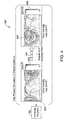
- Figure 4 is a block diagram of example output from computing device 200 based on calculating the amount of solar irradiance 106 over the predetermined time period for geographical area 102. More specifically, and as described above, computing device 200, executing computer program 322, generates time-phased simulation 324, which includes a plurality of intensity maps 400, 402, and 404. More specifically, computing device 200 generates first intensity map 400, which pertains to the beginning of the predetermined time period. Additionally computing device 200 generates final intensity map 404, which pertains to the end of the predetermined time period. Further, computing device generates at least one intermediate intensity map 402 that pertains to at least one time interval (e.g.
- computing device 200 causes first intensity map 400, at least one intermediate intensity map 402, and final intensity map 404 to be displayed in a chronological sequence, for example as an animation.
- first intensity map 400 may include a graphical representation of geographical area 102 that is coded with colors, shades of gray, patterns, or other indicia that represents an intensity (e.g., Watts per meters squared) of solar irradiance 106 received at geographical points 104 of geographical area 102 received at the beginning of the predetermined time period.
- first intensity map 400 may represent solar intensity over a first hour of the predetermined time period.
- first intensity map 400 may include a legend 406 that identifies levels of intensity represented by the color, shades of gray, patterns, or other indicia.
- at least one intermediate intensity map 402 and final intensity map 404 include corresponding indicia and legend 406 for respective time intervals within the predetermined time period.
- FIG 5 is a flow chart of a process 500 that may be performed by computing device 200 for calculating the amount of solar irradiance 106 over the predetermined time period for geographical area 102.
- computing device 200 reads 502 or receives input parameters 302 ( Figure 3 ).
- computing device 200 computes (i.e., calculates or determines) a weather and atmosphere attenuation model (e.g., weather and atmosphere attenuation model 314).
- a weather and atmosphere attenuation model e.g., weather and atmosphere attenuation model 314.
- computing device 200 For relatively lower altitudes (i.e., below clouds), utilizes weather data 313 and 315, for example from weather database 312, to generate a model (e.g., weather and atmosphere attenuation model 314) for clarity conditions and diffuse light.
- a model e.g., weather and atmosphere attenuation model 314.
- computing device 200 uses probability generating function 316 to generate weather and atmosphere attenuation model 314.
- computing device 200 averages historical weather data 313 to generate weather and atmosphere attenuation model 314.
- computing device 200 calculates 510 solar parameters including an azimuth, a declination, an hour angle, and a solar time. Additionally, computing device 200 computes 512 an irradiance or amount of solar irradiance 106 received at the geographical point 104 in view of weather and atmosphere attenuation model 314 and the solar parameters. In some implementations, computing device 200 computes an amount of solar irradiance received at a horizontal plane (not shown) associated with geographical point 104.
- While a certain set of solar parameters may indicate that a first amount of solar irradiance 106 will be received at geographical point 104, when computing device 200 applies weather and atmosphere attenuation model 314, the first amount of solar irradiance 106, may be reduced to a second amount, for example, due to clouds located above geographical point 104.
- computing device 200 increments 514 to a subsequent time interval (i.e., a date and time stamp) in the predetermined time period. Accordingly, with each iteration of outer loop 504, computing device 200 generates a complete intensity map 400, 402, 404. Additionally, computing device 200 runs 516 (e.g., displays or otherwise outputs) an intensity plot animation, for example a chronological sequence of first intensity map 400, at least one intermediate intensity map 402, and final intensity map 404.
- a subsequent time interval i.e., a date and time stamp
- Figure 6 is another flow chart of a process 600 that may be performed by computing device 200 for calculating the amount solar irradiance received over the predetermined time period in geographical area 102.
- computing device 200 receives 602 first identifier 304 corresponding to a beginning of the predetermined time period. Additionally, computing device 200 receives 604 second identifier 306 corresponding to an ending of the predetermined time period. Additionally, computing device 200 receives 606 weather data, for example weather data 313 and 315, from weather database 312.
- computing device 200 generates 608 a model (e.g., weather and atmosphere attenuation model 314) of diffuse light and atmospheric attenuation, based at least on first identifier 304, second identifier 306, and weather data 313 and/or 315. Additionally, computing device 200 determines 610 solar parameters, for example an azimuth, a declination, an hour angle, and a solar time. Additionally, computing device 200, determines 612 an amount of solar irradiance 106 for each geographical point 104 for each of a plurality of time intervals within the predetermined time period, based at least on the model (e.g., weather and atmosphere attenuation model 314) and the solar parameters.
- a model e.g., weather and atmosphere attenuation model 314
- computing device 200 additionally generates an animation of solar irradiance 106 over the predetermined time period. Additionally, in some implementations, computing device 200 receives third identifier 308 corresponding to an altitude and generates the model (e.g., weather and atmosphere attenuation model 314) based additionally on the altitude. In some implementations, computing device 200 determines an amount of solar irradiance 106 for each geographical point 104 by determining an amount of solar irradiance for each geographical point 104 of a planet (e.g., planet 101), such as the Earth. In some implementations, computing device 200 determines an average weather based on historical weather data 313 in weather database 312.
- computing device 200 determines a probability of a weather event affecting solar irradiance based on weather data (e.g., historical weather data 313 and/or current weather data 315) in weather database 312. In some implementations, computing device 200 assigns a first weight to a first set of weather data (e.g., current weather data 315) having a first age, and assigns a second weight to a second set of weather data (e.g., historical weather data 313) having a second age, wherein the first age is less than the second age, and the first weight is greater than the second weight. In other words, in computing weather and atmosphere attenuation model 314, computing device 200 may assign more weight to more recent weather data, and comparatively less weight to comparatively older weather data. In some implementations, computing device 200 estimates extraterrestrial irradiance for altitudes above the atmosphere and determines that the attenuation is zero.
- weather data e.g., historical weather data 313 and/or current weather data 315
- computing device 200 assigns a
- a technical effect of systems and methods described herein includes at least one of: (a) receiving a first identifier corresponding to a beginning of a predetermined time period and a second identifier corresponding to an ending of the predetermined time period; (b) receiving weather data from a weather database; (c) generating a model of diffuse light and atmosphere attenuation, based at least on the first identifier, the second identifier, and the weather data; (d) determining solar parameters; and (e) determining an amount of solar irradiance for each geographical point of a plurality of geographic points in a geographical area, for each of a plurality of time intervals within the predetermined time period, based at least on the model and the solar parameters.
- the methods and systems described herein facilitate calculating amounts of solar irradiation received in a geographical area that includes a plurality of geographical points, over a predetermined time period.
Landscapes
- Environmental & Geological Engineering (AREA)
- Engineering & Computer Science (AREA)
- Life Sciences & Earth Sciences (AREA)
- Atmospheric Sciences (AREA)
- Biodiversity & Conservation Biology (AREA)
- Ecology (AREA)
- Environmental Sciences (AREA)
- Processing Or Creating Images (AREA)
- Supply And Distribution Of Alternating Current (AREA)
Abstract
Description
- The present disclosure relates generally to calculating solar irradiance for a geographic area, and more particularly to systems and methods for simulating time phased solar irradiance plots.
- Known systems for calculating an amount of solar irradiance for a geographical location are limited to calculating the solar irradiance for a fixed geographical point and a fixed instant in time. Typically, such systems output the calculated irradiance as a text-based string representation, rather than a graphical representation. Moreover, such systems typically do not incorporate data pertaining to weather conditions in calculating the solar irradiance. Given that known systems are limited to calculating solar irradiance for a fixed geographical point and a fixed instant in time, do not take into account weather conditions, and do not provide a graphical representation of the calculated solar irradiance, a system that overcomes such limitations would be beneficial.
- In one aspect, a method for calculating solar irradiance over a predetermined time period for a geographical area including a plurality of geographical points is provided. The method is implemented by a computing device coupled to a weather database. The method includes receiving a first identifier corresponding to a beginning of the predetermined time period and a second identifier corresponding to an ending of the predetermined time period, receiving weather data from the weather database, generating a model of diffuse light and atmosphere attenuation, based at least on the first identifier, the second identifier, and the weather data, determining solar parameters, and determining an amount of solar irradiance for each geographical point for each of a plurality of time intervals within the predetermined time period, based at least on the model and the solar parameters.
- In another aspect, a computing device for calculating solar irradiance over a predetermined time period for a geographical area including a plurality of geographical points is provided. The computing device is coupled to a weather database. The computing device is configured to receive a first identifier corresponding to a beginning of the predetermined time period, receive a second identifier corresponding to an ending of the predetermined time period, receive weather data from the weather database, generate a model of diffuse light and atmosphere attenuation, based at least on the first identification, the second identification, and the weather data, determine solar parameters, and determine an amount of solar irradiance for each geographical point for each of a plurality of time intervals within the predetermined time period, based at least on the model and the solar parameters.
- In another aspect, a computer-readable storage medium having computer-executable instructions embodied thereon for calculating solar irradiance over a predetermined time period for a geographical area, including a plurality of geographical points, is provided. When executed by a computing device coupled to a weather database and having at least one processor, the computer-executable instructions cause the computing device to receive a first identifier corresponding to a beginning of the predetermined time period, receive a second identifier corresponding to an ending of the predetermined time period, receive weather data from the weather database, generate a model of diffuse light and atmosphere attenuation, based at least on the first identification, the second identification, and the weather data, determine solar parameters, and determine an amount of solar irradiance for each geographical point for each of a plurality of time intervals within the predetermined time period, based at least on the model and the solar parameters.
-
-
Figure 1 is a simplified diagram of an example environment in which a geographical area having a plurality of geographical points receives solar irradiance. -
Figure 2 is a block diagram of an example computing device that may calculate an amount of solar irradiance over a predetermined time period for the geographical area. -
Figure 3 is a block diagram of an example data flow that may be used for calculating the amount of solar irradiance over the predetermined time period for the geographical area. -
Figure 4 is a block diagram of example output from the computing device ofFigure 2 based on calculating the amount of solar irradiance over the predetermined time period for the geographical area. -
Figure 5 is a flow chart of a process that may be performed by the computing device ofFigure 2 for calculating the amount of solar irradiance over the predetermined time period for the geographical area. -
Figure 6 is another flow chart of a process that may be performed by the computing device ofFigure 2 for calculating the amount solar irradiance over the predetermined time period for the geographical area. -
Figure 1 is a simplified diagram of anexample environment 100 in which ageographical area 102 having a plurality ofgeographical points 104 receivessolar irradiance 106.Solar irradiance 106 is generated by Sun 108.Geographical area 102 is all or a portion of a surface or area above the surface of a planet 101 (e.g. Earth). Each ofgeographical points 104 may receive a different amount ofsolar irradiance 106 during a given time period, for example a 24-hour period. Factors that may affect an amount ofsolar irradiance 106 received at ageographical point 104 include the location ofgeographical point 104 relative to Sun 108, time of day, time of year, weather conditions, and an altitude ofgeographical point 104. More specifically,geographical point 104 is not necessarily on the surface ofplanet 101, but rather may be at a given elevation above the surface. -
Figure 2 is a block diagram of anexample computing device 200 that may calculate an amount of solar irradiance over a predetermined time period for a geographical area (e.g., a plurality of geographical points 104).Computing device 200 may include abus 202, aprocessor 204, amain memory 206, a read only memory (ROM) 208, astorage device 210, aninput device 212, anoutput device 214, and acommunication interface 216.Bus 202 may include a path that permits communication among the components ofcomputing device 200. -
Processor 204 may include any type of conventional processor, microprocessor, or processing logic that interprets and executes instructions.Main memory 206 may include a random access memory (RAM) or another type of dynamic storage device that stores information and instructions for execution byprocessor 204.ROM 208 may include a conventional ROM device or another type of static storage device that stores static information and instructions for use byprocessor 204.Storage device 210 may include a magnetic and/or optical recording medium and its corresponding drive. In some implementations,storage device 210 includes a weather database 312 (Figure 3 ) described in more detail herein. -
Input device 212 may include a conventional mechanism that permitscomputing device 200 to receive commands, instructions, or other inputs from a user, including visual, audio, touch, button presses, stylus taps, etc. Additionally, input device may receive location information. Accordingly,input device 212 may include, for example, a camera, a microphone, one or more buttons, and/or a touch screen.Output device 214 may include a conventional mechanism that outputs information to a user, including a display (including a touch screen) and/or a speaker.Communication interface 216 may include any transceiver-like mechanism that enablescomputing device 200 to communicate with other devices and/or systems. For example,communication interface 216 may include mechanisms for communicating with another computing device. - As described herein,
computing device 200 facilitates calculatingsolar irradiance 106 over a predetermined time period forgeographical area 102.Computing device 200 may perform these and other operations in response toprocessor 204 executing software instructions contained in a computer-readable medium, such asmemory 206. A computer-readable medium may be defined as a physical or logical memory device and/or carrier wave. The software instructions may be read intomemory 206 from another computer-readable medium, such asdata storage device 210, or from another device viacommunication interface 216. The software instructions contained inmemory 206 may causeprocessor 204 to perform processes described herein. In other implementations, hardwired circuitry may be used in place of or in combination with software instructions to implement processes consistent with the subject matter herein. Thus, implementations consistent with the principles of the subject matter disclosed herein are not limited to any specific combination of hardware circuitry and software. -
Figure 3 is a block diagram of anexample data flow 300 that may be used for calculating the amount ofsolar irradiance 106 over the predetermined time period for geographical area 102 (Figure 1 ).Input parameters 302 provided tocomputing device 200 include afirst identifier 304 corresponding to a beginning of the predetermined time period, asecond identifier 306 corresponding to an ending of the time period, and, in some implementations, athird identifier 308 corresponding to an altitude. In some implementations,input parameters 302 additionally include afourth identifier 310 corresponding to the geographical area for whichcomputing device 200 is to calculate the amount ofsolar irradiance 106 received over the predetermined time period. In other implementations,input parameters 302 do not includefourth identifier 310. Rather, in such implementations,geographical area 102 includes allgeographical points 104 ofplanet 101.First identifier 304 may be, for example, a date and/or time. Likewise,second identifier 306 may be a later date and/or time.Third identifier 308 may be, for example, a number of feet above sea level, or any other indication of altitude.Computing device 200 may receiveinput parameters 302 throughinput device 212 and/or throughcommunication interface 216, for example from another computing device (not shown) in communication withcomputing device 200. -
Computing device 200 additionally receives weather data from aweather database 312 forgeographical area 102.Weather database 312 may includehistorical weather data 313 and/orcurrent weather data 315. In some implementations,historical weather data 313 andcurrent weather data 315 is obtained from one or more global weather stations (not shown).Computing device 200 parsesweather data weather database 312 to generate a weather andatmosphere attenuation model 314. More specifically,computing device 200 generates weather andatmosphere attenuation model 314 by applying a probability engine and transition matrix 316 (i.e., a probability generating function) to determine a probability or percentage chance of one or more weather events occurring in one or moregeographical points 104 ofgeographical area 102, at a particular altitude or range of altitudes, during all or a portion of the predetermined time period specified byinput parameters 302. The weather events may include rain, clouds, and/or other events that may affect an amount ofsolar irradiance 106 received at the one or moregeographical points 104. In other implementations,computing device 200 generates weather andatmosphere attenuation model 314 by determining an average 318 for weather conditions for the one or moregeographical points 104 ingeographical area 102. For example, for a given day of a month,computing device 200 may retrieve, fromweather database 312, weather conditions for each of the one or moregeographical points 104 for multiple previous years and calculate anaverage weather 318 for eachgeographical point 104. In some implementations,computing device 200 assigns weights to weatherdata weather database 312, such that older weather data is weighted less heavily than more recent weather data, in calculating weather andatmosphere attenuation model 314. - Additionally,
computing device 200 generates or calculates anirradiance model 320 based at least in part oninput parameters 302 and weather andatmosphere attenuation model 314. More specifically for eachgeographical point 104,computing device 200 calculates solar parameters including an azimuth, a declination, an hour angle, and a solar time. Additionally,computing device 200 combines the solar parameters with weather andatmosphere attenuation model 314 to determine an amount ofsolar irradiance 106 received at eachgeographical point 104. More specifically, by combining weather andatmosphere attenuation model 314 with the solar parameters,computing device 200 determines an amount of solar irradiance received at eachgeographical point 104 under weather conditions that may attenuate or decrease an amount ofsolar irradiance 106 that would otherwise be received at eachgeographical point 104 under clear sky conditions. - Additionally,
computing device 200 executes a computer program 322 (i.e., computer-executable instructions) that causescomputing device 200 to generate a time-phasedsimulation 324 ofsolar irradiance 106 received ingeographical area 102. As described herein, in some implementations, time-phasedsimulation 324 is an animation. In some implementations, time-phasedsimulation 324 may be a time-phased simulation of global irradiance ifgeographical area 102 includes allgeographical points 104 onplanet 101. -
Figure 4 is a block diagram of example output fromcomputing device 200 based on calculating the amount ofsolar irradiance 106 over the predetermined time period forgeographical area 102. More specifically, and as described above,computing device 200, executingcomputer program 322, generates time-phasedsimulation 324, which includes a plurality of intensity maps 400, 402, and 404. More specifically,computing device 200 generatesfirst intensity map 400, which pertains to the beginning of the predetermined time period. Additionally computingdevice 200 generatesfinal intensity map 404, which pertains to the end of the predetermined time period. Further, computing device generates at least oneintermediate intensity map 402 that pertains to at least one time interval (e.g. an hour, a minute, a second, or other unit of time) between the beginning of the predetermined time period and the end of the predetermined time period. In some implementations,computing device 200 causesfirst intensity map 400, at least oneintermediate intensity map 402, andfinal intensity map 404 to be displayed in a chronological sequence, for example as an animation. - In some implementations,
first intensity map 400 may include a graphical representation ofgeographical area 102 that is coded with colors, shades of gray, patterns, or other indicia that represents an intensity (e.g., Watts per meters squared) ofsolar irradiance 106 received atgeographical points 104 ofgeographical area 102 received at the beginning of the predetermined time period. For example,first intensity map 400 may represent solar intensity over a first hour of the predetermined time period. Additionally,first intensity map 400 may include alegend 406 that identifies levels of intensity represented by the color, shades of gray, patterns, or other indicia. In such implementations, at least oneintermediate intensity map 402 andfinal intensity map 404 include corresponding indicia andlegend 406 for respective time intervals within the predetermined time period. -
Figure 5 is a flow chart of aprocess 500 that may be performed by computingdevice 200 for calculating the amount ofsolar irradiance 106 over the predetermined time period forgeographical area 102. Initially,computing device 200 reads 502 or receives input parameters 302 (Figure 3 ). Next, in anouter loop 504 thatcomputing device 200 executes for each time interval orintensity map computing device 200 computes (i.e., calculates or determines) a weather and atmosphere attenuation model (e.g., weather and atmosphere attenuation model 314). For relatively lower altitudes (i.e., below clouds),computing device 200 utilizesweather data weather database 312, to generate a model (e.g., weather and atmosphere attenuation model 314) for clarity conditions and diffuse light. In some implementations,computing device 200 usesprobability generating function 316 to generate weather andatmosphere attenuation model 314. In other implementations,computing device 200 averageshistorical weather data 313 to generate weather andatmosphere attenuation model 314. - In
inner loop 508, whichcomputing device 200 executes for eachgeographical point 104 ingeographical area 102,computing device 200 calculates 510 solar parameters including an azimuth, a declination, an hour angle, and a solar time. Additionally,computing device 200 computes 512 an irradiance or amount ofsolar irradiance 106 received at thegeographical point 104 in view of weather andatmosphere attenuation model 314 and the solar parameters. In some implementations,computing device 200 computes an amount of solar irradiance received at a horizontal plane (not shown) associated withgeographical point 104. While a certain set of solar parameters may indicate that a first amount ofsolar irradiance 106 will be received atgeographical point 104, when computingdevice 200 applies weather andatmosphere attenuation model 314, the first amount ofsolar irradiance 106, may be reduced to a second amount, for example, due to clouds located abovegeographical point 104. - Returning to
outer loop 504,computing device 200increments 514 to a subsequent time interval (i.e., a date and time stamp) in the predetermined time period. Accordingly, with each iteration ofouter loop 504,computing device 200 generates acomplete intensity map computing device 200 runs 516 (e.g., displays or otherwise outputs) an intensity plot animation, for example a chronological sequence offirst intensity map 400, at least oneintermediate intensity map 402, andfinal intensity map 404. -
Figure 6 is another flow chart of aprocess 600 that may be performed by computingdevice 200 for calculating the amount solar irradiance received over the predetermined time period ingeographical area 102. Initially,computing device 200 receives 602first identifier 304 corresponding to a beginning of the predetermined time period. Additionally,computing device 200 receives 604second identifier 306 corresponding to an ending of the predetermined time period. Additionally,computing device 200 receives 606 weather data, forexample weather data weather database 312. Additionally,computing device 200 generates 608 a model (e.g., weather and atmosphere attenuation model 314) of diffuse light and atmospheric attenuation, based at least onfirst identifier 304,second identifier 306, andweather data 313 and/or 315. Additionally,computing device 200 determines 610 solar parameters, for example an azimuth, a declination, an hour angle, and a solar time. Additionally,computing device 200, determines 612 an amount ofsolar irradiance 106 for eachgeographical point 104 for each of a plurality of time intervals within the predetermined time period, based at least on the model (e.g., weather and atmosphere attenuation model 314) and the solar parameters. - In some implementations,
computing device 200 additionally generates an animation ofsolar irradiance 106 over the predetermined time period. Additionally, in some implementations,computing device 200 receivesthird identifier 308 corresponding to an altitude and generates the model (e.g., weather and atmosphere attenuation model 314) based additionally on the altitude. In some implementations,computing device 200 determines an amount ofsolar irradiance 106 for eachgeographical point 104 by determining an amount of solar irradiance for eachgeographical point 104 of a planet (e.g., planet 101), such as the Earth. In some implementations,computing device 200 determines an average weather based onhistorical weather data 313 inweather database 312. In some implementations,computing device 200 determines a probability of a weather event affecting solar irradiance based on weather data (e.g.,historical weather data 313 and/or current weather data 315) inweather database 312. In some implementations,computing device 200 assigns a first weight to a first set of weather data (e.g., current weather data 315) having a first age, and assigns a second weight to a second set of weather data (e.g., historical weather data 313) having a second age, wherein the first age is less than the second age, and the first weight is greater than the second weight. In other words, in computing weather andatmosphere attenuation model 314,computing device 200 may assign more weight to more recent weather data, and comparatively less weight to comparatively older weather data. In some implementations,computing device 200 estimates extraterrestrial irradiance for altitudes above the atmosphere and determines that the attenuation is zero. - A technical effect of systems and methods described herein includes at least one of: (a) receiving a first identifier corresponding to a beginning of a predetermined time period and a second identifier corresponding to an ending of the predetermined time period; (b) receiving weather data from a weather database; (c) generating a model of diffuse light and atmosphere attenuation, based at least on the first identifier, the second identifier, and the weather data; (d) determining solar parameters; and (e) determining an amount of solar irradiance for each geographical point of a plurality of geographic points in a geographical area, for each of a plurality of time intervals within the predetermined time period, based at least on the model and the solar parameters.
- As compared to known methods and systems for calculating an amount of solar irradiance received at a fixed geographical point at a fixed instant in time, the methods and systems described herein facilitate calculating amounts of solar irradiation received in a geographical area that includes a plurality of geographical points, over a predetermined time period.
- Further, the disclosure compromises embodiments according to the following clauses:
- Clause 1. A method for calculating solar irradiance over a predetermined time period for a geographical area including a plurality of geographical points, the method is implemented by a computing device coupled to a weather database, the method comprising:
- receiving a first identifier corresponding to a beginning of the predetermined time period and a second identifier corresponding to an ending of the predetermined time period;
- receiving weather data from the weather database;
- generating a model of diffuse light and atmosphere attenuation, based at least on the first identifier, the second identifier, and the weather data;
- determining solar parameters; and
- determining an amount of solar irradiance for each geographical point for each of a plurality of time intervals within the predetermined time period, based at least on the model and the solar parameters.
- Clause 2. The method of any preceding Clause, further comprising generating an animation of the solar irradiance over the predetermined time period.
- Clause 3. The method of any preceding Clause, further comprising receiving a third identifier corresponding to an altitude and wherein generating the model further comprises generating the model based additionally on the altitude.
- Clause 4. The method of any preceding Clause, wherein determining an amount of solar irradiance for each geographical point further comprises determining an amount of solar irradiance for each geographical point of the Earth.
- Clause 5. The method of any preceding Clause, wherein the weather data includes historical weather data and said method further comprises determining an average weather for the predetermined time period based on the historical weather data.
- Clause 6. The method of any preceding Clause, further comprising determining a probability of a weather event affecting solar irradiance based on the weather data.
- Clause 7. The method of any preceding Clause, wherein determining the solar parameters includes determining at least one of an azimuth, a declination, an hour angle, and a solar time.
- Clause 8. The method of any preceding Clause, further comprising assigning a first weight to a first set of the weather data having a first age and assigning a second weight to a second set of the weather data having a second age, wherein the first age is less than the second age and the first weight is greater than the second weight.
- Clause 9. A computing device for calculating solar irradiance over a predetermined time period for a geographical area including a plurality of geographical points, said computing device coupled to a weather database, said computing device configured to:
- receive a first identifier corresponding to a beginning of the predetermined time period;
- receive a second identifier corresponding to an ending of the predetermined time period;
- receive weather data from the weather database;
- generate a model of diffuse light and atmosphere attenuation, based at least on the first identification, the second identification, and the weather data;
- determine solar parameters; and
- determine an amount of solar irradiance for each geographical point for each of a plurality of time intervals within the predetermined time period, based at least on the model and the solar parameters.
- Clause 10. The computing device of Clause 9, further configured to generate an animation of the solar irradiance over the predetermined time period.
- Clause 11. The computing device of Clause 9 or 10, further configured to receive a third identifier corresponding to an altitude and to generate the model based additionally on the altitude.
- Clause 12. The computing device of any of Clauses 9 to 11, further configured such that determining an amount of solar irradiance for each geographical point further comprises determining an amount of solar irradiance for each geographical point of the Earth.
- Clause 13. The computing device of any of Clauses 9 to 12, wherein the weather data includes historical weather data and said computing device is further configured to determine an average weather for the predetermined time period based on the historical weather data.
- Clause 14. The computing device of any of Clauses 9 to 13, further configured to determine a probability of a weather event affecting solar irradiance based on the weather data.
- Clause 15. The computing device of any of Clauses 9 to 14, further configured to determine the solar parameters by determining at least one of an azimuth, a declination, an hour angle, and a solar time.
- Clause 16. The computing device of any of Clauses 9 to 15, further configured to assign a first weight to a first set of the weather data having a first age and assign a second weight to a second set of the weather data having a second age, wherein the first age is less than the second age and the first weight is greater than the second weight.
- Clause 17. A computer-readable storage medium having computer-executable instructions embodied thereon for calculating solar irradiance over a predetermined time period for a geographical area including a plurality of geographical points, wherein when executed by a computing device coupled to a weather database and having at least one processor, the computer-executable instructions cause the computing device to:
- receive a first identifier corresponding to a beginning of the predetermined time period;
- receive a second identifier corresponding to an ending of the predetermined time period;
- receive weather data from the weather database;
- generate a model of diffuse light and atmosphere attenuation, based at least on the first identification, the second identification, and the weather data;
- determine solar parameters; and
- determine an amount of solar irradiance for each geographical point for each of a plurality of time intervals within the predetermined time period, based at least on the model and the solar parameters.
- Clause 18. The computer-readable storage medium of Clause 17, wherein said computer-executable instructions further cause the computing device to generate an animation of the solar irradiance over the predetermined time period.
- Clause 19. The computer-readable storage medium of Clause 17 or 18, wherein said computer-executable instructions further cause the computing device to receive a third identifier corresponding to an altitude and to generate the model based additionally on the altitude.
- Clause 20. The computer-readable storage medium of any of Clauses 17 to 19, wherein said computer-executable instructions further cause the computing device to determine an amount of solar irradiance for each geographical point by determining an amount of solar irradiance for each geographical point of the Earth.
- The description of the different advantageous implementations has been presented for purposes of illustration and description, and is not intended to be exhaustive or limited to the implementations in the form disclosed. Many modifications and variations will be apparent to those of ordinary skill in the art. Further, different advantageous implementations may provide different advantages as compared to other advantageous implementations. The implementation or implementations selected are chosen and described in order to best explain the principles of the implementations, the practical application, and to enable others of ordinary skill in the art to understand the disclosure for various implementations with various modifications as are suited to the particular use contemplated. This written description uses examples to disclose various implementations, which include the best mode, to enable any person skilled in the art to practice those implementations, including making and using any devices or systems and performing any incorporated methods. The patentable scope is defined by the claims, and may include other examples that occur to those skilled in the art. Such other examples are intended to be within the scope of the claims if they have structural elements that do not differ from the literal language of the claims, or if they include equivalent structural elements with insubstantial differences from the literal languages of the claims.
Claims (15)
- A method for calculating solar irradiance (106) over a predetermined time period for a geographical area (102) including a plurality of geographical points (104), the method is implemented by a computing device (200) coupled to a weather database (312), the method comprising:receiving a first identifier (304) corresponding to a beginning of the predetermined time period and a second identifier (306) corresponding to an ending of the predetermined time period;receiving weather data (313, 315) from the weather database (312);generating a model of diffuse light and atmosphere attenuation (314), based at least on the first identifier (304), the second identifier (306), and the weather data;determining solar parameters; anddetermining an amount of solar irradiance (106) for each geographical point (104) for each of a plurality of time intervals within the predetermined time period, based at least on the model and the solar parameters.
- The method of Claim 1, further comprising generating an animation of the solar irradiance (106) over the predetermined time period.
- The method of Claim 1 or 2, further comprising receiving a third identifier (308) corresponding to an altitude and wherein generating the model further comprises generating the model based additionally on the altitude.
- The method of any of Claims 1 to 3, wherein determining an amount of solar irradiance (106) for each geographical point (104) further comprises determining an amount of solar irradiance for each geographical point (104) of the Earth.
- The method of any of Claims 1 to 4, wherein the weather data includes historical weather data (313) and said method further comprises determining an average weather for the predetermined time period based on the historical weather data (313).
- The method of any of Claims 1 to 5, further comprising determining a probability of a weather event affecting solar irradiance based on the weather data (313, 315).
- The method of any of Claims 1 to 6, wherein determining the solar parameters includes determining (610) at least one of an azimuth, a declination, an hour angle, and a solar time.
- The method of any of Claims 1 to 7, further comprising assigning a first weight to a first set of the weather data (315) having a first age and assigning a second weight to a second set of the weather data (313) having a second age, wherein the first age is less than the second age and the first weight is greater than the second weight.
- A computing device (200) for calculating solar irradiance over a predetermined time period for a geographical area including a plurality of geographical points, said computing device (200) coupled to a weather database, said computing device (200) configured to:receive a first identifier (304) corresponding to a beginning of the predetermined time period;receive a second identifier (306) corresponding to an ending of the predetermined time period;receive weather data from the weather database (312);generate a model of diffuse light and atmosphere attenuation (314), based at least on the first identification, the second identification, and the weather data (313, 315);determine solar parameters; anddetermine an amount of solar irradiance (106) for each geographical point (104) for each of a plurality of time intervals within the predetermined time period, based at least on the model and the solar parameters.
- The computing device (200) of Claim 9, further configured to generate an animation of the solar irradiance (106) over the predetermined time period.
- The computing device (200) of Claim 9 or 10, further configured to receive a third identifier (308) corresponding to an altitude and to generate the model based additionally on the altitude.
- The computing device (200) of any of Claims 9 to 11, further configured such that determining an amount of solar irradiance (106) for each geographical point (104) further comprises determining an amount of solar irradiance for each geographical point (104) of the Earth.
- The computing device (200) of any of Claims 9 to 12, further configured to determine a probability of a weather event affecting solar irradiance based on the weather data (313, 315).
- The computing device (200) of any of Claims 9 to 13, further configured to determine the solar parameters by determining (610) at least one of an azimuth, a declination, an hour angle, and a solar time.
- The computing device (200) of any of Claims 9 to 14, further configured to assign a first weight to a first set of the weather data (315) having a first age and assign a second weight to a second set of the weather data (313) having a second age, wherein the first age is less than the second age and the first weight is greater than the second weight.
Applications Claiming Priority (1)
| Application Number | Priority Date | Filing Date | Title |
|---|---|---|---|
| US14/160,867 US10502866B2 (en) | 2014-01-22 | 2014-01-22 | Systems and methods for simulating time phased solar irradiance plots |
Publications (2)
| Publication Number | Publication Date |
|---|---|
| EP2899572A1 true EP2899572A1 (en) | 2015-07-29 |
| EP2899572B1 EP2899572B1 (en) | 2018-07-18 |
Family
ID=52465176
Family Applications (1)
| Application Number | Title | Priority Date | Filing Date |
|---|---|---|---|
| EP15151511.1A Active EP2899572B1 (en) | 2014-01-22 | 2015-01-16 | Systems and methods for simulating time phased solar irradiance plots |
Country Status (2)
| Country | Link |
|---|---|
| US (1) | US10502866B2 (en) |
| EP (1) | EP2899572B1 (en) |
Cited By (1)
| Publication number | Priority date | Publication date | Assignee | Title |
|---|---|---|---|---|
| CN105954821A (en) * | 2016-04-20 | 2016-09-21 | 中国水利水电科学研究院 | Typical rainfall event selection method for numerical atmospheric model |
Families Citing this family (5)
| Publication number | Priority date | Publication date | Assignee | Title |
|---|---|---|---|---|
| US10275923B2 (en) * | 2016-02-09 | 2019-04-30 | Google Llc | Determining and presenting solar flux information |
| US11300707B2 (en) | 2016-08-02 | 2022-04-12 | International Business Machines Corporation | Solar forecasting using machine learned cloudiness classification |
| CN107786164B (en) * | 2016-08-25 | 2019-10-22 | 成都鼎桥通信技术有限公司 | A method of assessment photovoltaic power station component decaying |
| US20220327610A1 (en) * | 2021-04-09 | 2022-10-13 | 1848 Ventures, LLC | Extending rental periods based upon the probability of an occurrence of observed weather conditions |
| CN115640467B (en) * | 2022-10-19 | 2023-07-14 | 中科三清科技有限公司 | Method for determining weather state, method and device for constructing feature database |
Citations (2)
| Publication number | Priority date | Publication date | Assignee | Title |
|---|---|---|---|---|
| US20130166266A1 (en) * | 2007-02-12 | 2013-06-27 | Michael Herzig | Weather and satellite model for estimating solar irradiance |
| WO2013181408A2 (en) * | 2012-05-30 | 2013-12-05 | Neo Virtus Engineering, Inc. | Method and apparatus for forecasting solar radiation and solar power production using synthetic irradiance imaging |
Family Cites Families (12)
| Publication number | Priority date | Publication date | Assignee | Title |
|---|---|---|---|---|
| US7048204B1 (en) | 2000-11-06 | 2006-05-23 | Aqua Conserve, Inc. | Irrigation controller using estimated solar radiation |
| EP1660917B1 (en) | 2003-08-20 | 2007-11-21 | New Energy Options, Inc. | Method and system for predicting solar energy production |
| US7873490B2 (en) | 2005-12-28 | 2011-01-18 | Solmetric Corporation | Solar access measurement device |
| US8972221B2 (en) | 2007-02-12 | 2015-03-03 | Locus Energy, Llc | Estimating solar irradiance components from plane of array irradiance and global horizontal irradiance |
| US7832267B2 (en) | 2007-04-25 | 2010-11-16 | Ecometriks, Llc | Method for determining temporal solar irradiance values |
| US8081795B2 (en) * | 2008-05-09 | 2011-12-20 | Hartford Fire Insurance Company | System and method for assessing a condition of property |
| US20100085360A1 (en) * | 2008-10-04 | 2010-04-08 | Microsoft Corporation | Rendering in scattering media |
| US9686122B2 (en) | 2010-05-10 | 2017-06-20 | Locus Energy, Inc. | Methods for orientation and tilt identification of photovoltaic systems and solar irradiance sensors |
| US8359128B1 (en) | 2011-07-13 | 2013-01-22 | The Boeing Company | Solar energy collection flight path management system for aircraft |
| KR101307908B1 (en) | 2011-08-30 | 2013-09-26 | 강릉원주대학교산학협력단 | Method and apparatus for providing onelayer solar radiation model for calculation of insolation |
| US8841592B1 (en) | 2011-09-22 | 2014-09-23 | Sandia Corporation | Solar glare hazard analysis tool on account of determined points of time |
| US8923567B2 (en) | 2011-12-19 | 2014-12-30 | General Electric Company | Apparatus and method for predicting solar irradiance variation |
-
2014
- 2014-01-22 US US14/160,867 patent/US10502866B2/en active Active
-
2015
- 2015-01-16 EP EP15151511.1A patent/EP2899572B1/en active Active
Patent Citations (2)
| Publication number | Priority date | Publication date | Assignee | Title |
|---|---|---|---|---|
| US20130166266A1 (en) * | 2007-02-12 | 2013-06-27 | Michael Herzig | Weather and satellite model for estimating solar irradiance |
| WO2013181408A2 (en) * | 2012-05-30 | 2013-12-05 | Neo Virtus Engineering, Inc. | Method and apparatus for forecasting solar radiation and solar power production using synthetic irradiance imaging |
Non-Patent Citations (1)
| Title |
|---|
| SCHILLINGS C ET AL: "Operational method for deriving high resolution direct normal irradiance from satellite data", SOLAR ENERGY, PERGAMON PRESS. OXFORD, GB, vol. 76, no. 4, 1 April 2004 (2004-04-01), pages 475 - 484, XP004483457, ISSN: 0038-092X, DOI: 10.1016/J.SOLENER.2003.07.038 * |
Cited By (1)
| Publication number | Priority date | Publication date | Assignee | Title |
|---|---|---|---|---|
| CN105954821A (en) * | 2016-04-20 | 2016-09-21 | 中国水利水电科学研究院 | Typical rainfall event selection method for numerical atmospheric model |
Also Published As
| Publication number | Publication date |
|---|---|
| US10502866B2 (en) | 2019-12-10 |
| EP2899572B1 (en) | 2018-07-18 |
| US20150205008A1 (en) | 2015-07-23 |
Similar Documents
| Publication | Publication Date | Title |
|---|---|---|
| EP2899572B1 (en) | Systems and methods for simulating time phased solar irradiance plots | |
| US9806528B2 (en) | Systems and methods for estimating net solar energy production for airborne photovoltaic systems | |
| Hahmann et al. | Wind climate estimation using WRF model output: method and model sensitivities over the sea. | |
| Li et al. | Assimilation of radar radial velocity data with the WRF hybrid ensemble–3DVAR system for the prediction of Hurricane Ike (2008) | |
| Golding et al. | Forecasting capabilities for the London 2012 Olympics | |
| CN105184017B (en) | A kind of battlefield simulations system and method based on OpenSceneGraph | |
| US20230059277A1 (en) | Map data processing method and apparatus, and storage medium | |
| CN103065466B (en) | Detection method of and detection device for abnormal traffic conditions | |
| CN112927336B (en) | Shadow processing method and device for three-dimensional building for road information display | |
| CN105842756B (en) | A kind of thunderstorm information prediction method | |
| CN115964593B (en) | Meteorological satellite data set generation method and device and terminal equipment thereof | |
| EP3441794B1 (en) | Device and method for obtaining local geomagnetic disturbances at mid-latitudes | |
| WO2017142894A1 (en) | System and method for stadium seating selection | |
| CN109375290A (en) | A kind of bridge spanning the sea mist monitoring system and its application method based on machine learning | |
| CN102568027A (en) | Pixelate virtual tree illumination influenced area obtaining method | |
| Bór et al. | On the series of+ CG lightning strokes in dancing sprite events | |
| Rice et al. | Typhoon Melor and ionospheric weather in the Asian sector: A case study | |
| Stucke et al. | Upward lightning at wind turbines: Risk assessment from larger‐scale meteorology | |
| CN103292776B (en) | The method of intelligent movable equipment, the method obtaining position of sun and forecast sunrise sunset | |
| Lawrence et al. | Initial comparisons of planetary waves in the stratosphere, mesosphere and ionosphere over Antarctica | |
| Herzfeld et al. | Elevation changes in Pine Island Glacier, Walgreen Coast, Antarctica, based on GLAS (2003) and ERS‐1 (1995) altimeter data analyses and glaciological implications | |
| Gahtan et al. | Extratropical influence on 200-hPa easterly acceleration over the western Indian Ocean preceding Madden–Julian oscillation convective onset | |
| Espenak et al. | Five Millennium Catalog of Lunar Eclipses:-1999 to+ 3000 (2000 BCE to 3000 CE) | |
| Tarquini et al. | Assessing the impact of lava flows during the 2020 unrest of the Svartsengi volcanic system on the Reykjanes peninsula, Iceland | |
| EP2507590A1 (en) | Device for displaying critical and non-critical information, and aircraft including such a device |
Legal Events
| Date | Code | Title | Description |
|---|---|---|---|
| PUAI | Public reference made under article 153(3) epc to a published international application that has entered the european phase |
Free format text: ORIGINAL CODE: 0009012 |
|
| 17P | Request for examination filed |
Effective date: 20150116 |
|
| AK | Designated contracting states |
Kind code of ref document: A1 Designated state(s): AL AT BE BG CH CY CZ DE DK EE ES FI FR GB GR HR HU IE IS IT LI LT LU LV MC MK MT NL NO PL PT RO RS SE SI SK SM TR |
|
| AX | Request for extension of the european patent |
Extension state: BA ME |
|
| STAA | Information on the status of an ep patent application or granted ep patent |
Free format text: STATUS: EXAMINATION IS IN PROGRESS |
|
| 17Q | First examination report despatched |
Effective date: 20170202 |
|
| GRAP | Despatch of communication of intention to grant a patent |
Free format text: ORIGINAL CODE: EPIDOSNIGR1 |
|
| STAA | Information on the status of an ep patent application or granted ep patent |
Free format text: STATUS: GRANT OF PATENT IS INTENDED |
|
| INTG | Intention to grant announced |
Effective date: 20180208 |
|
| GRAS | Grant fee paid |
Free format text: ORIGINAL CODE: EPIDOSNIGR3 |
|
| GRAA | (expected) grant |
Free format text: ORIGINAL CODE: 0009210 |
|
| STAA | Information on the status of an ep patent application or granted ep patent |
Free format text: STATUS: THE PATENT HAS BEEN GRANTED |
|
| AK | Designated contracting states |
Kind code of ref document: B1 Designated state(s): AL AT BE BG CH CY CZ DE DK EE ES FI FR GB GR HR HU IE IS IT LI LT LU LV MC MK MT NL NO PL PT RO RS SE SI SK SM TR |
|
| REG | Reference to a national code |
Ref country code: GB Ref legal event code: FG4D |
|
| REG | Reference to a national code |
Ref country code: CH Ref legal event code: EP |
|
| REG | Reference to a national code |
Ref country code: IE Ref legal event code: FG4D |
|
| REG | Reference to a national code |
Ref country code: DE Ref legal event code: R096 Ref document number: 602015013578 Country of ref document: DE |
|
| REG | Reference to a national code |
Ref country code: AT Ref legal event code: REF Ref document number: 1019970 Country of ref document: AT Kind code of ref document: T Effective date: 20180815 |
|
| REG | Reference to a national code |
Ref country code: NL Ref legal event code: MP Effective date: 20180718 |
|
| REG | Reference to a national code |
Ref country code: LT Ref legal event code: MG4D |
|
| REG | Reference to a national code |
Ref country code: AT Ref legal event code: MK05 Ref document number: 1019970 Country of ref document: AT Kind code of ref document: T Effective date: 20180718 |
|
| PG25 | Lapsed in a contracting state [announced via postgrant information from national office to epo] |
Ref country code: NL Free format text: LAPSE BECAUSE OF FAILURE TO SUBMIT A TRANSLATION OF THE DESCRIPTION OR TO PAY THE FEE WITHIN THE PRESCRIBED TIME-LIMIT Effective date: 20180718 |
|
| PG25 | Lapsed in a contracting state [announced via postgrant information from national office to epo] |
Ref country code: GR Free format text: LAPSE BECAUSE OF FAILURE TO SUBMIT A TRANSLATION OF THE DESCRIPTION OR TO PAY THE FEE WITHIN THE PRESCRIBED TIME-LIMIT Effective date: 20181019 Ref country code: NO Free format text: LAPSE BECAUSE OF FAILURE TO SUBMIT A TRANSLATION OF THE DESCRIPTION OR TO PAY THE FEE WITHIN THE PRESCRIBED TIME-LIMIT Effective date: 20181018 Ref country code: SE Free format text: LAPSE BECAUSE OF FAILURE TO SUBMIT A TRANSLATION OF THE DESCRIPTION OR TO PAY THE FEE WITHIN THE PRESCRIBED TIME-LIMIT Effective date: 20180718 Ref country code: IS Free format text: LAPSE BECAUSE OF FAILURE TO SUBMIT A TRANSLATION OF THE DESCRIPTION OR TO PAY THE FEE WITHIN THE PRESCRIBED TIME-LIMIT Effective date: 20181118 Ref country code: AT Free format text: LAPSE BECAUSE OF FAILURE TO SUBMIT A TRANSLATION OF THE DESCRIPTION OR TO PAY THE FEE WITHIN THE PRESCRIBED TIME-LIMIT Effective date: 20180718 Ref country code: RS Free format text: LAPSE BECAUSE OF FAILURE TO SUBMIT A TRANSLATION OF THE DESCRIPTION OR TO PAY THE FEE WITHIN THE PRESCRIBED TIME-LIMIT Effective date: 20180718 Ref country code: FI Free format text: LAPSE BECAUSE OF FAILURE TO SUBMIT A TRANSLATION OF THE DESCRIPTION OR TO PAY THE FEE WITHIN THE PRESCRIBED TIME-LIMIT Effective date: 20180718 Ref country code: PL Free format text: LAPSE BECAUSE OF FAILURE TO SUBMIT A TRANSLATION OF THE DESCRIPTION OR TO PAY THE FEE WITHIN THE PRESCRIBED TIME-LIMIT Effective date: 20180718 Ref country code: LT Free format text: LAPSE BECAUSE OF FAILURE TO SUBMIT A TRANSLATION OF THE DESCRIPTION OR TO PAY THE FEE WITHIN THE PRESCRIBED TIME-LIMIT Effective date: 20180718 Ref country code: BG Free format text: LAPSE BECAUSE OF FAILURE TO SUBMIT A TRANSLATION OF THE DESCRIPTION OR TO PAY THE FEE WITHIN THE PRESCRIBED TIME-LIMIT Effective date: 20181018 |
|
| PG25 | Lapsed in a contracting state [announced via postgrant information from national office to epo] |
Ref country code: AL Free format text: LAPSE BECAUSE OF FAILURE TO SUBMIT A TRANSLATION OF THE DESCRIPTION OR TO PAY THE FEE WITHIN THE PRESCRIBED TIME-LIMIT Effective date: 20180718 Ref country code: HR Free format text: LAPSE BECAUSE OF FAILURE TO SUBMIT A TRANSLATION OF THE DESCRIPTION OR TO PAY THE FEE WITHIN THE PRESCRIBED TIME-LIMIT Effective date: 20180718 Ref country code: LV Free format text: LAPSE BECAUSE OF FAILURE TO SUBMIT A TRANSLATION OF THE DESCRIPTION OR TO PAY THE FEE WITHIN THE PRESCRIBED TIME-LIMIT Effective date: 20180718 |
|
| REG | Reference to a national code |
Ref country code: DE Ref legal event code: R097 Ref document number: 602015013578 Country of ref document: DE |
|
| PG25 | Lapsed in a contracting state [announced via postgrant information from national office to epo] |
Ref country code: EE Free format text: LAPSE BECAUSE OF FAILURE TO SUBMIT A TRANSLATION OF THE DESCRIPTION OR TO PAY THE FEE WITHIN THE PRESCRIBED TIME-LIMIT Effective date: 20180718 Ref country code: CZ Free format text: LAPSE BECAUSE OF FAILURE TO SUBMIT A TRANSLATION OF THE DESCRIPTION OR TO PAY THE FEE WITHIN THE PRESCRIBED TIME-LIMIT Effective date: 20180718 Ref country code: RO Free format text: LAPSE BECAUSE OF FAILURE TO SUBMIT A TRANSLATION OF THE DESCRIPTION OR TO PAY THE FEE WITHIN THE PRESCRIBED TIME-LIMIT Effective date: 20180718 Ref country code: ES Free format text: LAPSE BECAUSE OF FAILURE TO SUBMIT A TRANSLATION OF THE DESCRIPTION OR TO PAY THE FEE WITHIN THE PRESCRIBED TIME-LIMIT Effective date: 20180718 Ref country code: IT Free format text: LAPSE BECAUSE OF FAILURE TO SUBMIT A TRANSLATION OF THE DESCRIPTION OR TO PAY THE FEE WITHIN THE PRESCRIBED TIME-LIMIT Effective date: 20180718 |
|
| PLBE | No opposition filed within time limit |
Free format text: ORIGINAL CODE: 0009261 |
|
| STAA | Information on the status of an ep patent application or granted ep patent |
Free format text: STATUS: NO OPPOSITION FILED WITHIN TIME LIMIT |
|
| PG25 | Lapsed in a contracting state [announced via postgrant information from national office to epo] |
Ref country code: SK Free format text: LAPSE BECAUSE OF FAILURE TO SUBMIT A TRANSLATION OF THE DESCRIPTION OR TO PAY THE FEE WITHIN THE PRESCRIBED TIME-LIMIT Effective date: 20180718 Ref country code: SM Free format text: LAPSE BECAUSE OF FAILURE TO SUBMIT A TRANSLATION OF THE DESCRIPTION OR TO PAY THE FEE WITHIN THE PRESCRIBED TIME-LIMIT Effective date: 20180718 Ref country code: DK Free format text: LAPSE BECAUSE OF FAILURE TO SUBMIT A TRANSLATION OF THE DESCRIPTION OR TO PAY THE FEE WITHIN THE PRESCRIBED TIME-LIMIT Effective date: 20180718 |
|
| 26N | No opposition filed |
Effective date: 20190423 |
|
| PG25 | Lapsed in a contracting state [announced via postgrant information from national office to epo] |
Ref country code: MC Free format text: LAPSE BECAUSE OF FAILURE TO SUBMIT A TRANSLATION OF THE DESCRIPTION OR TO PAY THE FEE WITHIN THE PRESCRIBED TIME-LIMIT Effective date: 20180718 Ref country code: SI Free format text: LAPSE BECAUSE OF FAILURE TO SUBMIT A TRANSLATION OF THE DESCRIPTION OR TO PAY THE FEE WITHIN THE PRESCRIBED TIME-LIMIT Effective date: 20180718 |
|
| REG | Reference to a national code |
Ref country code: CH Ref legal event code: PL |
|
| PG25 | Lapsed in a contracting state [announced via postgrant information from national office to epo] |
Ref country code: LU Free format text: LAPSE BECAUSE OF NON-PAYMENT OF DUE FEES Effective date: 20190116 |
|
| REG | Reference to a national code |
Ref country code: BE Ref legal event code: MM Effective date: 20190131 |
|
| REG | Reference to a national code |
Ref country code: IE Ref legal event code: MM4A |
|
| PG25 | Lapsed in a contracting state [announced via postgrant information from national office to epo] |
Ref country code: BE Free format text: LAPSE BECAUSE OF NON-PAYMENT OF DUE FEES Effective date: 20190131 |
|
| PG25 | Lapsed in a contracting state [announced via postgrant information from national office to epo] |
Ref country code: LI Free format text: LAPSE BECAUSE OF NON-PAYMENT OF DUE FEES Effective date: 20190131 Ref country code: CH Free format text: LAPSE BECAUSE OF NON-PAYMENT OF DUE FEES Effective date: 20190131 |
|
| PG25 | Lapsed in a contracting state [announced via postgrant information from national office to epo] |
Ref country code: IE Free format text: LAPSE BECAUSE OF NON-PAYMENT OF DUE FEES Effective date: 20190116 |
|
| PG25 | Lapsed in a contracting state [announced via postgrant information from national office to epo] |
Ref country code: TR Free format text: LAPSE BECAUSE OF FAILURE TO SUBMIT A TRANSLATION OF THE DESCRIPTION OR TO PAY THE FEE WITHIN THE PRESCRIBED TIME-LIMIT Effective date: 20180718 |
|
| PG25 | Lapsed in a contracting state [announced via postgrant information from national office to epo] |
Ref country code: PT Free format text: LAPSE BECAUSE OF FAILURE TO SUBMIT A TRANSLATION OF THE DESCRIPTION OR TO PAY THE FEE WITHIN THE PRESCRIBED TIME-LIMIT Effective date: 20181118 Ref country code: MT Free format text: LAPSE BECAUSE OF NON-PAYMENT OF DUE FEES Effective date: 20190116 |
|
| PG25 | Lapsed in a contracting state [announced via postgrant information from national office to epo] |
Ref country code: CY Free format text: LAPSE BECAUSE OF FAILURE TO SUBMIT A TRANSLATION OF THE DESCRIPTION OR TO PAY THE FEE WITHIN THE PRESCRIBED TIME-LIMIT Effective date: 20180718 |
|
| PG25 | Lapsed in a contracting state [announced via postgrant information from national office to epo] |
Ref country code: HU Free format text: LAPSE BECAUSE OF FAILURE TO SUBMIT A TRANSLATION OF THE DESCRIPTION OR TO PAY THE FEE WITHIN THE PRESCRIBED TIME-LIMIT; INVALID AB INITIO Effective date: 20150116 |
|
| PG25 | Lapsed in a contracting state [announced via postgrant information from national office to epo] |
Ref country code: MK Free format text: LAPSE BECAUSE OF FAILURE TO SUBMIT A TRANSLATION OF THE DESCRIPTION OR TO PAY THE FEE WITHIN THE PRESCRIBED TIME-LIMIT Effective date: 20180718 |
|
| P01 | Opt-out of the competence of the unified patent court (upc) registered |
Effective date: 20230516 |
|
| PGFP | Annual fee paid to national office [announced via postgrant information from national office to epo] |
Ref country code: GB Payment date: 20260127 Year of fee payment: 12 |
|
| PGFP | Annual fee paid to national office [announced via postgrant information from national office to epo] |
Ref country code: DE Payment date: 20260128 Year of fee payment: 12 |
|
| PGFP | Annual fee paid to national office [announced via postgrant information from national office to epo] |
Ref country code: FR Payment date: 20260126 Year of fee payment: 12 |