EP2406755B1 - Method for performing automatic classification of image information - Google Patents
Method for performing automatic classification of image information Download PDFInfo
- Publication number
- EP2406755B1 EP2406755B1 EP10751095.0A EP10751095A EP2406755B1 EP 2406755 B1 EP2406755 B1 EP 2406755B1 EP 10751095 A EP10751095 A EP 10751095A EP 2406755 B1 EP2406755 B1 EP 2406755B1
- Authority
- EP
- European Patent Office
- Prior art keywords
- classification
- pixel
- image
- classes
- calculated
- Prior art date
- Legal status (The legal status is an assumption and is not a legal conclusion. Google has not performed a legal analysis and makes no representation as to the accuracy of the status listed.)
- Active
Links
Images



Classifications
-
- G—PHYSICS
- G06—COMPUTING OR CALCULATING; COUNTING
- G06T—IMAGE DATA PROCESSING OR GENERATION, IN GENERAL
- G06T7/00—Image analysis
- G06T7/40—Analysis of texture
-
- G—PHYSICS
- G06—COMPUTING OR CALCULATING; COUNTING
- G06V—IMAGE OR VIDEO RECOGNITION OR UNDERSTANDING
- G06V20/00—Scenes; Scene-specific elements
- G06V20/10—Terrestrial scenes
- G06V20/13—Satellite images
-
- G—PHYSICS
- G06—COMPUTING OR CALCULATING; COUNTING
- G06F—ELECTRIC DIGITAL DATA PROCESSING
- G06F18/00—Pattern recognition
- G06F18/20—Analysing
- G06F18/23—Clustering techniques
- G06F18/232—Non-hierarchical techniques
- G06F18/2321—Non-hierarchical techniques using statistics or function optimisation, e.g. modelling of probability density functions
- G06F18/23213—Non-hierarchical techniques using statistics or function optimisation, e.g. modelling of probability density functions with fixed number of clusters, e.g. K-means clustering
-
- G—PHYSICS
- G06—COMPUTING OR CALCULATING; COUNTING
- G06F—ELECTRIC DIGITAL DATA PROCESSING
- G06F18/00—Pattern recognition
- G06F18/20—Analysing
- G06F18/24—Classification techniques
-
- G—PHYSICS
- G06—COMPUTING OR CALCULATING; COUNTING
- G06F—ELECTRIC DIGITAL DATA PROCESSING
- G06F18/00—Pattern recognition
- G06F18/20—Analysing
- G06F18/24—Classification techniques
- G06F18/241—Classification techniques relating to the classification model, e.g. parametric or non-parametric approaches
- G06F18/2415—Classification techniques relating to the classification model, e.g. parametric or non-parametric approaches based on parametric or probabilistic models, e.g. based on likelihood ratio or false acceptance rate versus a false rejection rate
-
- G—PHYSICS
- G06—COMPUTING OR CALCULATING; COUNTING
- G06V—IMAGE OR VIDEO RECOGNITION OR UNDERSTANDING
- G06V10/00—Arrangements for image or video recognition or understanding
- G06V10/20—Image preprocessing
- G06V10/26—Segmentation of patterns in the image field; Cutting or merging of image elements to establish the pattern region, e.g. clustering-based techniques; Detection of occlusion
- G06V10/267—Segmentation of patterns in the image field; Cutting or merging of image elements to establish the pattern region, e.g. clustering-based techniques; Detection of occlusion by performing operations on regions, e.g. growing, shrinking or watersheds
-
- G—PHYSICS
- G06—COMPUTING OR CALCULATING; COUNTING
- G06V—IMAGE OR VIDEO RECOGNITION OR UNDERSTANDING
- G06V20/00—Scenes; Scene-specific elements
- G06V20/10—Terrestrial scenes
- G06V20/194—Terrestrial scenes using hyperspectral data, i.e. more or other wavelengths than RGB
Definitions
- the present invention relates to the automatic classification of image information.
- Imaging techniques in two or more dimensions are now central within many fields of technology.
- satellite images are used as originals or in processed form for mapping, in demographic, economic and environmental analyses, as well as within community planning.
- Three-dimensional images is for instance achieved through various medical imaging techniques, and are used to analyze the human body, as support for surgeons during surgery, and so forth, but also within for example the nanotechnological field.
- Collected image data is analyzed and used in numerous applications to control the behaviour of robots and other technical equipment, with the aim of navigating through space, selecting and handling objects and interacting with other technology as well as with people.
- two-dimensional imaging techniques are used within microscopy.
- the information contained in such an image requires interpretation before use.
- the goal of such interpretation is typically to identify the structural components in the image, such as an object against a background; different fields that are delimited one to another or volumes of different colour intensity, structure or which are distinct as compared to each other in other ways; or deviating elements. Examples include identifying roads, housing, forest, farm land, etc. from satellite images; distinguishing faces in a photography depicting human beings; separating various types of tissue in a three-dimensional NMR image of a person; and identification of material deviations based upon a photography of a manufactured detail.
- One way to carry out such interpretation starts out from a digital image in two or more dimensions, built up from a number of individual pixels. Each pixel is then associated with one certain respective class of pixels, selected among a number of such classes designed to represent a certain pixel type. When all pixels have been associated with a respective class, an inventory can be made of each class, so as to obtain a collected picture of where in the image pixels of a certain type occur.
- a classification Hence, a certain class can for example represent "road”, “muscle tissue” or "material defect”.
- classification techniques are used to locate objects and borders, such as lines, curves, fields, etc., in an image.
- a method has been proposed in which a movable "window" is swept across the image in an attempt to classify a pixel located in the centre of the window to a certain class identity by studying the centre pixel's surrounding pixels and using statistical methods (kernel-based segmentation).
- kernel-based segmentation For some types of images, such methods can be efficient, but the result of the classification is often very scattered, with classes comprising pixels from many different parts of the image. The result is that it is difficult to obtain useful information from the classification without large amounts of manual work.
- An automatic classification of an image has also been proposed with parallel consideration to all pixels, in an iterative method (window-independent classification).
- An algorithm which can be used in such method is a cluster analysis of K-means type. Even such methods often result in scattered classifications when used to classify digitally stored images.
- an iterative classification of a three-dimensional MR-reproduction of a human skull is disclosed.
- the classification is performed iteratively, with the help of among other things local segmentation strategies and a distance transform which calculates the distance between a certain voxel (a three-dimensional pixel) and a certain class, and also on the basis of information regarding greyscale intensity of the voxels taking part of the reproduction.
- the present invention solves the above described problems for photographic satellite ground images in accordance with the scope of the appended claims.
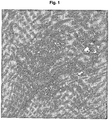
- Figure 1 is thus a photographic satellite image with a pixel resolution of 10x10 m over a partly developed geographical area.
- the expression "photographic image” is hereby used with the meaning that it is brought about by light being captured and interpreted by an image sensor. In other words, the image may be constructed by reading of light in one or several wavelength intervals.
- the image in figure 1 is a so-called composite image, based upon 3 different spectral bands that subsequently have been converted to greyscale in a manner which is conventional as such.
- the image is stored in digital format on a suitable storage medium in the form of a set of pixels, wherein each pixel is associated with image information in at least one channel for light intensity.
- figure 1 a two-dimensional image is shown, where the pixels are arranged in a two-dimensional coordinate system, and where each pixel is associated with one single channel for light intensity (grey nuance).
- images having more than two dimensions, and with light intensities across more than one cannel may be used according to the present invention.
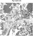
- the image shown in figure 2 is the same image as the one in figure 1 , but where the image has been processed by a conventional, kernel-based segmentation.
- a window of 5x5 pixels has been swept across the image, and for each pixel the standard deviation has been calculated with respect to light intensity of the pixel in question.
- These metrics have subsequently provided the basis for a conventional distribution into classes based upon threshold values, resulting in the illustrated classification.
- the result is illustrated in figure 2 , in which different classes are illustrated using different shades of grey. It is clear from the figure that such method is successful for finding different classes and in order to, for each pixel, assign to the pixel an association to a specific class.
- figure 3 illustrates a classification of the image shown in figure 1 , with the difference that the classification in figure 3 is done according to a conventional, window-independent cluster analysis of K-means type over 29 classes. As is clear from figure 3 , this classification suffers from the same types of problems as that of figure 2 .
- Figure 6 shows a flow diagram illustrating a method according to the present invention.
- a computer in a first step 101 , stores the image digitally onto a digital storage medium in the form of a set of pixels, where each pixel is associated with image information in at least one channel for light intensity.
- a second step 102 the computer or computers thereafter carry out a first classification of the digitally stored image, and stores the result from this classification in a first database.
- the classification shown in figure 3 is stored in the first database.
- the result of this classification is denoted "the first classification”.
- the database can be the internal memory of the operating computer, a file on a hard disk or another type of internal or external database. What is important is that an association to a certain specific class in the set of classes (the first set of classes) used in the first classification is stored in the first database for each pixel in the original image.
- the first classification is a cluster analysis of K-means.
- a third step 103 the computer or computers calculate for each pixel in the original image the smallest distance, preferably the smallest Euclidian distance, in the image between the pixel in question and the closest pixel which in the first classification has been associated to a certain specific class in the classes used during the course of this first classification.
- This calculated distance is associated with each respective pixel, and the association is stored in a second database, which may be the same as the first database or a second one. In the latter case, this second database may be of the type described above in connection with the first database.
- Such a smallest distance is calculated for each one of the pixels in the original image, and for several of the classes in the first classification.
- Figure 4 graphically illustrates the calculated smallest distance between each pixel and one of the classes illustrated in figure 3 .
- the smallest distance between each respective pixel and the class in question is illustrated using shades of grey - the darker the colour of the pixel, the longer its distance to the closest pixel which has been associated with the class in question.
- the computer or computers perform a second classification, this time based upon the data stored in the second database and preferably for and based upon all pixels in the original image.
- the relevant metric for this second classification is, for each pixel, the or those calculated smallest distance(s) to classes as calculated in step 103. These calculated smallest distances can thus be one or several measurement values per pixel, why it may be necessary to for example perform a multi-dimensional cluster analyses as a part of the second classification.
- the second classification is of the same type as the first classification.
- the outcome of this second classification is an association between each respective pixel in the original image and a certain specific class in a second set of classes which is defined during the course of the second classification.
- the computer or the interconnected computers stores, in a fifth step 105, this association for each respective pixel onto a digital storage medium, which is the same one as that onto which the original image was stored or a different one, and where the storage technique can be as described above regarding the original image.
- the set of pixels, each with an association to a certain specific class is stored in a way which permits this information to be represented as a classified image, in which the position of each pixel in the classified image corresponds to the position of the pixel in the original image, and in which the value of the respective pixel, such as colour intensity in one or several channels, corresponds to the class to which the pixel in question has been associated.
- the classified image has the same dimensions regarding the number of pixels as the original image.
- the resolution of the classified image may of course be adjusted.
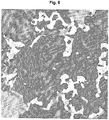
- Figure 5 illustrates such a finally classified image, based upon the original image shown in figure 1 , and in which different classes are represented with different shades of grey.
- the classification shown in figure 5 is thus based upon the smallest Euclidian distances for each pixel in the original image to each one of the classes resulting from the first classification and illustrated in figure 3 .
- the probability that nearby pixels are associated to the same final class will be relatively large.
- the probability will be small that one pixel, being similar to a group of pixels which in the final classification falls in a certain class but which is isolated in terms of distance from these other pixels in the image, falls in the same class.
- a method according to the present invention will have a strong tendency to group nearby pixels into the same class, and can therefore create connected areas of pixels associated to one and the same class.
- the calculated smallest distances to a certain class will change rapidly between nearby pixels in case the composition of classes in the first classification is rapidly changed locally in an area of the image.
- the result from the first classification is not necessarily useful in itself. Some of the classes will possibly achieve a grouping of pixels in a way which reflects the real composition of the original image. On the other hand, in most cases at least one class will more often than not group pixels in a noisy way which is difficult to interpret, as described above. This circumstance does however not affect the final result after the second classification, even in the case that this second classification uses all of the classes from the first classification in the same way.
- the above described method can be used to automatically and with no extensive prior knowledge about the contents of a certain image achieve a relevant classification with low scattering.
- step 103 the smallest distance is calculated, for each pixel, to each one of all classes used during the first classification, and all classes during the first classification are in this case also used in the second classification. This maximizes the use of the information contained in the original image.
- the first classification comprises a classification using a K-means cluster analysis followed by a classification using a maximum likelihood cluster analysis, in which the result from the K-means classification is used as a starting point.
- the second classification comprises a K-means cluster analysis. The present inventors have discovered that such a method yields good end results.
- the present inventors have obtained good results in case the number of classes in the first classification are either set beforehand to between 20 and 100, or when the first classification uses a variable number of classes, and where the classification in this case is adjusted so that the resulting number of classes is between 20 and 100.
- the so-called Akaike information criterion is used in order to decide an optimal number of classes in the first classification, by balancing the complexity of the model to the variance within each class. In other words, the number of classes is selected so that an Akaike information criterion is maximized for the classification for this choice of number of classes. See Akaike H., "A new look at the statistical model identification", IEEE Trans. Automat. Contr. AC-19:716-23, 1974 [Institute of Statistical Mathematics, Minato-ku, Tokyo, Japan ].
- a suitable number of classes in the second classification is between 5 and 20, especially when the number of classes in the first classification is between 20 and 100.
- a number of classes namely yields a finally classified image with relevant classification of individual pixels and with limited noise in most classes.
- the choice of number of classes in the second classification depends on the one hand on the type of result desired from the method according to the present invention, on the other hand on if additional processing of the achieved classification is to be performed in later steps. It is especially preferred to used the Akaike criterion to decide the number of classes also in the second classification, in a way corresponding to the one described above.
- each calculated smallest distance between a pixel and a certain class is weighted before being stored in the second database.
- the difference in calculated smallest distance to a certain class can be given a larger impact in the second classification.
- d i j x i j , wherein x i j is the calculated smallest distance between pixel i and the closest pixel associated with class j , and d i j is the value for the smallest distance between pixel i and class j which is actually stored into the second database.
- a method according to the present invention can advantageously be used to automatically achieve a relevant classification of two-dimensional photographic satellite ground images. Classification of such photographical images containing image information in one channel, such as greyscale light intensity, has been found to yield high quality results.
- a method according to the present invention is also very useful in the case with photographical images with image information in three or more channels, such as for example colour intensity information according to some conventional colour system using three channels, such as RGB or NCS, or a representation where several different channels represent colour intensity over different wavelength intervals.
- the latter type of colour information models are for example used in satellite imaging, and in that case often using four or more channels for different wavelengths.
- a method according to the present invention can thus be used, for instance as an automatic tool for mapping, demographical or geographical investigations, environmental analyses, etc.
- a kernel-based operation to the original image, and the result from this is then used as the basis for the first classification together with the image information of the original image.
- a value for each pixel may be calculated for the texture over a limited area around the pixel in question, for example a 9x9 matrix with the pixel in question in the centre, and that this calculated value may then be incorporated into the existing image information for the pixel in question, as an additional information channel, before the first classification is performed. This way, certain information from surrounding pixels will affect what class a certain pixel is associated to in the first database, which in some applications can increase the precision of the final classification.
- additional information which is known beforehand is added to the colour intensity information as an additional channel or additional channels to each pixel before the first classification.
- additional information in case the image to be classified is a satellite image include local measurement values for geographical data, such as inclination, precipitation, elevation and distribution of solid ground, as well as demographical data such as population density and land ownership. This additional information is thereafter used in the first classification in a way corresponding to the one described above for texture data.
- additional data is collected, but this additional data is not used in the first classification in the same way as the colour intensity data. Instead, the additional data is used as an initial condition for the classification.
- a certain value such as the geographical extension of a population centre
- a certain condition such as "does the pixel fall outside of the limits of a population centre?".
- the second classification can be performed only on the distinguished pixels, and the pixels not distinguished, hence those pixels in the original image not being located within a population centre in the preceding example, can be placed in a separate class in addition to the classes used in the first classification.
- the present method can be performed iteratively.
- an additional calculation may be performed of the smallest Euclidian distance to one or several of the classes resulting from the second classification, and thereafter an additional classification can be performed based upon these calculated smallest distances.
- the latter calculation of smallest distance and classification can be varied within the scope of what has been described above for such calculation and for the second classification. For some embodiments, such a classification in several, iterative steps can yield even better results.
Landscapes
- Engineering & Computer Science (AREA)
- Physics & Mathematics (AREA)
- Theoretical Computer Science (AREA)
- General Physics & Mathematics (AREA)
- Data Mining & Analysis (AREA)
- Computer Vision & Pattern Recognition (AREA)
- Multimedia (AREA)
- Bioinformatics & Computational Biology (AREA)
- Life Sciences & Earth Sciences (AREA)
- Artificial Intelligence (AREA)
- Bioinformatics & Cheminformatics (AREA)
- Evolutionary Biology (AREA)
- Evolutionary Computation (AREA)
- General Engineering & Computer Science (AREA)
- Probability & Statistics with Applications (AREA)
- Remote Sensing (AREA)
- Astronomy & Astrophysics (AREA)
- Image Analysis (AREA)
- Information Retrieval, Db Structures And Fs Structures Therefor (AREA)
Description
- The present invention relates to the automatic classification of image information.
- Various imaging techniques in two or more dimensions are now central within many fields of technology. For example, satellite images are used as originals or in processed form for mapping, in demographic, economic and environmental analyses, as well as within community planning. Three-dimensional images is for instance achieved through various medical imaging techniques, and are used to analyze the human body, as support for surgeons during surgery, and so forth, but also within for example the nanotechnological field. Collected image data is analyzed and used in numerous applications to control the behaviour of robots and other technical equipment, with the aim of navigating through space, selecting and handling objects and interacting with other technology as well as with people. Furthermore, two-dimensional imaging techniques are used within microscopy.
- In general, the information contained in such an image requires interpretation before use. The goal of such interpretation is typically to identify the structural components in the image, such as an object against a background; different fields that are delimited one to another or volumes of different colour intensity, structure or which are distinct as compared to each other in other ways; or deviating elements. Examples include identifying roads, housing, forest, farm land, etc. from satellite images; distinguishing faces in a photography depicting human beings; separating various types of tissue in a three-dimensional NMR image of a person; and identification of material deviations based upon a photography of a manufactured detail.
- It is often for cost reasons desirable to achieve an automatic interpretation of an image. One way to carry out such interpretation starts out from a digital image in two or more dimensions, built up from a number of individual pixels. Each pixel is then associated with one certain respective class of pixels, selected among a number of such classes designed to represent a certain pixel type. When all pixels have been associated with a respective class, an inventory can be made of each class, so as to obtain a collected picture of where in the image pixels of a certain type occur. Herein, such method is denoted a "classification". Hence, a certain class can for example represent "road", "muscle tissue" or "material defect".
- Typically, classification techniques are used to locate objects and borders, such as lines, curves, fields, etc., in an image.
- Several attempts have been made to achieve a method for automatically performing various useful classifications of images where the knowledge of the image contents is limited before the start of the classification.
- For instance, a method has been proposed in which a movable "window" is swept across the image in an attempt to classify a pixel located in the centre of the window to a certain class identity by studying the centre pixel's surrounding pixels and using statistical methods (kernel-based segmentation). For some types of images, such methods can be efficient, but the result of the classification is often very scattered, with classes comprising pixels from many different parts of the image. The result is that it is difficult to obtain useful information from the classification without large amounts of manual work.
- An automatic classification of an image has also been proposed with parallel consideration to all pixels, in an iterative method (window-independent classification). One example of an algorithm which can be used in such method is a cluster analysis of K-means type. Even such methods often result in scattered classifications when used to classify digitally stored images.
- The article by CHARLOTTE M. GURNEY: "The use of contextual information to improve land cover classification of digital remotely sensed data", INTERNATIONAL JOURNAL OF REMOTE SENSING, vol. 2, no. 4, October 1981, pages 379-388, describes contextual classifiers and reclassifiers for remotely sensed data.
- In the article "Automated Segmentation of MR Images of Brain Tumors", Kaus, Michael R., et al., Radiology 2001; 218:586-591, an iterative classification of a three-dimensional MR-reproduction of a human skull is disclosed. The classification is performed iteratively, with the help of among other things local segmentation strategies and a distance transform which calculates the distance between a certain voxel (a three-dimensional pixel) and a certain class, and also on the basis of information regarding greyscale intensity of the voxels taking part of the reproduction.
- The majority of the steps making up such method must be carried out manually in order to achieve sufficient reliability of the finally classified result. Additionally, a comparatively solid knowledge of the object is required before the classification is started, for example in the form of a comparative image illustrating a "normal case" or the like.
- The present invention solves the above described problems for photographic satellite ground images in accordance with the scope of the appended claims.
- In the following, the invention will be described in detail, with reference to exemplifying embodiments of the invention and to the appended drawings, where:
-
Figure 1 is a photographic, digital satellite greyscale image of a partly developed area; -
Figure 2 shows a conventional, kernel-based segmentation over five classes for the satellite image illustrated infigure 1 ; -
Figure 3 shows a conventional, window-independent classification over twenty-nine classes for the satellite image illustrated infigure 1 ; -
Figure 4 is a graphical illustration of the distribution of smallest distances from each respective pixel to one of the classes shown infigure 3 ; -
Figure 5 shows a classification according to the invention over ten classes for the satellite image illustrated infigure 1 ; and -
Figure 6 is a flow diagram illustrating a method according to the present invention. -
Figure 1 is thus a photographic satellite image with a pixel resolution of 10x10 m over a partly developed geographical area. The expression "photographic image" is hereby used with the meaning that it is brought about by light being captured and interpreted by an image sensor. In other words, the image may be constructed by reading of light in one or several wavelength intervals. The image infigure 1 is a so-called composite image, based upon 3 different spectral bands that subsequently have been converted to greyscale in a manner which is conventional as such. The image is stored in digital format on a suitable storage medium in the form of a set of pixels, wherein each pixel is associated with image information in at least one channel for light intensity. Infigure 1 , a two-dimensional image is shown, where the pixels are arranged in a two-dimensional coordinate system, and where each pixel is associated with one single channel for light intensity (grey nuance). However, it is realized that images having more than two dimensions, and with light intensities across more than one cannel (for example light intensity information stored according to the RGB standard), may be used according to the present invention. - It is desirable to achieve an automatic classification of such images, in order to simply and with high precision distinguish different types of features in the image, such as roads, housing, forest, arable land, parks, etc.
- The image shown in
figure 2 is the same image as the one infigure 1 , but where the image has been processed by a conventional, kernel-based segmentation. A window of 5x5 pixels has been swept across the image, and for each pixel the standard deviation has been calculated with respect to light intensity of the pixel in question. These metrics have subsequently provided the basis for a conventional distribution into classes based upon threshold values, resulting in the illustrated classification. The result is illustrated infigure 2 , in which different classes are illustrated using different shades of grey. It is clear from the figure that such method is successful for finding different classes and in order to, for each pixel, assign to the pixel an association to a specific class. Moreover, many of the pixels constituting different types of terrain, such as for example "road", in the image shown infigure 1 are grouped since they are associated with one and the same class. To the contrary, there is comparatively large noise in the classified image. Too many pixels have been associated with some other class than most pixels constituting the same type of ground in the original image. Therefore, it is difficult to for example perform an automatic mapping based upon such classification. - In a way similar to that of
figure 2 ,figure 3 illustrates a classification of the image shown infigure 1 , with the difference that the classification infigure 3 is done according to a conventional, window-independent cluster analysis of K-means type over 29 classes. As is clear fromfigure 3 , this classification suffers from the same types of problems as that offigure 2 . -
Figure 6 shows a flow diagram illustrating a method according to the present invention. - Hence, according to the invention, in a first step 101 a computer, or several interconnected computers, stores the image digitally onto a digital storage medium in the form of a set of pixels, where each pixel is associated with image information in at least one channel for light intensity.
- In a
second step 102, the computer or computers thereafter carry out a first classification of the digitally stored image, and stores the result from this classification in a first database. In the present exemplifying embodiment, the classification shown infigure 3 is stored in the first database. Herein, the result of this classification is denoted "the first classification". The database can be the internal memory of the operating computer, a file on a hard disk or another type of internal or external database. What is important is that an association to a certain specific class in the set of classes (the first set of classes) used in the first classification is stored in the first database for each pixel in the original image. - The first classification is a cluster analysis of K-means.
- After this initial classification, in a
third step 103 according to the invention, the computer or computers calculate for each pixel in the original image the smallest distance, preferably the smallest Euclidian distance, in the image between the pixel in question and the closest pixel which in the first classification has been associated to a certain specific class in the classes used during the course of this first classification. This calculated distance is associated with each respective pixel, and the association is stored in a second database, which may be the same as the first database or a second one. In the latter case, this second database may be of the type described above in connection with the first database. - Such a smallest distance is calculated for each one of the pixels in the original image, and for several of the classes in the first classification.
-
Figure 4 graphically illustrates the calculated smallest distance between each pixel and one of the classes illustrated infigure 3 . The smallest distance between each respective pixel and the class in question is illustrated using shades of grey - the darker the colour of the pixel, the longer its distance to the closest pixel which has been associated with the class in question. - Thereafter, according to a
fourth step 104 according to the invention, the computer or computers perform a second classification, this time based upon the data stored in the second database and preferably for and based upon all pixels in the original image. According to the invention, the relevant metric for this second classification is, for each pixel, the or those calculated smallest distance(s) to classes as calculated instep 103. These calculated smallest distances can thus be one or several measurement values per pixel, why it may be necessary to for example perform a multi-dimensional cluster analyses as a part of the second classification. - The second classification is of the same type as the first classification.
- Hence, the outcome of this second classification is an association between each respective pixel in the original image and a certain specific class in a second set of classes which is defined during the course of the second classification.
- Thereafter, according to the invention the computer or the interconnected computers stores, in a
fifth step 105, this association for each respective pixel onto a digital storage medium, which is the same one as that onto which the original image was stored or a different one, and where the storage technique can be as described above regarding the original image. The important thing is that the set of pixels, each with an association to a certain specific class, is stored in a way which permits this information to be represented as a classified image, in which the position of each pixel in the classified image corresponds to the position of the pixel in the original image, and in which the value of the respective pixel, such as colour intensity in one or several channels, corresponds to the class to which the pixel in question has been associated. As a result, the classified image has the same dimensions regarding the number of pixels as the original image. In subsequent steps, the resolution of the classified image may of course be adjusted. -
Figure 5 illustrates such a finally classified image, based upon the original image shown infigure 1 , and in which different classes are represented with different shades of grey. The classification shown infigure 5 is thus based upon the smallest Euclidian distances for each pixel in the original image to each one of the classes resulting from the first classification and illustrated infigure 3 . - Since the smallest distance to a certain class is used for the second classification, the probability that nearby pixels are associated to the same final class will be relatively large. In a similar manner, the probability will be small that one pixel, being similar to a group of pixels which in the final classification falls in a certain class but which is isolated in terms of distance from these other pixels in the image, falls in the same class. In other words, a method according to the present invention will have a strong tendency to group nearby pixels into the same class, and can therefore create connected areas of pixels associated to one and the same class. These effects lead to low scattering in the finally classified image.
- On the other hand, the calculated smallest distances to a certain class will change rapidly between nearby pixels in case the composition of classes in the first classification is rapidly changed locally in an area of the image. This results in that a method according to the present invention in a relatively precise way will produce a final classification in which borders between final classes really represent relevant borders and transitions in the original image.
- It is noted that the result from the first classification is not necessarily useful in itself. Some of the classes will possibly achieve a grouping of pixels in a way which reflects the real composition of the original image. On the other hand, in most cases at least one class will more often than not group pixels in a noisy way which is difficult to interpret, as described above. This circumstance does however not affect the final result after the second classification, even in the case that this second classification uses all of the classes from the first classification in the same way.
- In summary, the above described method can be used to automatically and with no extensive prior knowledge about the contents of a certain image achieve a relevant classification with low scattering.
- According to a preferred embodiment, in
step 103 the smallest distance is calculated, for each pixel, to each one of all classes used during the first classification, and all classes during the first classification are in this case also used in the second classification. This maximizes the use of the information contained in the original image. - According to a preferred embodiment, the first classification comprises a classification using a K-means cluster analysis followed by a classification using a maximum likelihood cluster analysis, in which the result from the K-means classification is used as a starting point. According to a further preferred embodiment, the second classification comprises a K-means cluster analysis. The present inventors have discovered that such a method yields good end results.
- Moreover, the present inventors have obtained good results in case the number of classes in the first classification are either set beforehand to between 20 and 100, or when the first classification uses a variable number of classes, and where the classification in this case is adjusted so that the resulting number of classes is between 20 and 100. According to an especially preferred embodiment, the so-called Akaike information criterion is used in order to decide an optimal number of classes in the first classification, by balancing the complexity of the model to the variance within each class. In other words, the number of classes is selected so that an Akaike information criterion is maximized for the classification for this choice of number of classes. See Akaike H., "A new look at the statistical model identification", IEEE Trans. Automat. Contr. AC-19:716-23, 1974 [Institute of Statistical Mathematics, Minato-ku, Tokyo, Japan].
- Correspondingly, it has been found that a suitable number of classes in the second classification is between 5 and 20, especially when the number of classes in the first classification is between 20 and 100. Depending on the detailed application, such a number of classes namely yields a finally classified image with relevant classification of individual pixels and with limited noise in most classes. The choice of number of classes in the second classification depends on the one hand on the type of result desired from the method according to the present invention, on the other hand on if additional processing of the achieved classification is to be performed in later steps. It is especially preferred to used the Akaike criterion to decide the number of classes also in the second classification, in a way corresponding to the one described above.
- According to one preferred embodiment, each calculated smallest distance between a pixel and a certain class is weighted before being stored in the second database. By such weighting, the difference in calculated smallest distance to a certain class can be given a larger impact in the second classification. In connection herewith, it is preferred to perform the weighting so that shorter calculated smallest distances affects the second classification relatively more as compared to longer calculated smallest distances. For example, this may be achieved by transforming all calculated smallest distances using a convex function. One example of such transformation is


- Such weighting increases the relevance for the final classification of the pixels.
- In case the smallest distance is to be calculated between a certain pixel and a certain class, and where the class to which the pixel has been associated in the first database is the same as the class for which the smallest distance is to be calculated, in other words when i = j in the formula above, there are two alternatives regarding what is to be regarded as the smallest distance between the pixel and the class. Either the smallest distance can be set to 0, which reflects that the distance between the pixel in question to itself is 0, alternatively the distance can be set to the smallest distance between the pixel and the closest other pixel which is associated with the same class as the pixel. Both these alternatives can be useful for different applications, but in general it is preferred to set the smallest distance to 0 in case i = j.
- As discussed above, a method according to the present invention can advantageously be used to automatically achieve a relevant classification of two-dimensional photographic satellite ground images. Classification of such photographical images containing image information in one channel, such as greyscale light intensity, has been found to yield high quality results. A method according to the present invention is also very useful in the case with photographical images with image information in three or more channels, such as for example colour intensity information according to some conventional colour system using three channels, such as RGB or NCS, or a representation where several different channels represent colour intensity over different wavelength intervals. The latter type of colour information models are for example used in satellite imaging, and in that case often using four or more channels for different wavelengths.
- Starting out from such a two-dimensional photographic satellite image, a method according to the present invention can thus be used, for instance as an automatic tool for mapping, demographical or geographical investigations, environmental analyses, etc.
- In order to improve the usefulness of the first classification, prior to said first classification the computer or computers applies, according to a preferred embodiment, a kernel-based operation to the original image, and the result from this is then used as the basis for the first classification together with the image information of the original image. One example of this is that a value for each pixel may be calculated for the texture over a limited area around the pixel in question, for example a 9x9 matrix with the pixel in question in the centre, and that this calculated value may then be incorporated into the existing image information for the pixel in question, as an additional information channel, before the first classification is performed. This way, certain information from surrounding pixels will affect what class a certain pixel is associated to in the first database, which in some applications can increase the precision of the final classification.
- According to one preferred embodiment, additional information which is known beforehand is added to the colour intensity information as an additional channel or additional channels to each pixel before the first classification. Examples of such additional information in case the image to be classified is a satellite image include local measurement values for geographical data, such as inclination, precipitation, elevation and distribution of solid ground, as well as demographical data such as population density and land ownership. This additional information is thereafter used in the first classification in a way corresponding to the one described above for texture data.
- According to another preferred embodiment, additional data is collected, but this additional data is not used in the first classification in the same way as the colour intensity data. Instead, the additional data is used as an initial condition for the classification. One example of this is that a certain value, such as the geographical extension of a population centre, is used in an initial step to distinguish those pixels fulfilling a certain condition, such as "does the pixel fall outside of the limits of a population centre?". Thereafter, the second classification can be performed only on the distinguished pixels, and the pixels not distinguished, hence those pixels in the original image not being located within a population centre in the preceding example, can be placed in a separate class in addition to the classes used in the first classification.
- What has been said herein about using additional data in connection with a classification is also useful regarding the second classification. These choices will depend upon the actual application and on what data is available to additionally increase the precision of the classification.
- Above, preferred embodiments have been described. However, it is apparent to the skilled person that many modifications can be made to the described embodiments without departing from the scope of the appended claims.
- By way of example, the present method can be performed iteratively. In other words, after a first classification, the calculation of the smallest distance to classes and a second classification, an additional calculation may be performed of the smallest Euclidian distance to one or several of the classes resulting from the second classification, and thereafter an additional classification can be performed based upon these calculated smallest distances. The latter calculation of smallest distance and classification can be varied within the scope of what has been described above for such calculation and for the second classification. For some embodiments, such a classification in several, iterative steps can yield even better results.
- Thus, the invention shall not be limited to the described embodiments, but may be varied within the scope of the enclosed claims.
Claims (12)
- Method for classifying a photographic satellite ground image for distinguishing features in said image, such as roads, housing, forest, arable land and parks, characterised in that the method comprises the steps that a computer or several interconnected computers are caused toa) store, in the form of a pixel set in which set each pixel is associated with image information in at least one channel for light intensity, a first image to be classified onto a digital storage medium;b) carry out a first classification of the image, which classification comprises a first K-means classification based upon the image information of each respective pixel and which classification is caused to associate each pixel with a certain class in a first set of classes, obtained as the clusters of the first K-means cluster analysis, and to store these associations in a first database;c) calculate, for each pixel and for all classes in the first set of classes, the smallest distance in the image between the pixel in question and the closest pixel which is associated with the class in question in the database, and to store an association between each pixel and the calculated smallest distance for the pixel in a second database for each class for which a distance has been calculated;d) carry out an unsupervised second classification of the data in the second database, which classification comprises a second K-means cluster analysis using the smallest respective distance for each pixel to each respective one of said first classes as coordinates in a multi-dimensional feature space, and to associate each pixel to a certain class in a second set of classes using only said calculated smallest distances, which second set of classes is obtained as the clusters of the second K-means cluster analysis; ande) store the classified image in the form of a set of pixels onto a digital storage medium, where each pixel comprises data regarding the association of the pixel to the certain class in the second set of classes, and where the classified image has the same dimensions as the first image.
- Method according to claim 1, characterised in that the first classification is caused to comprise said K-means classification followed by a maximum likelihood classification, in which the result from the K-means classification is used as starting point.
- Method according to any one of the preceding claims, characterised in that the number of classes in the first set of classes is caused to be the number maximizing an Akaike information criterion for the classification.
- Method according to any one of the preceding claims, characterised in that the number of classes in the first set of classes is caused to be between 20 and 100.
- Method according to any one of the preceding claims, characterised in that the number of classes in the second set of classes is caused to be the number maximizing an Akaike information criterion for the classification.
- Method according to any one of the preceding claims, characterised in that the number of classes in the second set of classes is caused to be between 5 and 20.
- Method according to any one of the preceding claims, characterised in that the computer or the interconnected computers in step c) are caused to weight-adjust each calculated smallest distance before it is stored into the second database, where the weighting is performed so that shorter calculated smallest distances are given relatively stronger impact as compared to longer calculated smallest distances in the second classification in step d).
- Method according to any one of the claims 1-7, characterised in that the first image is a two-dimensional photographic image, and in that each pixel comprises image information in at least three channels, each containing light intensity for a certain wavelength spectrum.
- Method according to any one of the preceding claims, characterised in that the computer or the interconnected computers are caused to use information which is calculated beforehand or calculated, in addition to colour intensity, for each pixel in the first image in the first and/or the second classification, as one or several additional channels together with the channel or those channels containing colour intensity data.
- Method according to any one of the preceding claims, characterised in that the computer or the interconnected computers are caused to use information which is calculated beforehand or calculated, in addition to colour intensity, for each pixel in the first image in the first and/or the second classification, in order to, before the classification in question is commenced, associate to a certain class the pixels fulfilling a certain initial condition in terms of the additional data, and then to perform the classification in question only for the rest of the pixels.
- Method according to claim 9 or 10, characterised in that the additional data comprises at least some of variables given beforehand such as inclination, precipitation, elevation, distribution of solid ground, population density or land ownership, or a calculated value for texture in a local environment to the pixel for which the texture has been calculated.
- Method according to any one of the preceding claims, characterised in that the smallest distance is the smallest Euclidian distance in the image.
Applications Claiming Priority (2)
| Application Number | Priority Date | Filing Date | Title |
|---|---|---|---|
| SE0950140A SE534089C2 (en) | 2009-03-10 | 2009-03-10 | Procedure for classifying image information |
| PCT/SE2010/050267 WO2010104462A1 (en) | 2009-03-10 | 2010-03-09 | Method for performing automatic classification of image information |
Publications (3)
| Publication Number | Publication Date |
|---|---|
| EP2406755A1 EP2406755A1 (en) | 2012-01-18 |
| EP2406755A4 EP2406755A4 (en) | 2012-11-07 |
| EP2406755B1 true EP2406755B1 (en) | 2019-05-01 |
Family
ID=42728571
Family Applications (1)
| Application Number | Title | Priority Date | Filing Date |
|---|---|---|---|
| EP10751095.0A Active EP2406755B1 (en) | 2009-03-10 | 2010-03-09 | Method for performing automatic classification of image information |
Country Status (8)
| Country | Link |
|---|---|
| US (1) | US8781216B2 (en) |
| EP (1) | EP2406755B1 (en) |
| JP (1) | JP2012520503A (en) |
| CN (1) | CN102369541B (en) |
| BR (1) | BRPI1006283A2 (en) |
| CA (1) | CA2755070A1 (en) |
| SE (1) | SE534089C2 (en) |
| WO (1) | WO2010104462A1 (en) |
Families Citing this family (8)
| Publication number | Priority date | Publication date | Assignee | Title |
|---|---|---|---|---|
| SE535070C2 (en) * | 2010-09-10 | 2012-04-03 | Choros Cognition Ab | Procedure for automatically classifying a two- or high-dimensional image |
| US9384397B2 (en) * | 2013-08-22 | 2016-07-05 | Ut-Battelle, Llc | Model for mapping settlements |
| CN104794483A (en) * | 2015-03-24 | 2015-07-22 | 江南大学 | Image division method based on inter-class maximized PCM (Pulse Code Modulation) clustering technology |
| CN109726639A (en) * | 2018-12-07 | 2019-05-07 | 河北工程大学 | A method for extracting ground object information based on unsupervised classification technology |
| CN109670425A (en) * | 2018-12-07 | 2019-04-23 | 河北工程大学 | A kind of ground object information extraction method based on multiscale idea |
| US10860897B2 (en) * | 2019-01-29 | 2020-12-08 | Victor Gorelik | Pattern recognition with AI maps |
| CN112766090B (en) * | 2021-01-05 | 2022-07-05 | 深圳市数字城市工程研究中心 | Method and system for rapidly identifying suburb idle cultivated land by utilizing multi-season-phase Sentinel-2 image |
| CN116310337A (en) * | 2023-03-21 | 2023-06-23 | 山西大学 | An Unsupervised Image Segmentation Method Based on Multi-Representative Superpixels |
Family Cites Families (6)
| Publication number | Priority date | Publication date | Assignee | Title |
|---|---|---|---|---|
| US7058197B1 (en) * | 1999-11-04 | 2006-06-06 | Board Of Trustees Of The University Of Illinois | Multi-variable model for identifying crop response zones in a field |
| US6549852B2 (en) * | 2001-07-13 | 2003-04-15 | Mzb Technologies, Llc | Methods and systems for managing farmland |
| US7200243B2 (en) * | 2002-06-28 | 2007-04-03 | The United States Of America As Represented By The Secretary Of The Army | Spectral mixture process conditioned by spatially-smooth partitioning |
| WO2008005311A2 (en) * | 2006-06-30 | 2008-01-10 | Carnegie Mellon University | Methods, apparatuses, and systems for damage detection |
| US8010589B2 (en) * | 2007-02-20 | 2011-08-30 | Xerox Corporation | Semi-automatic system with an iterative learning method for uncovering the leading indicators in business processes |
| US8615133B2 (en) * | 2007-03-26 | 2013-12-24 | Board Of Regents Of The Nevada System Of Higher Education, On Behalf Of The Desert Research Institute | Process for enhancing images based on user input |
-
2009
- 2009-03-10 SE SE0950140A patent/SE534089C2/en not_active IP Right Cessation
-
2010
- 2010-03-09 WO PCT/SE2010/050267 patent/WO2010104462A1/en not_active Ceased
- 2010-03-09 CA CA2755070A patent/CA2755070A1/en not_active Abandoned
- 2010-03-09 EP EP10751095.0A patent/EP2406755B1/en active Active
- 2010-03-09 US US13/255,686 patent/US8781216B2/en not_active Expired - Fee Related
- 2010-03-09 CN CN201080011107.6A patent/CN102369541B/en not_active Expired - Fee Related
- 2010-03-09 BR BRPI1006283A patent/BRPI1006283A2/en not_active IP Right Cessation
- 2010-03-09 JP JP2011553988A patent/JP2012520503A/en active Pending
Non-Patent Citations (1)
| Title |
|---|
| DUDA R ET AL: "Pattern Classification, chapter 9: Algorithm-Independent Machine Learning", 1 January 2001, PATTERN CLASSIFICATION, NEW YORK, JOHN WILEY & SONS, US, PAGE(S) 453 - 515, ISBN: 978-0-471-05669-0, XP002472161 * |
Also Published As
| Publication number | Publication date |
|---|---|
| JP2012520503A (en) | 2012-09-06 |
| SE534089C2 (en) | 2011-04-26 |
| US20120002865A1 (en) | 2012-01-05 |
| CN102369541B (en) | 2014-04-09 |
| EP2406755A4 (en) | 2012-11-07 |
| CN102369541A (en) | 2012-03-07 |
| BRPI1006283A2 (en) | 2019-04-02 |
| CA2755070A1 (en) | 2010-09-16 |
| EP2406755A1 (en) | 2012-01-18 |
| WO2010104462A1 (en) | 2010-09-16 |
| US8781216B2 (en) | 2014-07-15 |
| SE0950140A1 (en) | 2010-09-11 |
Similar Documents
| Publication | Publication Date | Title |
|---|---|---|
| US8781216B2 (en) | Method for performing automatic classification of image information | |
| Kurmi et al. | Leaf image analysis-based crop diseases classification | |
| US9483709B2 (en) | Visual saliency estimation for images and video | |
| US9286537B2 (en) | System and method for classifying a skin infection | |
| US8433105B2 (en) | Method for acquiring region-of-interest and/or cognitive information from eye image | |
| JP7294695B2 (en) | Program, Information Recording Medium, Classification Apparatus, and Classification Method Based on Trained Model | |
| US7983486B2 (en) | Method and apparatus for automatic image categorization using image texture | |
| EP1324267A2 (en) | Automatic detection of regions of interest in digital images of biological tissue | |
| CN118470481A (en) | Intelligent endoscope image feature processing method and device | |
| Rizvi et al. | Object-based image analysis of high-resolution satellite images using modified cloud basis function neural network and probabilistic relaxation labeling process | |
| Blomley et al. | Using multi-scale features for the 3D semantic labeling of airborne laser scanning data | |
| CN112464983A (en) | Small sample learning method for apple tree leaf disease image classification | |
| CN120451968B (en) | Blueberry intelligent disease detection method and system based on multimodal unsupervised learning | |
| Lu et al. | Comparison between several feature extraction/classification methods for mapping complicated agricultural land use patches using airborne hyperspectral data | |
| Bauer et al. | Investigation into the classification of diseases of sugar beet leaves using multispectral images | |
| Chi | Self‐organizing map‐based color image segmentation with k‐means clustering and saliency map | |
| CN118411609B (en) | Rice disease seed identification method and system based on random forest | |
| US9036924B2 (en) | Method for automatically classifying a two-or higher-dimensional image | |
| Nancy et al. | Skin lesion segmentation and classification using Fcn-Alexnet framework | |
| Araki et al. | Patch-based cervical cancer segmentation using distance from boundary of tissue | |
| Hill et al. | Information theoretic clustering for medical image segmentation | |
| Angayarkanni et al. | LEAF DISEASE RECOGNITION USING SEGMENTATION WITH VISUAL FEATURE DESCRIPTOR. | |
| Hill | Application of information theoretic unsupervised learning to medical image analysis | |
| Jagannathan et al. | On the determination of inconsistent edges in graph-based segmentation algorithms | |
| Yadav et al. | Mapping of Vegetation and Landcover Using Semantic Image Segmentation Based on High-Resolution Uav and Satellite Images |
Legal Events
| Date | Code | Title | Description |
|---|---|---|---|
| PUAI | Public reference made under article 153(3) epc to a published international application that has entered the european phase |
Free format text: ORIGINAL CODE: 0009012 |
|
| 17P | Request for examination filed |
Effective date: 20111007 |
|
| AK | Designated contracting states |
Kind code of ref document: A1 Designated state(s): AT BE BG CH CY CZ DE DK EE ES FI FR GB GR HR HU IE IS IT LI LT LU LV MC MK MT NL NO PL PT RO SE SI SK SM TR |
|
| DAX | Request for extension of the european patent (deleted) | ||
| A4 | Supplementary search report drawn up and despatched |
Effective date: 20121008 |
|
| RIC1 | Information provided on ipc code assigned before grant |
Ipc: G06T 7/40 20060101ALI20121001BHEP Ipc: G06K 9/00 20060101ALI20121001BHEP Ipc: G06K 9/62 20060101AFI20121001BHEP |
|
| STAA | Information on the status of an ep patent application or granted ep patent |
Free format text: STATUS: EXAMINATION IS IN PROGRESS |
|
| 17Q | First examination report despatched |
Effective date: 20170626 |
|
| GRAP | Despatch of communication of intention to grant a patent |
Free format text: ORIGINAL CODE: EPIDOSNIGR1 |
|
| STAA | Information on the status of an ep patent application or granted ep patent |
Free format text: STATUS: GRANT OF PATENT IS INTENDED |
|
| INTG | Intention to grant announced |
Effective date: 20181120 |
|
| GRAS | Grant fee paid |
Free format text: ORIGINAL CODE: EPIDOSNIGR3 |
|
| GRAA | (expected) grant |
Free format text: ORIGINAL CODE: 0009210 |
|
| STAA | Information on the status of an ep patent application or granted ep patent |
Free format text: STATUS: THE PATENT HAS BEEN GRANTED |
|
| AK | Designated contracting states |
Kind code of ref document: B1 Designated state(s): AT BE BG CH CY CZ DE DK EE ES FI FR GB GR HR HU IE IS IT LI LT LU LV MC MK MT NL NO PL PT RO SE SI SK SM TR |
|
| REG | Reference to a national code |
Ref country code: GB Ref legal event code: FG4D |
|
| REG | Reference to a national code |
Ref country code: CH Ref legal event code: EP Ref country code: AT Ref legal event code: REF Ref document number: 1127910 Country of ref document: AT Kind code of ref document: T Effective date: 20190515 |
|
| REG | Reference to a national code |
Ref country code: DE Ref legal event code: R096 Ref document number: 602010058583 Country of ref document: DE |
|
| REG | Reference to a national code |
Ref country code: IE Ref legal event code: FG4D |
|
| REG | Reference to a national code |
Ref country code: NL Ref legal event code: MP Effective date: 20190501 |
|
| REG | Reference to a national code |
Ref country code: LT Ref legal event code: MG4D |
|
| PG25 | Lapsed in a contracting state [announced via postgrant information from national office to epo] |
Ref country code: NO Free format text: LAPSE BECAUSE OF FAILURE TO SUBMIT A TRANSLATION OF THE DESCRIPTION OR TO PAY THE FEE WITHIN THE PRESCRIBED TIME-LIMIT Effective date: 20190801 Ref country code: FI Free format text: LAPSE BECAUSE OF FAILURE TO SUBMIT A TRANSLATION OF THE DESCRIPTION OR TO PAY THE FEE WITHIN THE PRESCRIBED TIME-LIMIT Effective date: 20190501 Ref country code: HR Free format text: LAPSE BECAUSE OF FAILURE TO SUBMIT A TRANSLATION OF THE DESCRIPTION OR TO PAY THE FEE WITHIN THE PRESCRIBED TIME-LIMIT Effective date: 20190501 Ref country code: NL Free format text: LAPSE BECAUSE OF FAILURE TO SUBMIT A TRANSLATION OF THE DESCRIPTION OR TO PAY THE FEE WITHIN THE PRESCRIBED TIME-LIMIT Effective date: 20190501 Ref country code: LT Free format text: LAPSE BECAUSE OF FAILURE TO SUBMIT A TRANSLATION OF THE DESCRIPTION OR TO PAY THE FEE WITHIN THE PRESCRIBED TIME-LIMIT Effective date: 20190501 Ref country code: PT Free format text: LAPSE BECAUSE OF FAILURE TO SUBMIT A TRANSLATION OF THE DESCRIPTION OR TO PAY THE FEE WITHIN THE PRESCRIBED TIME-LIMIT Effective date: 20190901 Ref country code: ES Free format text: LAPSE BECAUSE OF FAILURE TO SUBMIT A TRANSLATION OF THE DESCRIPTION OR TO PAY THE FEE WITHIN THE PRESCRIBED TIME-LIMIT Effective date: 20190501 Ref country code: SE Free format text: LAPSE BECAUSE OF FAILURE TO SUBMIT A TRANSLATION OF THE DESCRIPTION OR TO PAY THE FEE WITHIN THE PRESCRIBED TIME-LIMIT Effective date: 20190501 |
|
| PG25 | Lapsed in a contracting state [announced via postgrant information from national office to epo] |
Ref country code: BG Free format text: LAPSE BECAUSE OF FAILURE TO SUBMIT A TRANSLATION OF THE DESCRIPTION OR TO PAY THE FEE WITHIN THE PRESCRIBED TIME-LIMIT Effective date: 20190801 Ref country code: GR Free format text: LAPSE BECAUSE OF FAILURE TO SUBMIT A TRANSLATION OF THE DESCRIPTION OR TO PAY THE FEE WITHIN THE PRESCRIBED TIME-LIMIT Effective date: 20190802 Ref country code: LV Free format text: LAPSE BECAUSE OF FAILURE TO SUBMIT A TRANSLATION OF THE DESCRIPTION OR TO PAY THE FEE WITHIN THE PRESCRIBED TIME-LIMIT Effective date: 20190501 |
|
| REG | Reference to a national code |
Ref country code: AT Ref legal event code: MK05 Ref document number: 1127910 Country of ref document: AT Kind code of ref document: T Effective date: 20190501 |
|
| PG25 | Lapsed in a contracting state [announced via postgrant information from national office to epo] |
Ref country code: IS Free format text: LAPSE BECAUSE OF FAILURE TO SUBMIT A TRANSLATION OF THE DESCRIPTION OR TO PAY THE FEE WITHIN THE PRESCRIBED TIME-LIMIT Effective date: 20190901 |
|
| PG25 | Lapsed in a contracting state [announced via postgrant information from national office to epo] |
Ref country code: SK Free format text: LAPSE BECAUSE OF FAILURE TO SUBMIT A TRANSLATION OF THE DESCRIPTION OR TO PAY THE FEE WITHIN THE PRESCRIBED TIME-LIMIT Effective date: 20190501 Ref country code: RO Free format text: LAPSE BECAUSE OF FAILURE TO SUBMIT A TRANSLATION OF THE DESCRIPTION OR TO PAY THE FEE WITHIN THE PRESCRIBED TIME-LIMIT Effective date: 20190501 Ref country code: DK Free format text: LAPSE BECAUSE OF FAILURE TO SUBMIT A TRANSLATION OF THE DESCRIPTION OR TO PAY THE FEE WITHIN THE PRESCRIBED TIME-LIMIT Effective date: 20190501 Ref country code: EE Free format text: LAPSE BECAUSE OF FAILURE TO SUBMIT A TRANSLATION OF THE DESCRIPTION OR TO PAY THE FEE WITHIN THE PRESCRIBED TIME-LIMIT Effective date: 20190501 Ref country code: CZ Free format text: LAPSE BECAUSE OF FAILURE TO SUBMIT A TRANSLATION OF THE DESCRIPTION OR TO PAY THE FEE WITHIN THE PRESCRIBED TIME-LIMIT Effective date: 20190501 Ref country code: AT Free format text: LAPSE BECAUSE OF FAILURE TO SUBMIT A TRANSLATION OF THE DESCRIPTION OR TO PAY THE FEE WITHIN THE PRESCRIBED TIME-LIMIT Effective date: 20190501 |
|
| REG | Reference to a national code |
Ref country code: DE Ref legal event code: R097 Ref document number: 602010058583 Country of ref document: DE |
|
| PG25 | Lapsed in a contracting state [announced via postgrant information from national office to epo] |
Ref country code: IT Free format text: LAPSE BECAUSE OF FAILURE TO SUBMIT A TRANSLATION OF THE DESCRIPTION OR TO PAY THE FEE WITHIN THE PRESCRIBED TIME-LIMIT Effective date: 20190501 Ref country code: SM Free format text: LAPSE BECAUSE OF FAILURE TO SUBMIT A TRANSLATION OF THE DESCRIPTION OR TO PAY THE FEE WITHIN THE PRESCRIBED TIME-LIMIT Effective date: 20190501 |
|
| PLBE | No opposition filed within time limit |
Free format text: ORIGINAL CODE: 0009261 |
|
| STAA | Information on the status of an ep patent application or granted ep patent |
Free format text: STATUS: NO OPPOSITION FILED WITHIN TIME LIMIT |
|
| PG25 | Lapsed in a contracting state [announced via postgrant information from national office to epo] |
Ref country code: TR Free format text: LAPSE BECAUSE OF FAILURE TO SUBMIT A TRANSLATION OF THE DESCRIPTION OR TO PAY THE FEE WITHIN THE PRESCRIBED TIME-LIMIT Effective date: 20190501 |
|
| 26N | No opposition filed |
Effective date: 20200204 |
|
| PG25 | Lapsed in a contracting state [announced via postgrant information from national office to epo] |
Ref country code: PL Free format text: LAPSE BECAUSE OF FAILURE TO SUBMIT A TRANSLATION OF THE DESCRIPTION OR TO PAY THE FEE WITHIN THE PRESCRIBED TIME-LIMIT Effective date: 20190501 |
|
| PG25 | Lapsed in a contracting state [announced via postgrant information from national office to epo] |
Ref country code: SI Free format text: LAPSE BECAUSE OF FAILURE TO SUBMIT A TRANSLATION OF THE DESCRIPTION OR TO PAY THE FEE WITHIN THE PRESCRIBED TIME-LIMIT Effective date: 20190501 |
|
| REG | Reference to a national code |
Ref country code: DE Ref legal event code: R119 Ref document number: 602010058583 Country of ref document: DE |
|
| PG25 | Lapsed in a contracting state [announced via postgrant information from national office to epo] |
Ref country code: MC Free format text: LAPSE BECAUSE OF FAILURE TO SUBMIT A TRANSLATION OF THE DESCRIPTION OR TO PAY THE FEE WITHIN THE PRESCRIBED TIME-LIMIT Effective date: 20190501 |
|
| REG | Reference to a national code |
Ref country code: CH Ref legal event code: PL |
|
| REG | Reference to a national code |
Ref country code: BE Ref legal event code: MM Effective date: 20200331 |
|
| PG25 | Lapsed in a contracting state [announced via postgrant information from national office to epo] |
Ref country code: LU Free format text: LAPSE BECAUSE OF NON-PAYMENT OF DUE FEES Effective date: 20200309 |
|
| PG25 | Lapsed in a contracting state [announced via postgrant information from national office to epo] |
Ref country code: IE Free format text: LAPSE BECAUSE OF NON-PAYMENT OF DUE FEES Effective date: 20200309 Ref country code: CH Free format text: LAPSE BECAUSE OF NON-PAYMENT OF DUE FEES Effective date: 20200331 Ref country code: FR Free format text: LAPSE BECAUSE OF NON-PAYMENT OF DUE FEES Effective date: 20200331 Ref country code: LI Free format text: LAPSE BECAUSE OF NON-PAYMENT OF DUE FEES Effective date: 20200331 Ref country code: DE Free format text: LAPSE BECAUSE OF NON-PAYMENT OF DUE FEES Effective date: 20201001 |
|
| PG25 | Lapsed in a contracting state [announced via postgrant information from national office to epo] |
Ref country code: BE Free format text: LAPSE BECAUSE OF NON-PAYMENT OF DUE FEES Effective date: 20200331 |
|
| GBPC | Gb: european patent ceased through non-payment of renewal fee |
Effective date: 20200309 |
|
| PG25 | Lapsed in a contracting state [announced via postgrant information from national office to epo] |
Ref country code: GB Free format text: LAPSE BECAUSE OF NON-PAYMENT OF DUE FEES Effective date: 20200309 |
|
| PG25 | Lapsed in a contracting state [announced via postgrant information from national office to epo] |
Ref country code: MT Free format text: LAPSE BECAUSE OF FAILURE TO SUBMIT A TRANSLATION OF THE DESCRIPTION OR TO PAY THE FEE WITHIN THE PRESCRIBED TIME-LIMIT Effective date: 20190501 Ref country code: CY Free format text: LAPSE BECAUSE OF FAILURE TO SUBMIT A TRANSLATION OF THE DESCRIPTION OR TO PAY THE FEE WITHIN THE PRESCRIBED TIME-LIMIT Effective date: 20190501 |
|
| PG25 | Lapsed in a contracting state [announced via postgrant information from national office to epo] |
Ref country code: MK Free format text: LAPSE BECAUSE OF FAILURE TO SUBMIT A TRANSLATION OF THE DESCRIPTION OR TO PAY THE FEE WITHIN THE PRESCRIBED TIME-LIMIT Effective date: 20190501 |